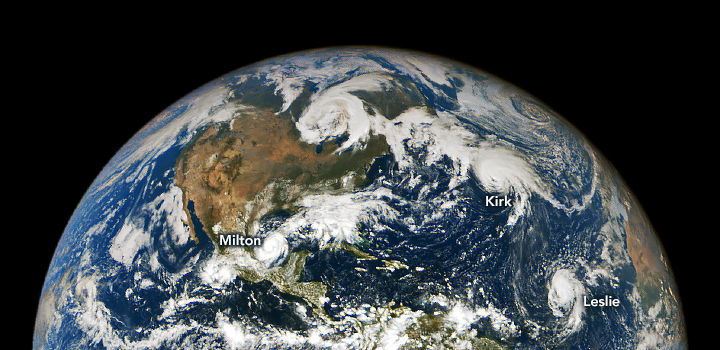
By Emily Cassidy 8 October 2024 (NASA Earth Observatory) – From the stable Lagrange point 1, located one million miles above Earth, NASA’s EPIC (Earth Polychromatic Imaging Camera) imager on the DSCOVR (Deep Space Climate Observatory) satellite observed an unusually active Atlantic Basin. In early October, three hurricanes simultaneously spun over the North Atlantic Ocean. This image shows the three […]
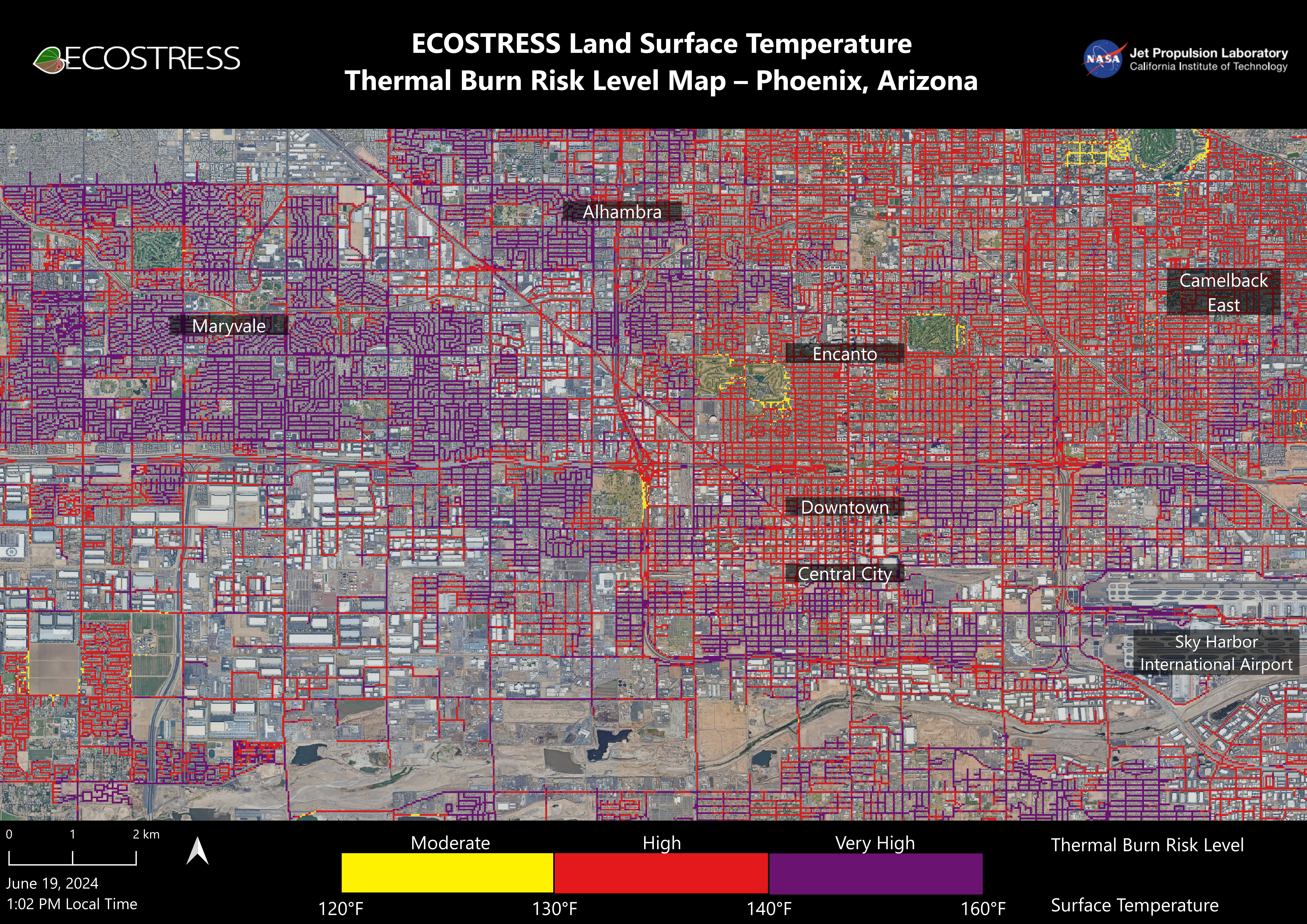
By Jessica Boehm 10 July 2024 (Axios) – Many Phoenix streets and sidewalks can reach 160° during the hottest parts of the day, according to a new NASA analysis. Why it matters: Surfaces that hot can cause contact burns in seconds, and Valley hospitals are seeing an uptick in patients with serious burn injuries. The big picture: Human-caused climate […]
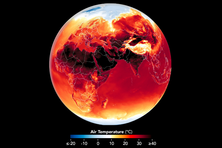
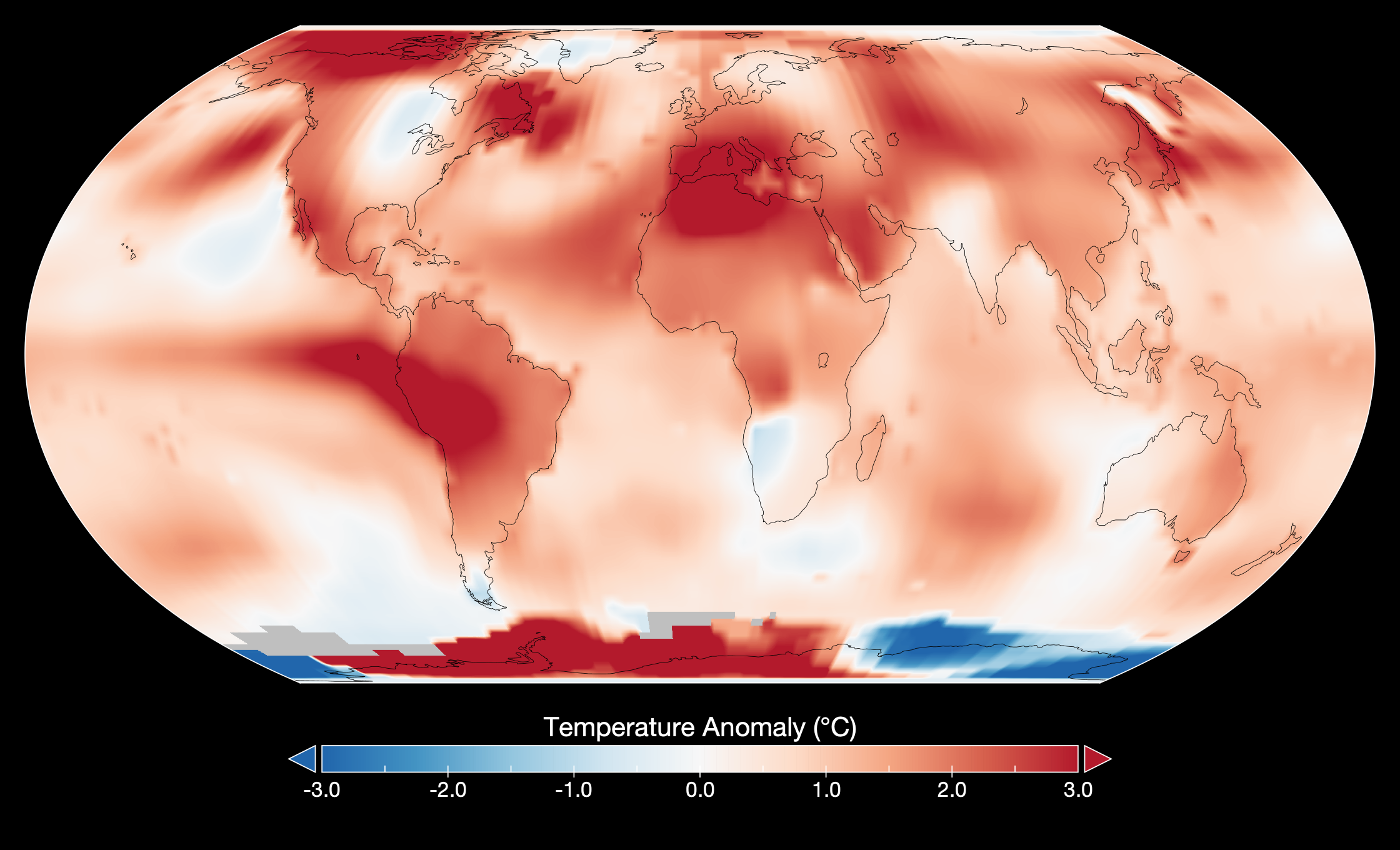
By Adam Voiland 28 June 2024 (NASA) – It’s only the beginning of the summer season in the Northern Hemisphere, but Earth is already roasting. Scientists from NASA’s Goddard Institute for Space Studies recently reported that May 2024, the hottest May in NASA’s global surface temperature analysis, marked a full year of record-high monthly temperatures. Likewise, NOAA recently reported that January through […]
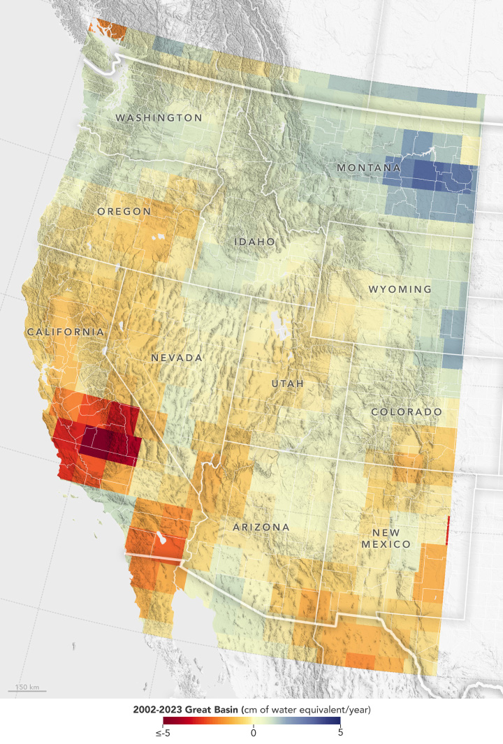
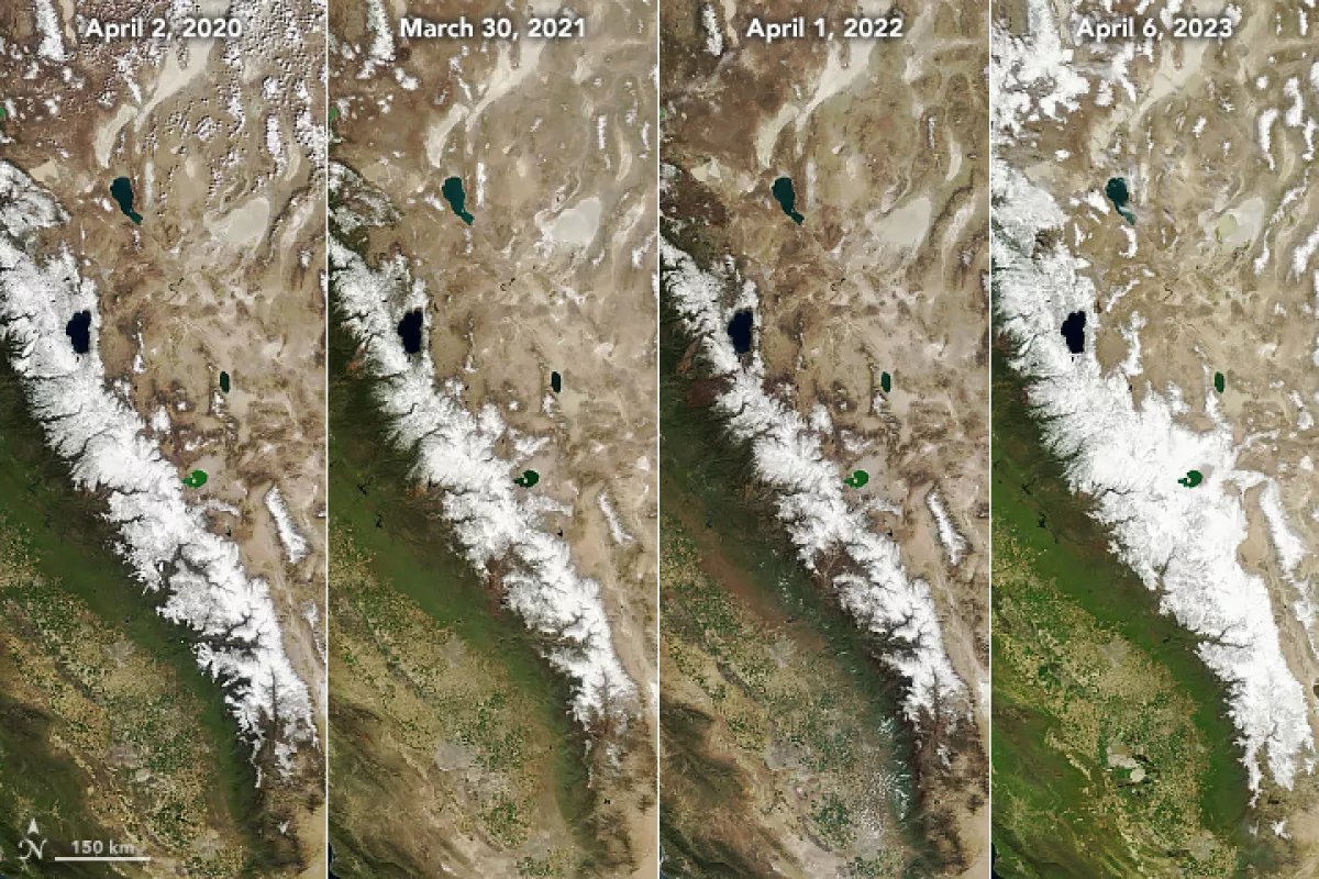
By James R. Riordon 17 June 2024 (NASA GSFC) – Record snowfall in recent years has not been enough to offset long-term drying conditions and increasing groundwater demands in the U.S. Southwest, according to a new analysis of NASA satellite data [Snowfall Replenishes Groundwater Loss in the Great Basin of the Western United States, but […]
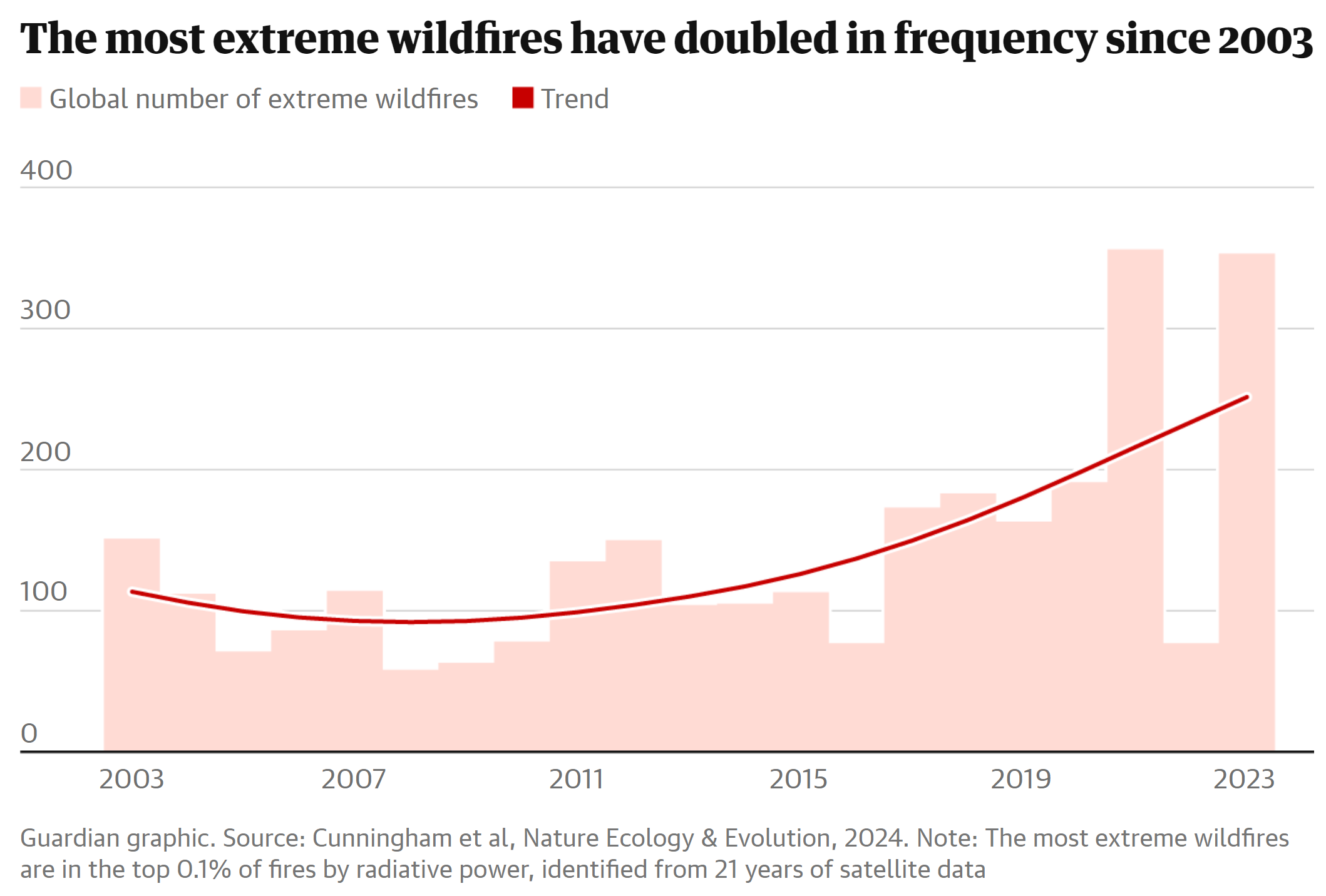
By Damian Carrington 24 June 2024 (The Guardian) – The climate crisis is driving an exponential rise in the most extreme wildfires in key regions around the world, research has revealed. The wildfires can cause catastrophic loss of human life, property and wildlife and cause billions of dollars of damage. Scientists say this is climate […]
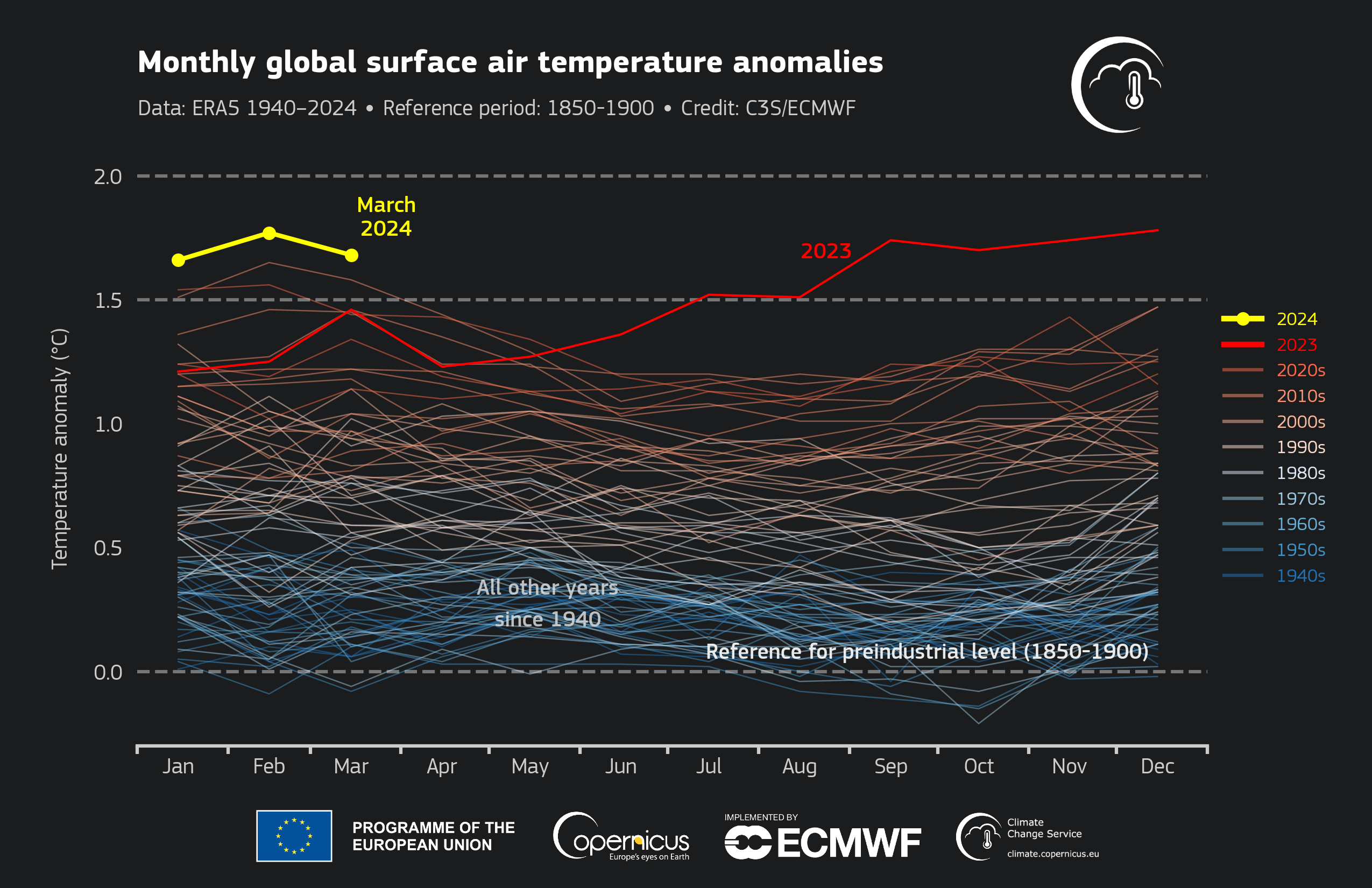
By Jonathan Erdman 12 April 2024 (Weather.com) – March was Earth’s warmest on record, according to data from three separate agencies, the latest month in a stretch of heat records since the planet’s hottest year in 2023. Another month, another record In a report released Friday, NOAA found March’s globally average temperature was 2.43 degrees Fahrenheit above […]
By Sheri Walsh 14 August 2023 (UPI) – July 2023 was the hottest month on record in 143 years, as Americans felt “the effects of the climate crisis,” scientists at NASA’s Goddard Institute for Space Studies in New York announced Monday. According to NASA, July 2023 was on average 0.43 degrees Fahrenheit warmer than any […]
By Jennifer Chu 12 July 2023 (MIT News Office) – The ocean’s color has changed significantly over the last 20 years, and the global trend is likely a consequence of human-induced climate change, report scientists at MIT, the National Oceanography Center in the U.K., and elsewhere. In a study appearing today in Nature, the team writes […]
By Terry Castleman 10 May 2023 (Los Angeles Times) – After a series of atmospheric rivers and cold weather hit California, this year’s snowpack was one of the biggest in history. “This year’s result will go down as one of the largest snowpack years on record in California,” Sean de Guzman, manager of the Department of Water Resources’ snow surveys, said […]
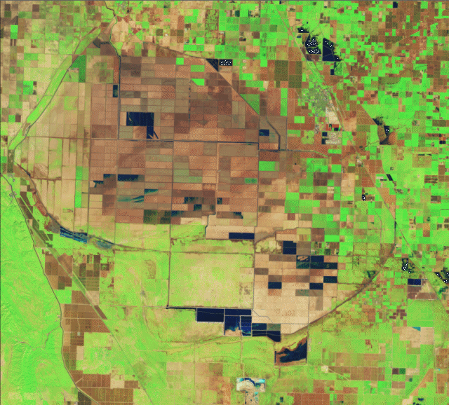
By Jess Thomson 5 May 2023 (Newsweek) – The long-dried basin of Lake Tulare in California has rapidly refilled in the wake of intense rainfall and snowmelt. The speed and scale of the southern San Joaquin Valley lake’s return can be seen in images taken from space by the Operational Land Imager (OLI) on NASA‘s Landsat […]