Striking satellite photos show the dramatic scale of California’s 2023 snowpack – “This melt really is still just getting started”
By Terry Castleman
10 May 2023
(Los Angeles Times) – After a series of atmospheric rivers and cold weather hit California, this year’s snowpack was one of the biggest in history.
“This year’s result will go down as one of the largest snowpack years on record in California,” Sean de Guzman, manager of the Department of Water Resources’ snow surveys, said in a news release.
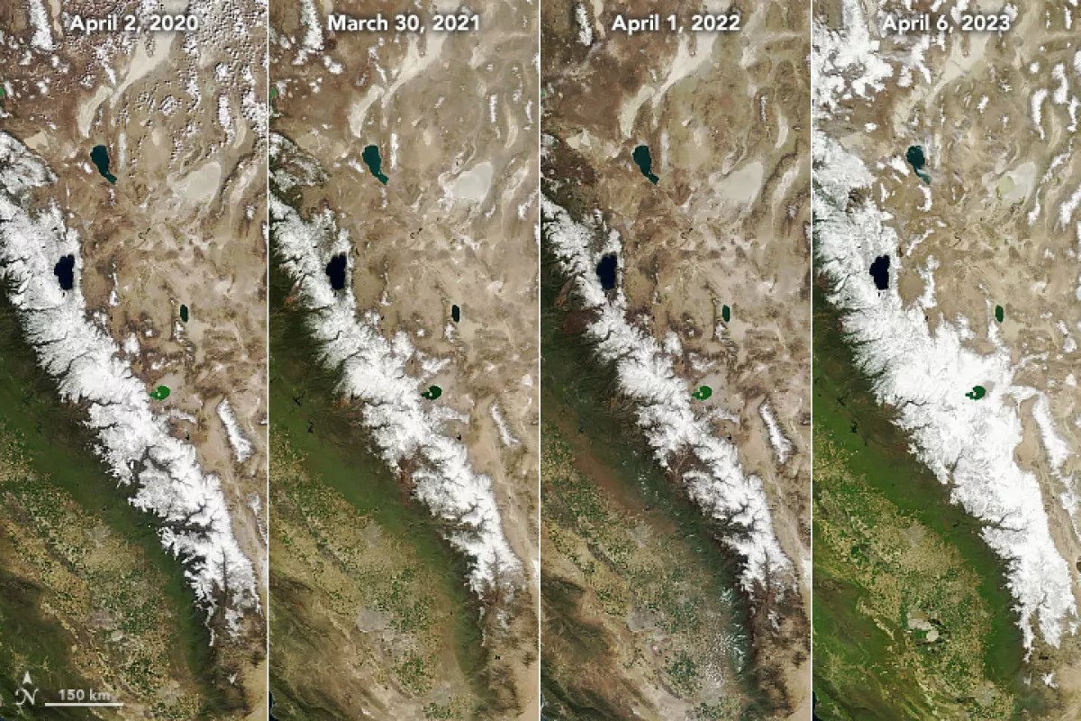
Striking images from the Moderate Resolution Imaging Spectroradiometer on NASA’s Terra satellite show just how massive the snowpack was.
The satellite images below show the Sierra Nevada mountain range on April 1, 2022, and April 6, 2023.
After what DWR director Karla Nemeth called “the driest three years on record,” which brought “devastating drought impacts to communities across the state,” this year’s weather has eased the drought and brought with it a new risk: flooding.
The side-by-side images below, also from NASA, show this year’s snowpack compared to that of the previous three years. The images show the Sierra at the end of winter from 2020 through 2023.
In April 2020, snowpack was at 50% of average levels for April. In April 2021, the figure was 62%. By April 2022, snowpack was at just 35% of average levels.
The big melt has begun, but plenty of snow remains. DWR’s most recent reading shows statewide snowpack at 243% of the average May level.
“This melt really is still just getting started,” Daniel Swain, a climate scientist with UCLA, told The Times. “I know that’s hard to believe, but we’re getting into May, and the peak is probably yet to come.”
Striking satellite photos show the dramatic scale of California’s 2023 snowpack