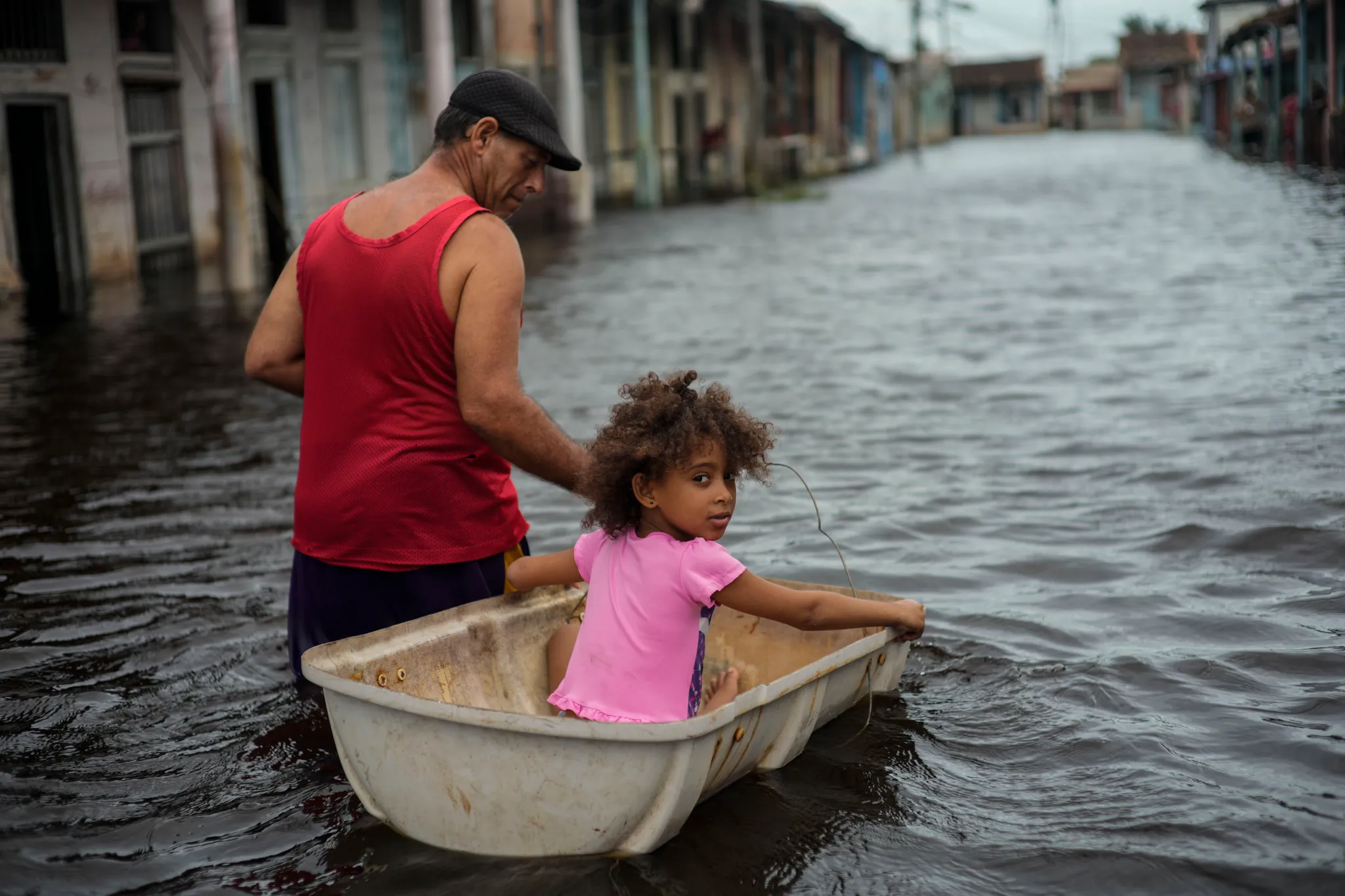
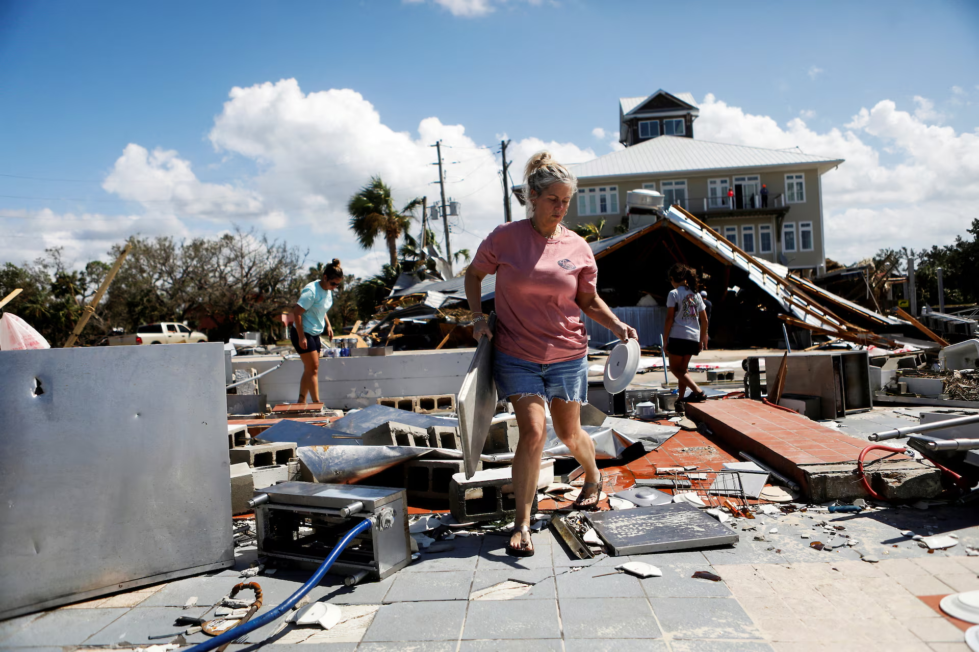
By Bill McKibben 9 October 2024 (The Guardian) – Even as the good people of Florida’s west coast pulled the soggy mattresses from Helene out to the curb, Milton appeared on the horizon this week – a double blast of destruction from the Gulf of Mexico that’s a reminder that physics takes no time off, not even in the […]
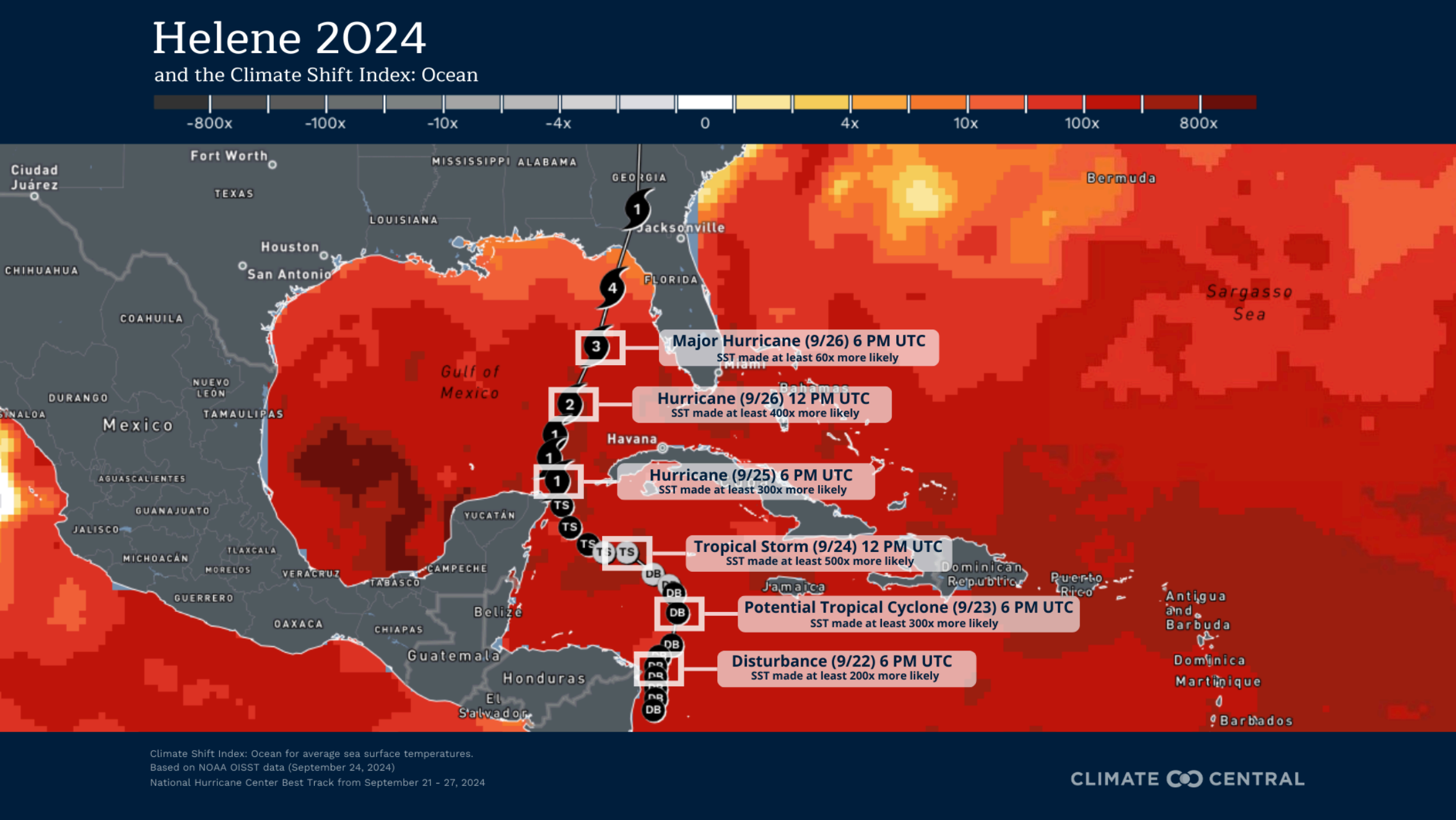
By Rachel Ramirez 9 October 2024 (CNN) – The exceptionally warm water of the Gulf of Mexico that supercharged deadly Helene last month was made up to 500 times more likely by human-caused climate change, which also ramped up the hurricane’s wind and rain, according to a new scientific analysis. Helene, which made landfall in Florida as […]
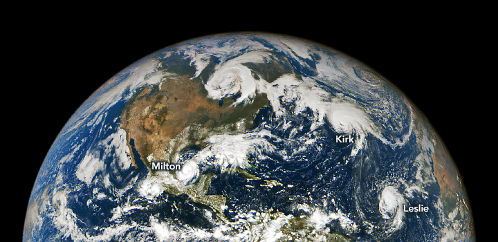
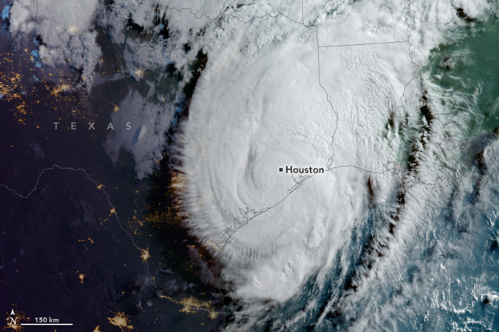
By Emily Cassidy 8 October 2024 (NASA Earth Observatory) – From the stable Lagrange point 1, located one million miles above Earth, NASA’s EPIC (Earth Polychromatic Imaging Camera) imager on the DSCOVR (Deep Space Climate Observatory) satellite observed an unusually active Atlantic Basin. In early October, three hurricanes simultaneously spun over the North Atlantic Ocean. This image shows the three […]
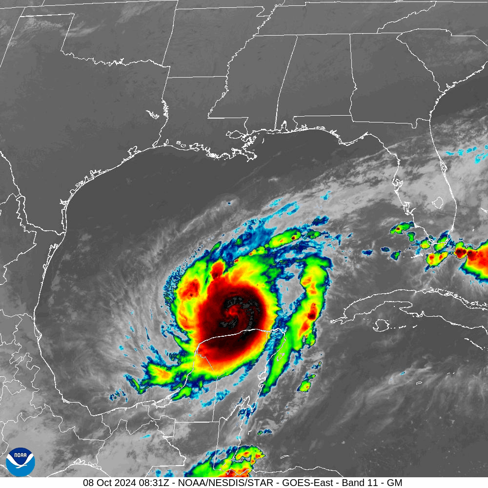
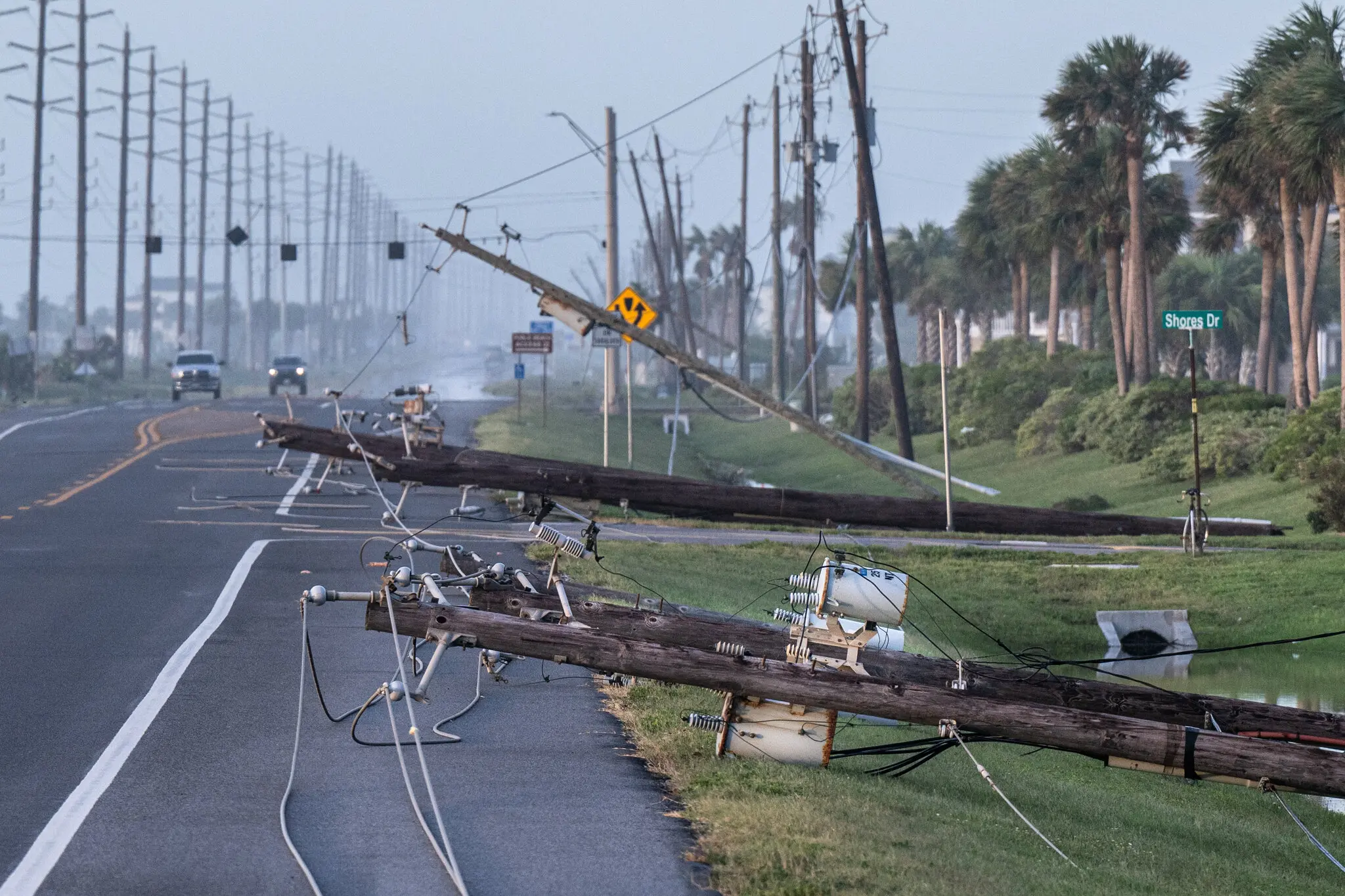
By Denise Chow 7 October 2024 (NBC News) – Hurricane Milton’s last 36 hours have been nothing short of astonishing, as it strengthened from a tropical storm to a Category 5 hurricane in just over a day. The storm’s blisteringly fast evolution is part of a trend of rapidly intensifying storms fueled by climate change. The term “rapid intensification” […]
8 August 2024 (Center for American Progress) – In the devastating aftermath of Hurricane Debby, the Southeast is tasked with the difficult work of rebuilding homes, businesses, and lives. Initial reports indicate at least six people have died from the storm. Federal agencies play a critical role in providing swift and efficient support to these families and […]
By J. David Goodman and Ivan Penn 10 July 2024 (The New York Times) – The sun felt hotter than usual in Houston this week, as millions of sweltering residents emerged from the rapid thrashing of Hurricane Beryl to face a prolonged power outage — the largest ever seen by the city’s utility, according to […]
By Clyde Hughes, Allen Cone, and Darryl Coote 8 July 2024 (UPI) – At least eight people were killed after Hurricane Beryl slammed southeast Texas with heavy winds, rain and flash flooding Monday. More than 2.5 million were still without power late Monday. The death toll included seven people killed in Texas and one in […]
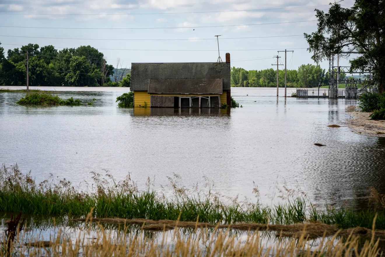
By Tyne Morgan 3 July 2024 (Farm Journal) – Portions of Iowa, South Dakota, and Nebraska are grappling with the aftermath of flooding, while continuing to fight a swollen river. The Mississippi River is facing flood threats, too. The high waters and flooding are suffocating fields, causing crop damage to key growing areas across the […]
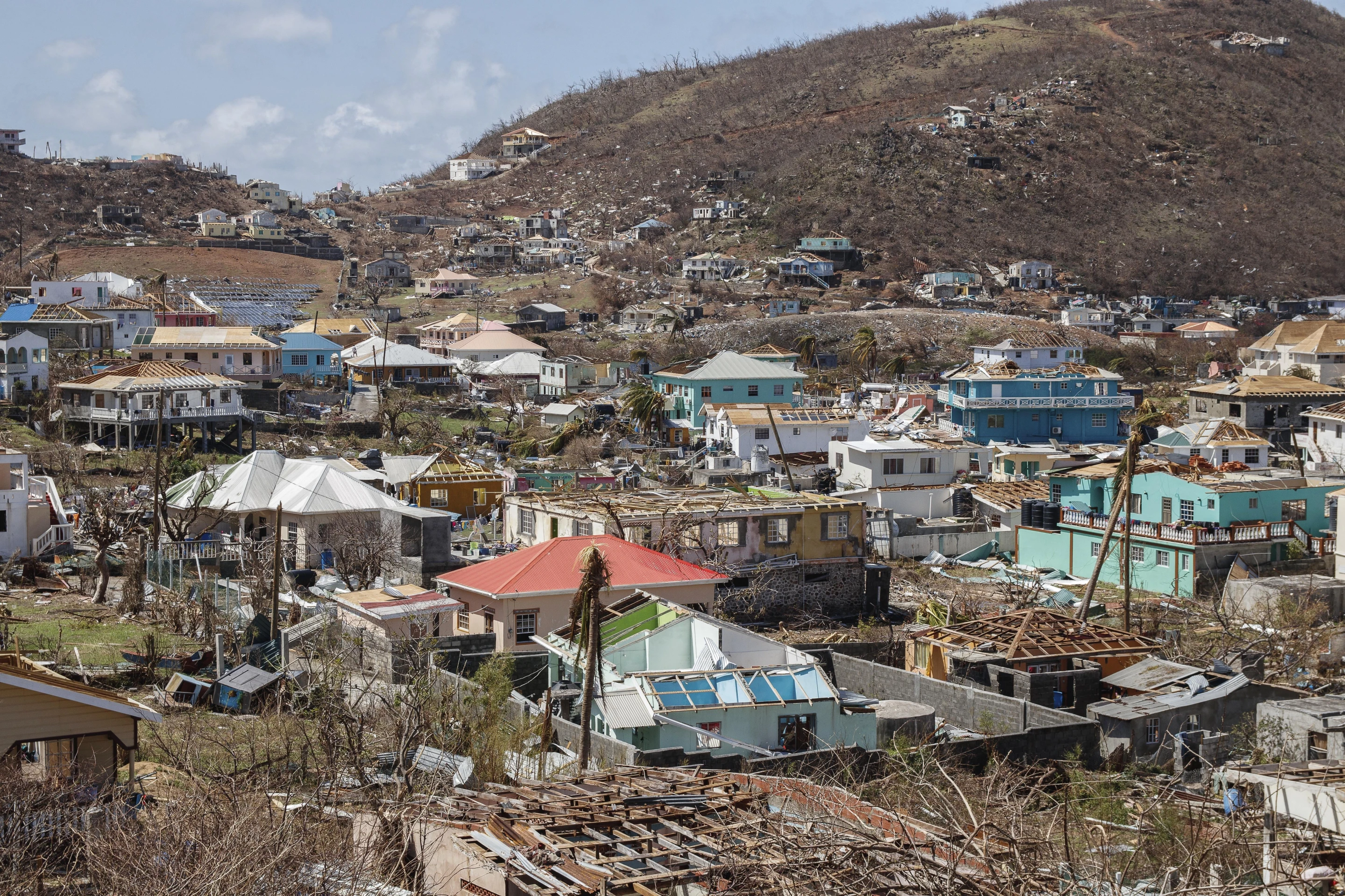
By Martín Silva and John Myers Jr. 5 July 2024 TULUM, Mexico (AP) – Beryl battered Mexico’s Yucatan Peninsula on Friday after hitting near the resort town of Tulum, whipping trees and knocking out power, while officials in Texas urged coastal residents to prepare as the storm moves toward the Gulf of Mexico. Beryl hit Mexico as […]
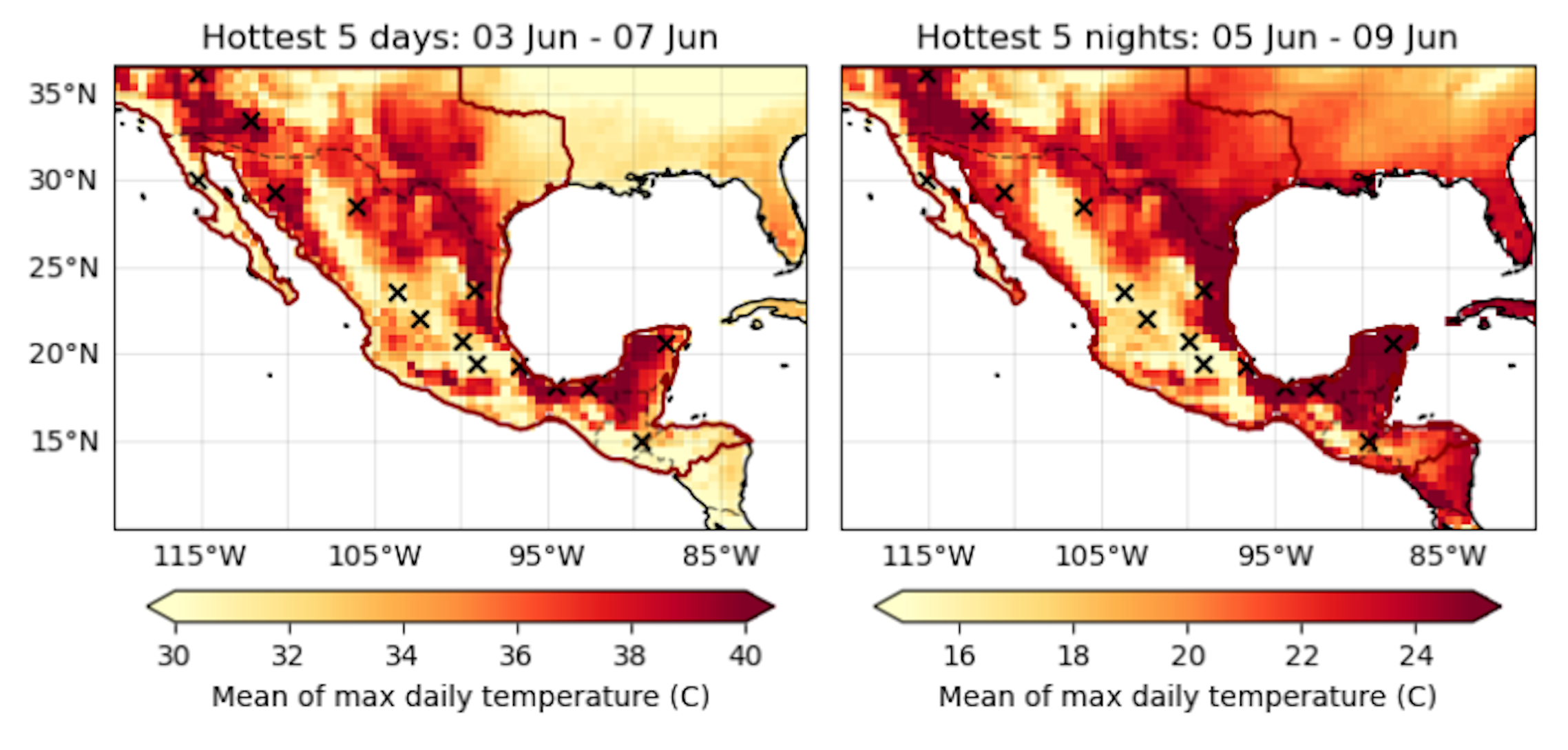
By Seth Borenstein 20 June 2024 WASHINGTON (AP) – Human-caused climate change dialed up the thermostat and turbocharged the odds of this month’s killer heat that has been baking the Southwestern United States, Mexico and Central America, a new flash study found. Sizzling daytime temperatures that triggered cases of heat stroke in parts of the United States were […]