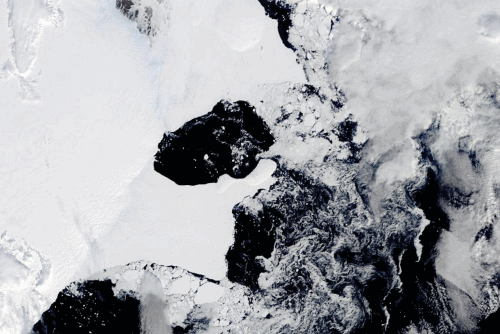
By Isla Binnie 25 March 2022 (Reuters) – An East Antarctica ice shelf disintegrated this month following a period of extreme heat in the region, according to scientists. Satellite images show the 1,200 square-kilometre Conger Ice Shelf collapsed completely on or around March 15. “Possible it hit its tipping point following the #Antarctic #AtmosphericRiver and […]
AMHERST, Massachusetts, 15 December 2021 (University of Massachusetts Amherst) – New research from the University of Massachusetts Amherst provides a novel answer to one of the persistent questions in historical climatology, environmental history and the earth sciences: what caused the Little Ice Age? The answer, we now know, is a paradox: warming. The Little Ice […]
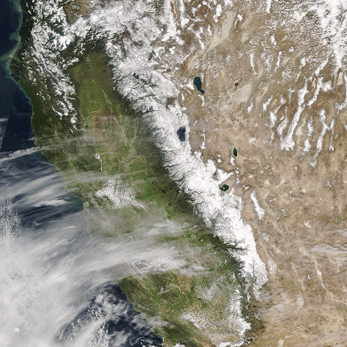
By Denise Chow 1 December 2021 (NBC News) – The Sierra Nevada snowpack, a major source of water for California, could largely disappear in 25 years if global warming continues unchecked, according to a recent study. The worrisome findings, published 26 October 2021 in the journal Nature Reviews Earth & Environment, have serious implications for California’s […]
By T. A. Moon, M. L. Druckenmiller, and R. L. Thoman 6 December 2021 (NOAA) – As the influences of human-caused global warming continue to intensify, with the Arctic warming significantly faster than the globe overall, the 2021 Arctic Report Card (ARC2021) brings a broad view of the state of the Arctic climate and environment. […]
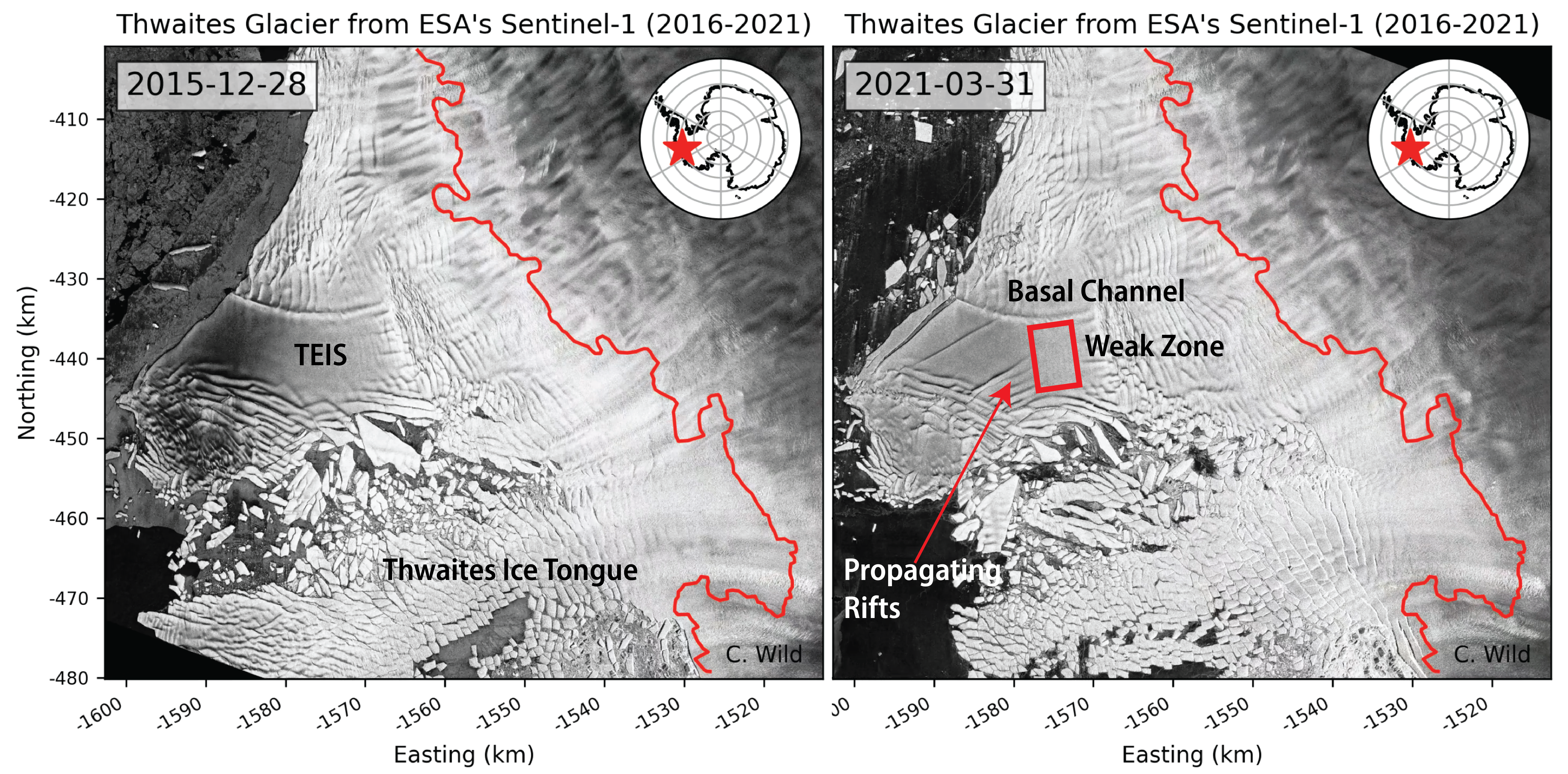
By Ella Gilbert 22 December 2021 (The Conversation) – The massive Thwaites glacier in West Antarctica contains enough ice to raise global sea levels by 65 centimeters if it were to completely collapse. And, worryingly, recent research suggests that its long-term stability is doubtful as the glacier haemorrhages more and more ice. Adding 65 centimeters to global sea levels […]
GENEVA, 31 October 2021 (WMO) – Record atmospheric greenhouse gas concentrations and associated accumulated heat have propelled the planet into uncharted territory, with far-reaching repercussions for current and future generations, according to the World Meteorological Organization (WMO). The past seven years are on track to be the seven warmest on record, according to the provisional WMO […]
9 April 2021 (University of Gothenburg) – For the first time, researchers have been able to obtain data from underneath Thwaites Glacier, also known as the “Doomsday Glacier”. They find that the supply of warm water to the glacier is larger than previously thought, triggering concerns of faster melting and accelerating ice flow. With the […]
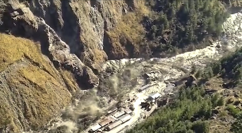
By Hannah Ellis-Petersen 8 February 2021 DELHI, India (The Guardian) – Twenty six bodies have been recovered in the Indian Himalayas and scores more people are still missing after a second day of rescue efforts after a glacier break that caused an avalanche of water and debris to engulf a river valley and demolish two […]
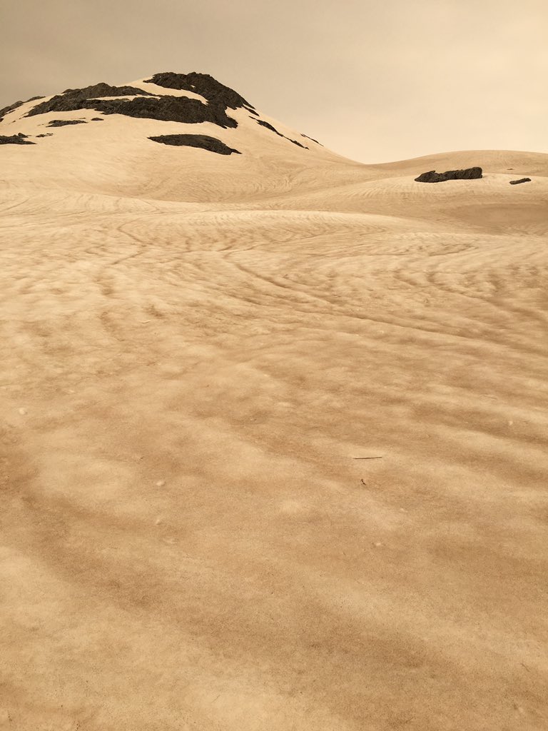
By Eleanor Ainge Roy 1 January 2020 WANAKA (The Guardian) – Snow and glaciers in New Zealand have turned brown after being exposed to dust from the Australian bushfires, with one expert saying the incident could increase glacier melt this season by as much as 30 percent. On Wednesday many parts of the South Island woke […]
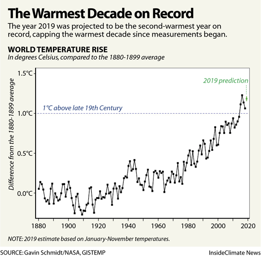
By Bob Berwyn 19 December 2019 (InsideClimate News) – Deadly heat waves, wildfires and widespread flooding punctuated a decade of climate extremes that, by many scientific accounts, show global warming kicking into overdrive. As the year drew to a close, scientists were confidently saying 2019 was Earth’s second-warmest recorded year on record, capping the warmest […]