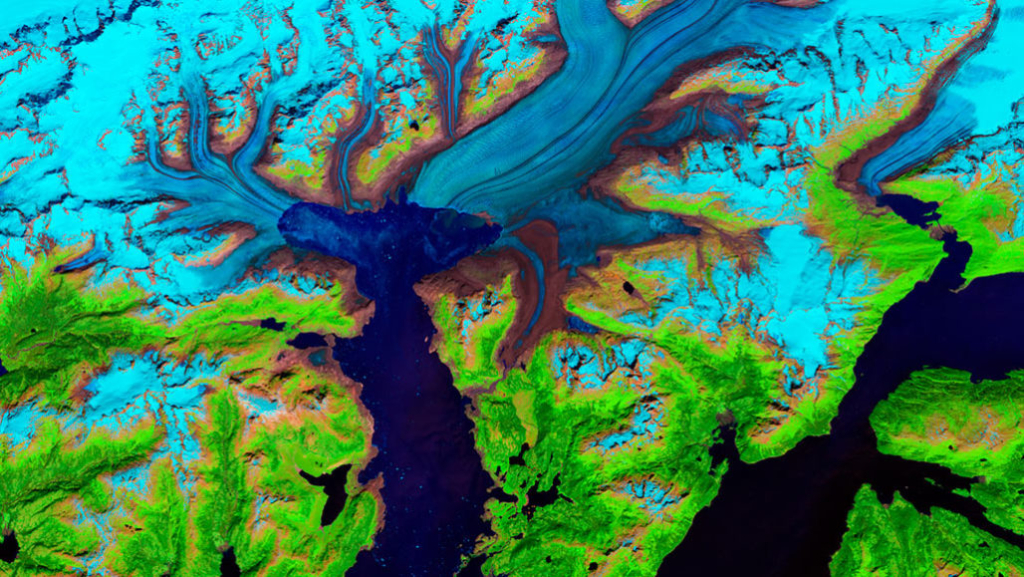
Video: 47 years of satellite images show retreat of Alaskan’s Columbia glacier
By Carolyn Gramling
10 December 2019
SAN FRANCISCO (Science News) – A mesmerizing new series of images shows the retreat of Alaska’s Columbia glacier over the last 47 years in gorgeous, excruciating detail. The images were presented December 10 at the American Geophysical Union’s annual meeting.
Landsat satellites operated by NASA and the U.S. Geological Survey have been collecting images of Earth since 1972, making the program the longest space-based observer of Earth’s land surface. That record provides an unprecedented opportunity to watch the movement of ice through time: the flow and rapid retreat of glaciers, the calving off of large chunks of ice and when landslide debris gets caught up in the action, says glaciologist Mark Fahnestock of the University of Alaska Fairbanks.
To illustrate the dynamic dance of the ice over time, Fahnestock and colleagues selected annual Landsat images of several of Alaska’s glaciers, including fast-retreating Columbia glacier on Prince William Sound, and turned them into mini movies. The images show how Columbia glacier has retreated by more than 20 kilometers since about 1980.