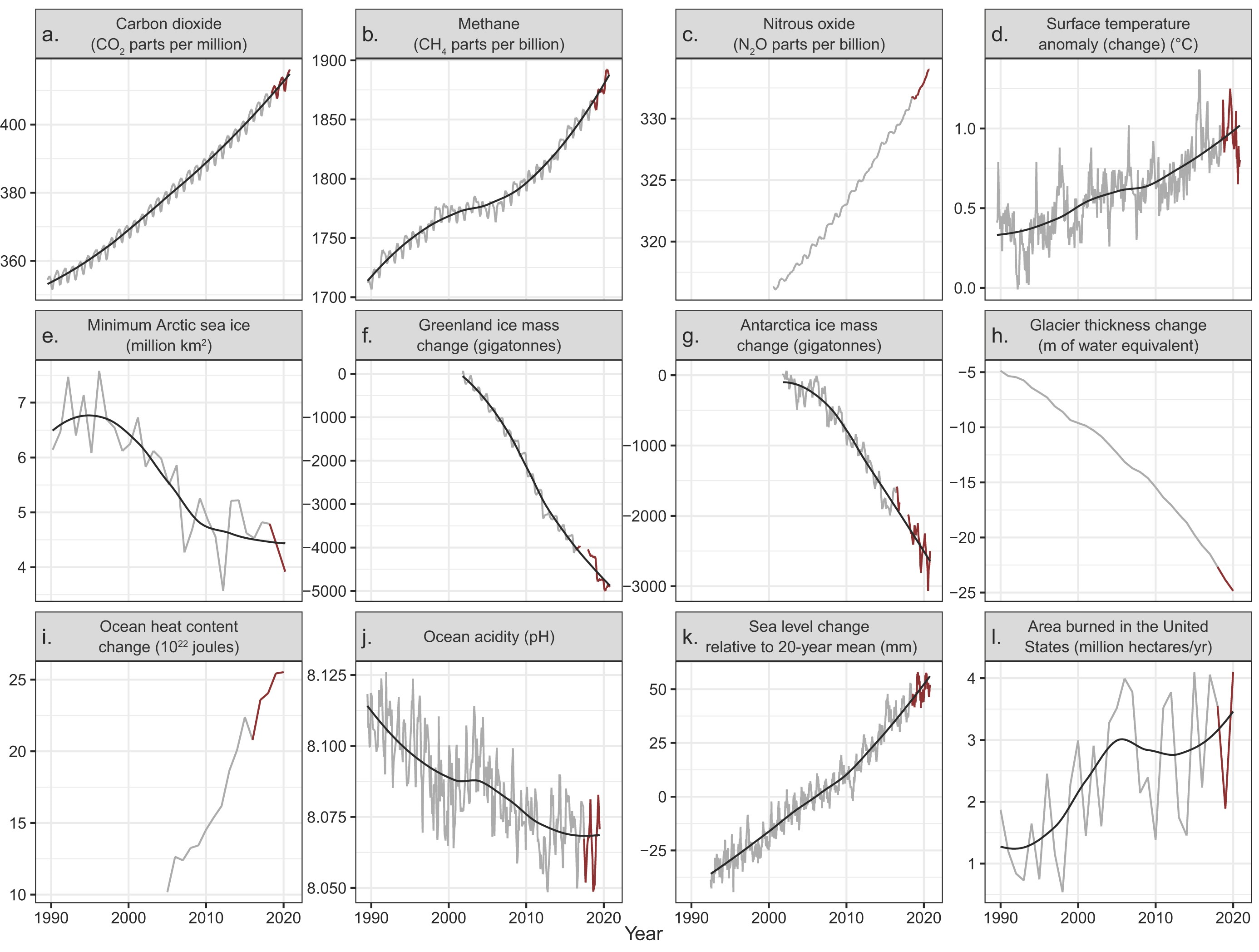
28 July 2021 (BioScience) – In 2019, Ripple and colleagues (2020) warned of untold suffering and declared a climate emergency together with more than 11,000 scientist signatories from 153 countries. They presented graphs of planetary vital signs indicating very troubling trends, along with little progress by humanity to address climate change. On the basis of […]
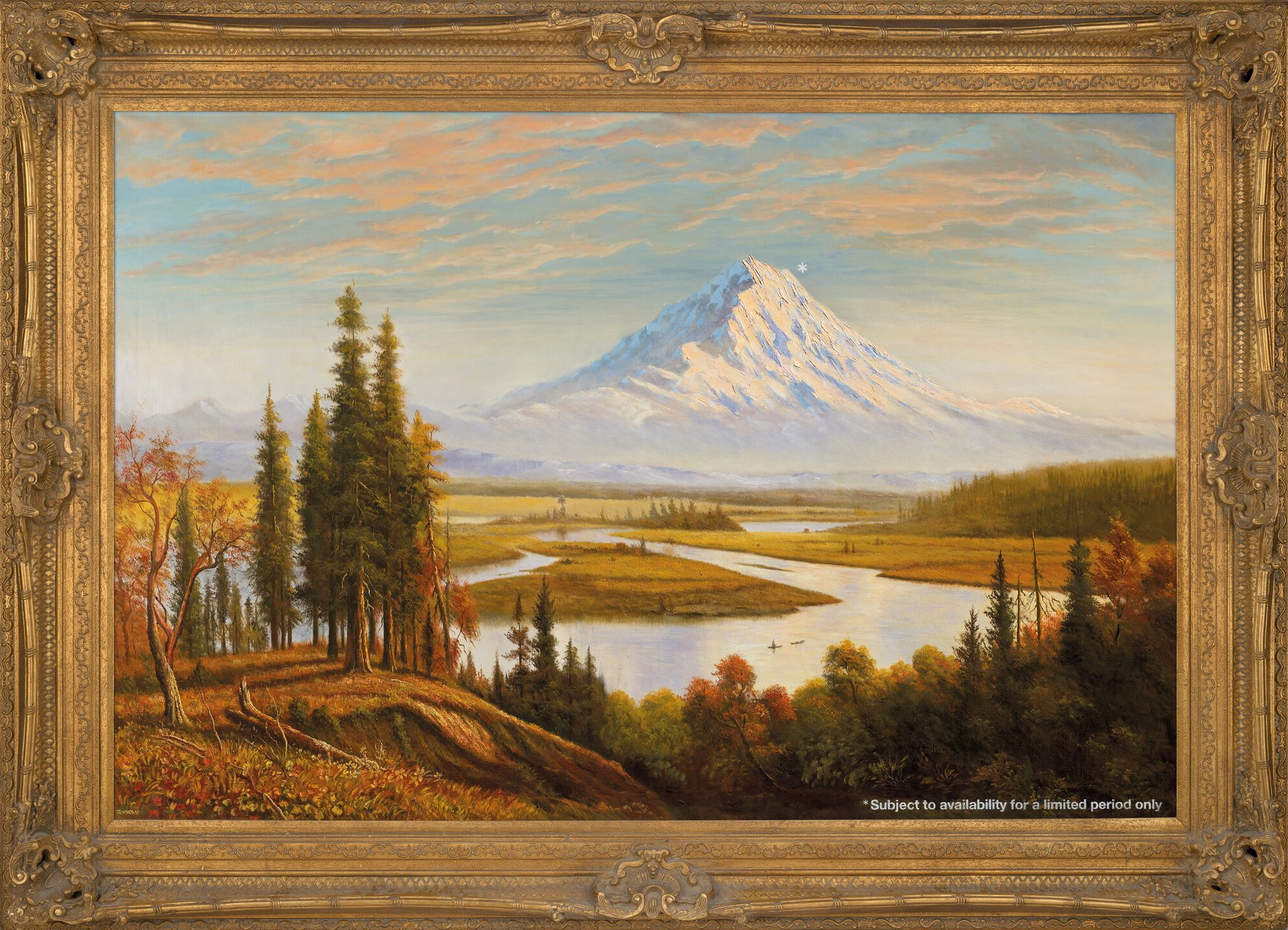
By Megan Burbank 30 June 2021 (The Seattle Times) – As the Puget Sound region coped this week with extreme heat caused by climate change, one of the art world’s most audacious commentaries on the issue reemerged across the Atlantic. A 2009 work of creative vandalism from British artist and agitator Banksy, Subject to Availability, was sold […]
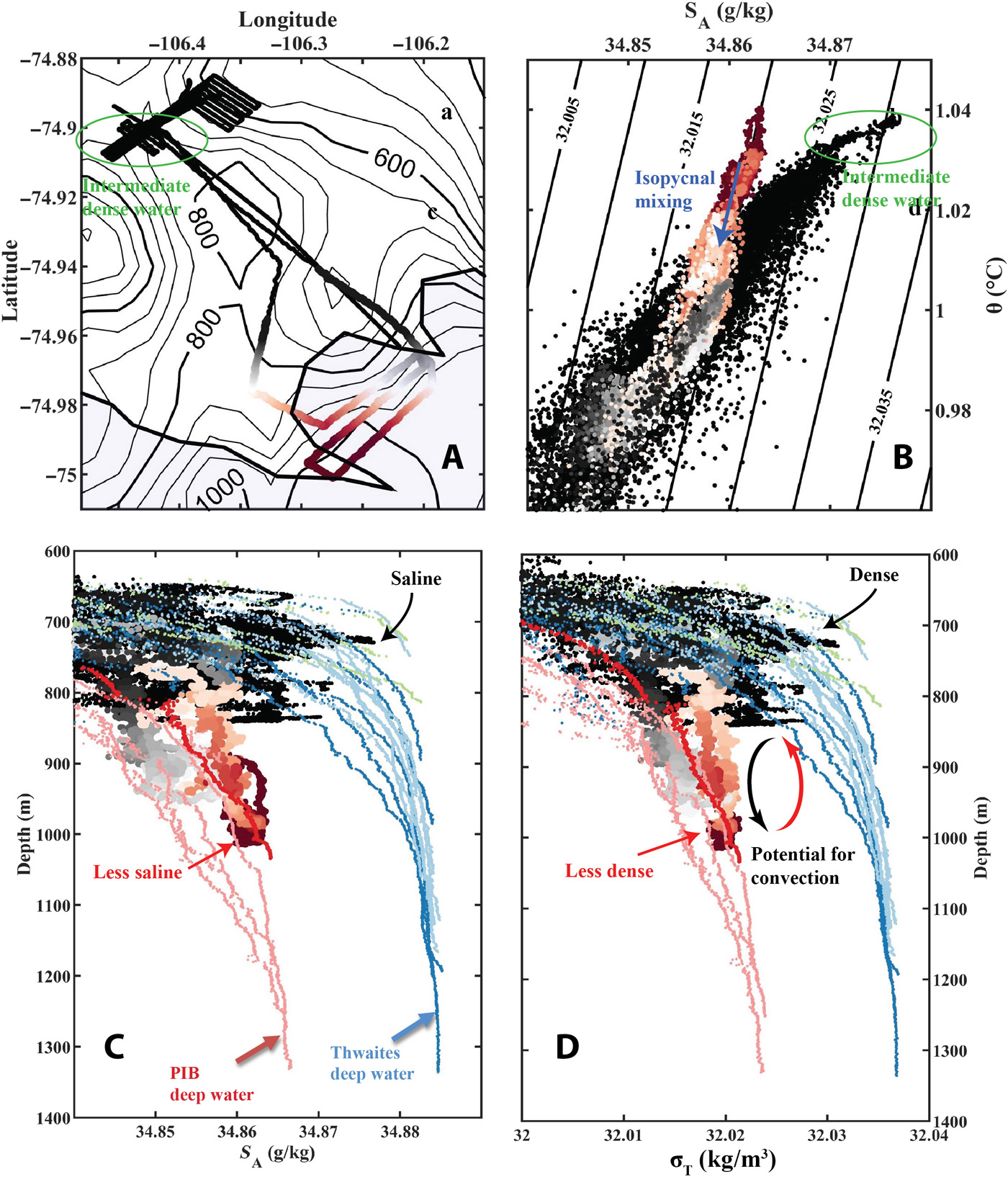
9 April 2021 (University of Gothenburg) – For the first time, researchers have been able to obtain data from underneath Thwaites Glacier, also known as the “Doomsday Glacier”. They find that the supply of warm water to the glacier is larger than previously thought, triggering concerns of faster melting and accelerating ice flow. With the […]
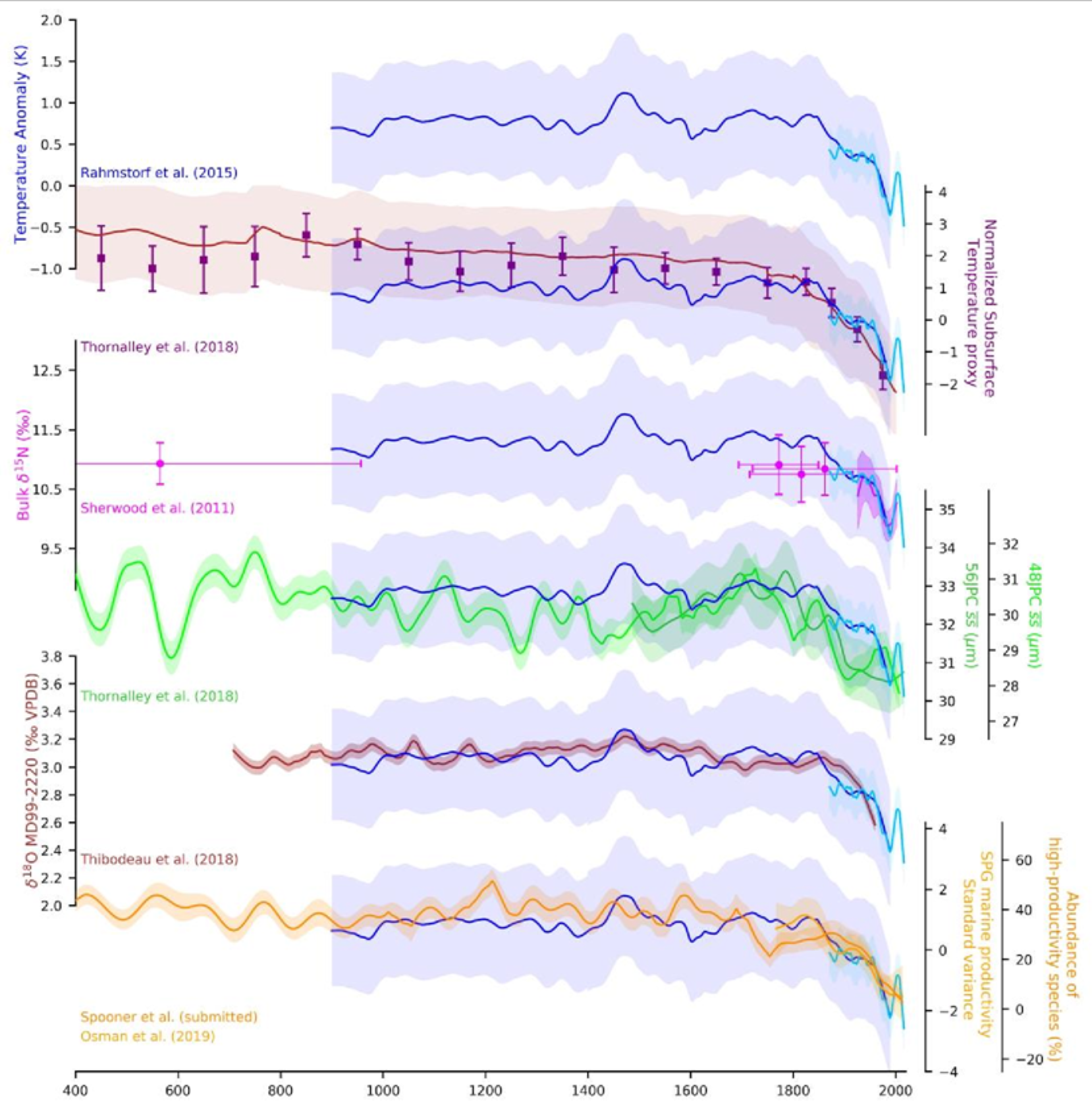
25 February 2021 (PIK) – Never before in over 1000 years the Atlantic Meridional Overturning Circulation (AMOC), also known as Gulf Stream System, has been as weak as in the last decades. This is the result of a new study by scientists from Ireland, Britain, and Germany. The researchers compiled so-called proxy data – taken […]
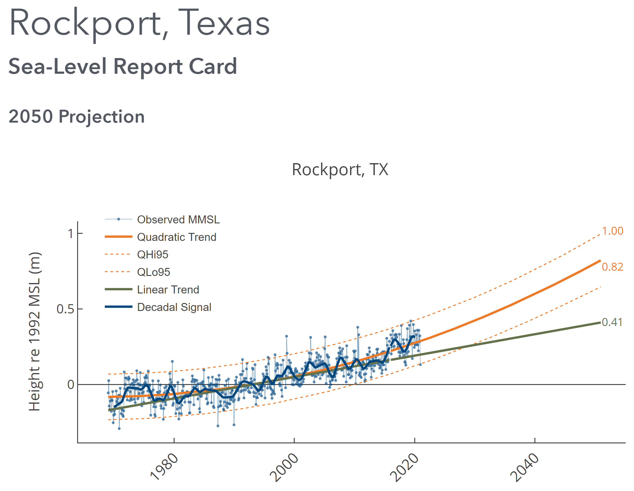
By David Malmquist 24 January 2021 (VIMS) – Sea level “report cards” issued annually by researchers at William & Mary’s Virginia Institute of Marine Science add further evidence of an accelerating rate of sea-level rise during 2020 at nearly all tidal stations along the U.S. coastline. The team’s web-based report cards project sea level to […]
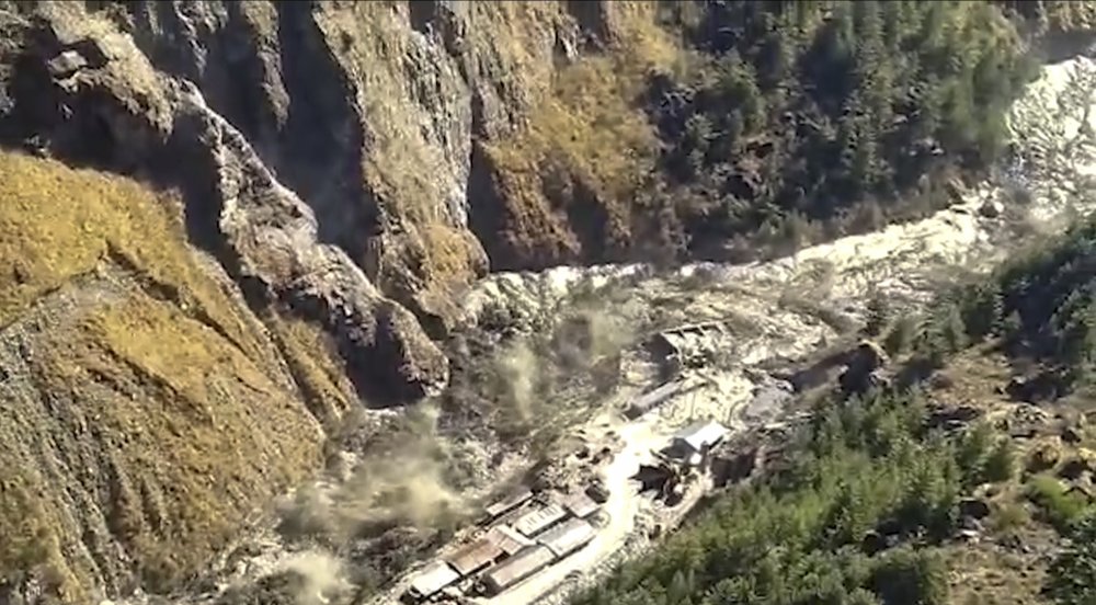
By Hannah Ellis-Petersen 8 February 2021 DELHI, India (The Guardian) – Twenty six bodies have been recovered in the Indian Himalayas and scores more people are still missing after a second day of rescue efforts after a glacier break that caused an avalanche of water and debris to engulf a river valley and demolish two […]
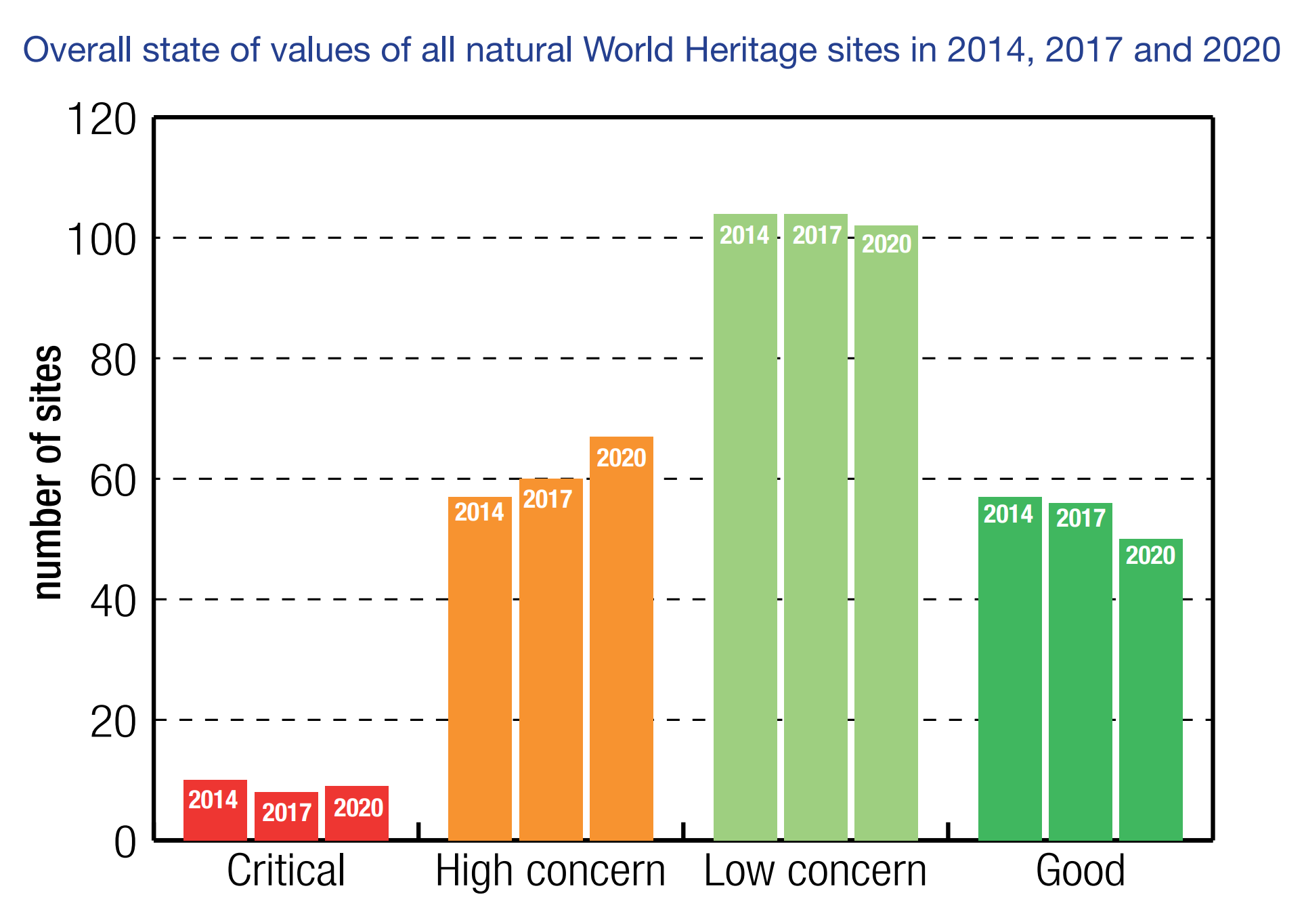
GLAND, SWITZERLAND, 2 December 2020 (IUCN) – Climate change is now the biggest threat to natural World Heritage, according to a report [pdf] published today by IUCN (International Union for Conservation of Nature). A third (33%) of natural World Heritage sites are threatened by climate change, including the world’s largest coral reef, the Great Barrier […]
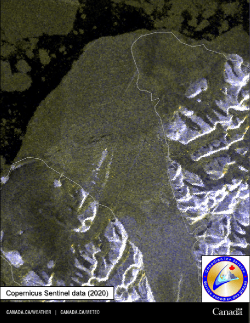
By Moira Warburton 6 August 2020 (Reuters) – The last fully intact ice shelf in the Canadian Arctic has collapsed, losing more than 40% of its area in just two days at the end of July, researchers said on Thursday. The Milne Ice Shelf is at the fringe of Ellesmere Island, in the sparsely populated […]
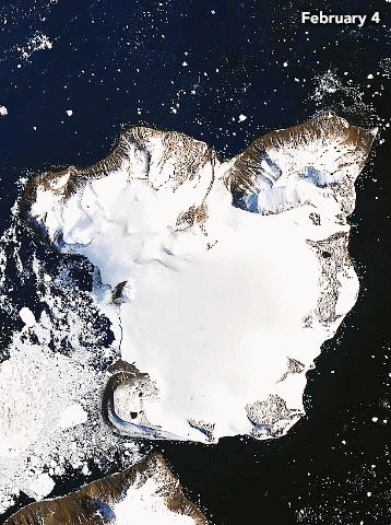
By Kasha Patel 21 February 2020 (NASA) – On 6 February 2020, weather stations recorded the hottest temperature on record for Antarctica. Thermometers at the Esperanza Base on the northern tip of the Antarctic Peninsula reached 18.3°C (64.9°F)—around the same temperature as Los Angeles that day. The warm spell caused widespread melting on nearby glaciers. The warm […]
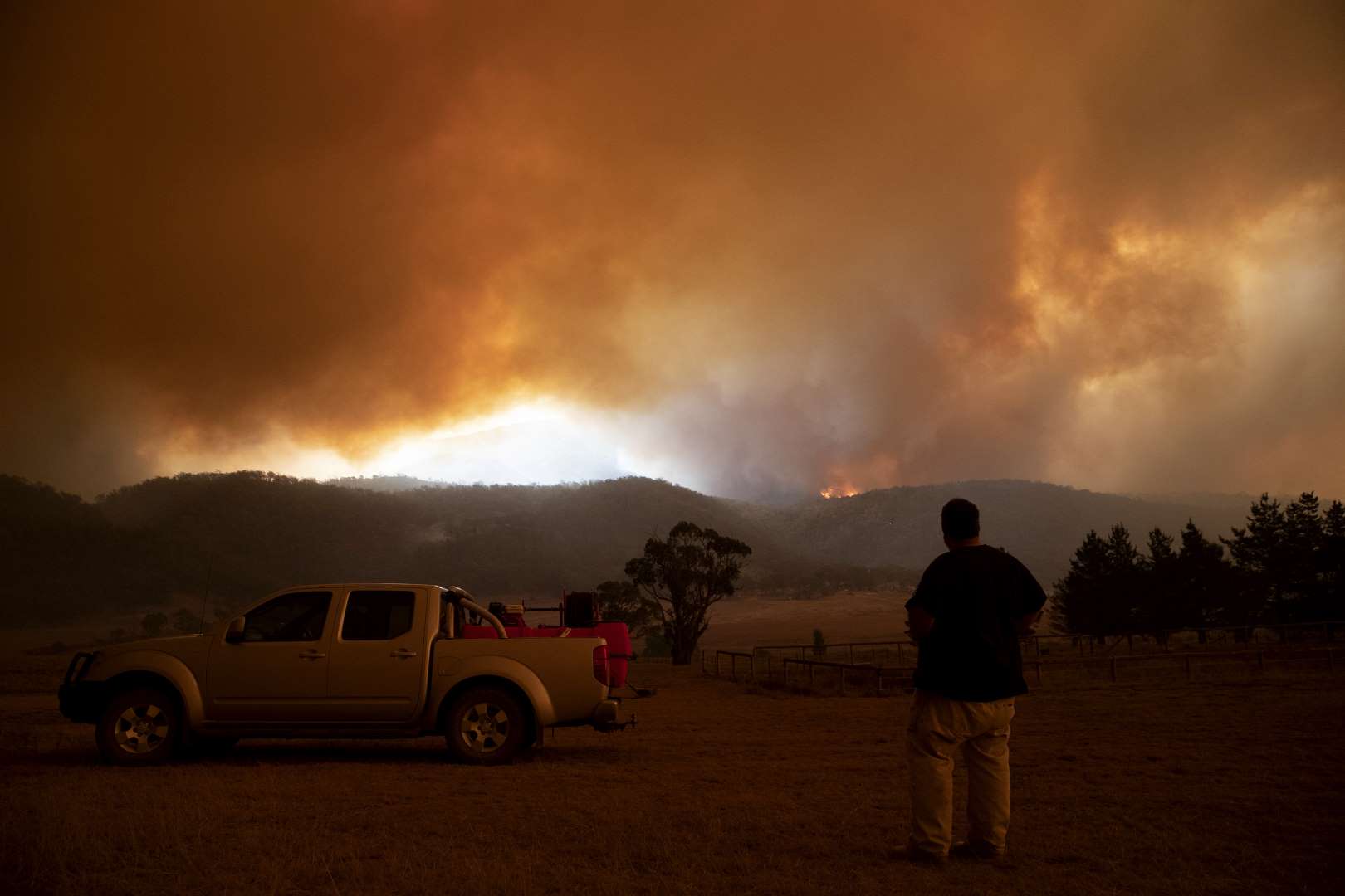
By Larissa Schneider, Colin Cooke, Nathan D Stansell, and Simon Haberle 29 January 2020 (The Conversation) – Climate change and bushfire may exacerbate recent mercury pollution and increase exposure to the poisonous neurotoxin, according to our study published in the Journal of Paleolimnology. Mercury stored in plants is released during bushfires, suggesting Australia is particularly at […]