By Ben Turner 6 August 2021 (LiveScience) – One of the most crucial ocean current systems for regulating the Northern Hemisphere’s climate could be on the verge of total collapse due to climate change, a new study has revealed. The Atlantic Meridional Overturning Circulation (AMOC), which includes the Gulf Stream and is responsible for moderating […]
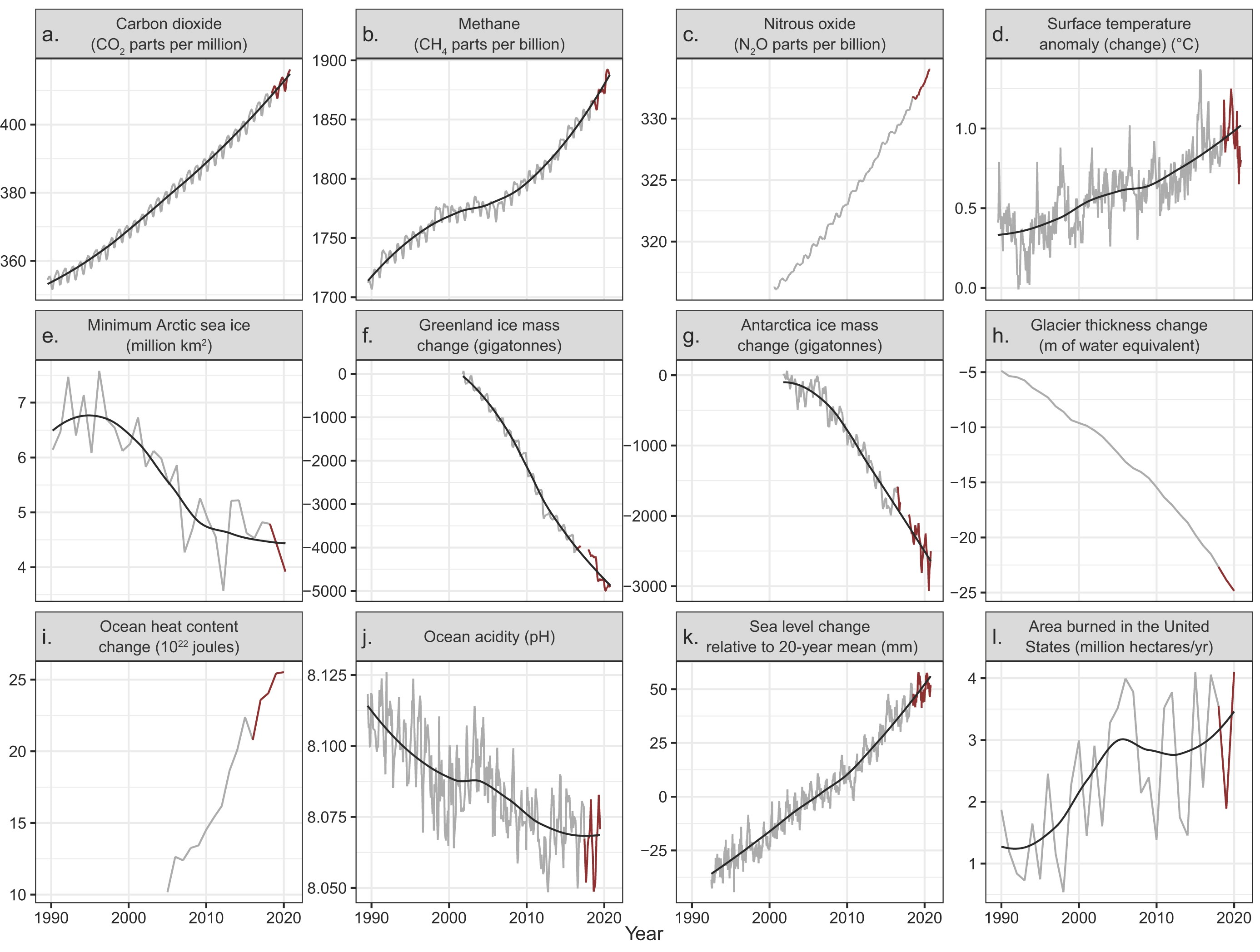
28 July 2021 (BioScience) – In 2019, Ripple and colleagues (2020) warned of untold suffering and declared a climate emergency together with more than 11,000 scientist signatories from 153 countries. They presented graphs of planetary vital signs indicating very troubling trends, along with little progress by humanity to address climate change. On the basis of […]
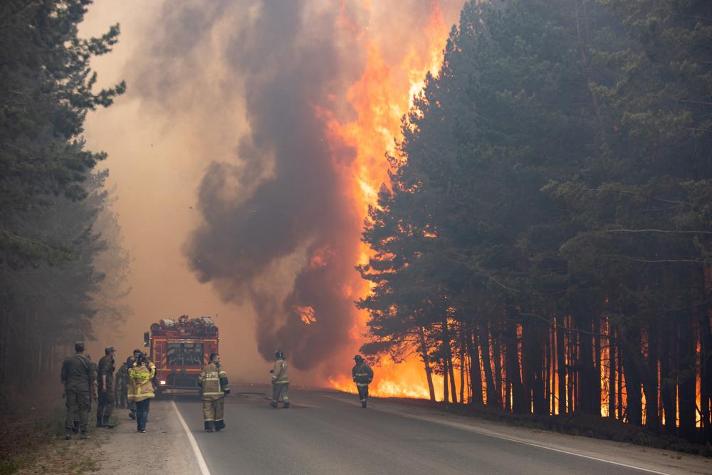
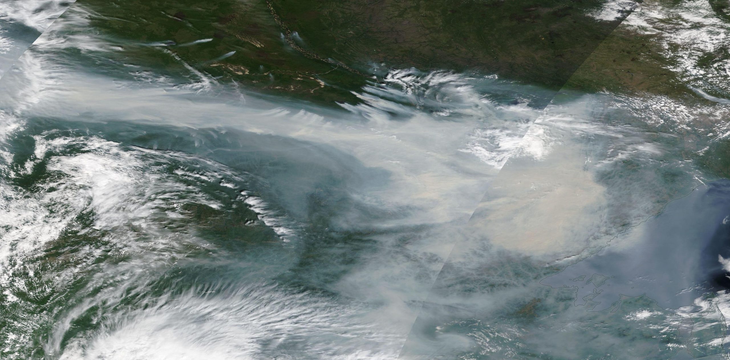
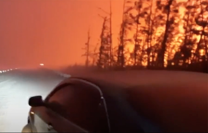
By Andrew Roth 20 July 2021 MOSCOW (The Guardian) – Every morning and evening for the last few days, shifts of young villagers have headed out into the taiga forest around Teryut with a seemingly impossible task: to quell the raging fires that have burned closer and closer for a month, shrouding this remote eastern […]
13 July 2021 (The Siberian Times) – Wildfires on permafrost are ravaging Yakutia – or the Sakha Republic, the largest and coldest entity of the Russian Federation. The scale is mesmerising. There are some separate 300 fires, now covering 12,140 square kilometres – but only around half of these are being tackled, because they pose […]
By Svetlana Skarbo 30 June 2021 (The Siberian Times) – More than 2,000 people are deployed in extinguishing wildfires raging around Russia’s coldest inhabited territory, Yakutia, now in the third year of an extremely intense season of wildfires. The first of them ignited as early as the beginning of May right outside the world-famous Pole […]
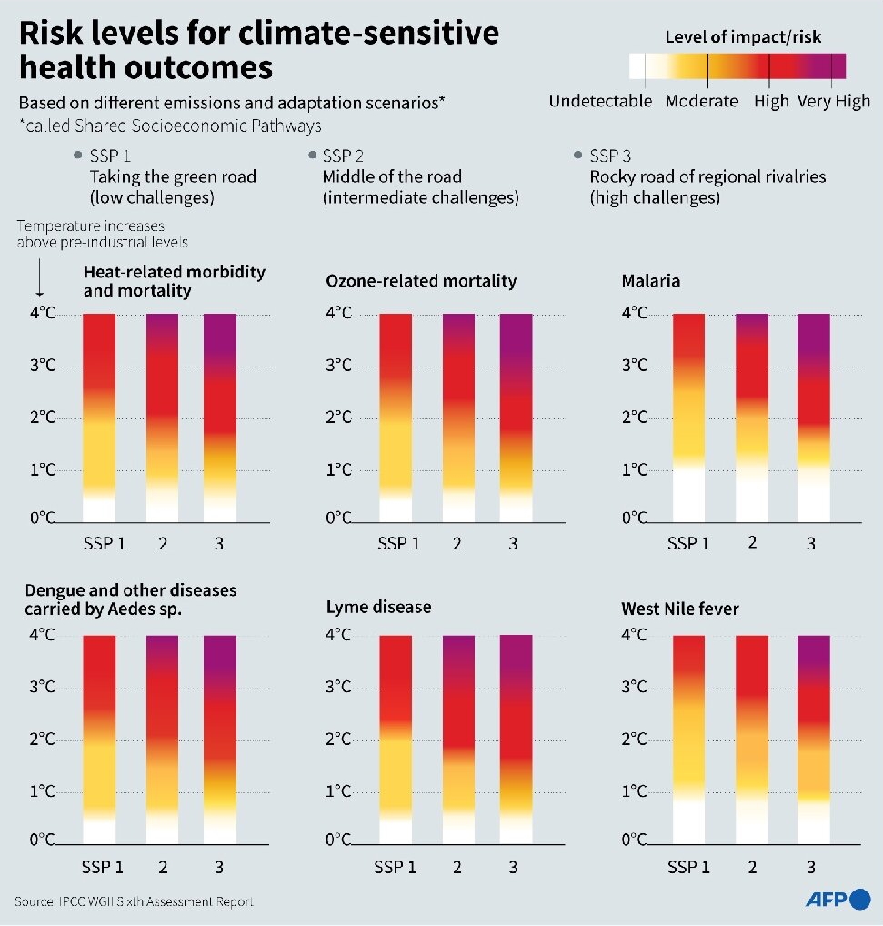
By Patrick Galey 23 June 2021 (AFP) – Hunger, drought and disease will afflict tens of millions more people within decades, according to a draft UN assessment that lays bare the dire human health consequences of a warming planet. After a pandemic year that saw the world turned on its head, a forthcoming report by […]
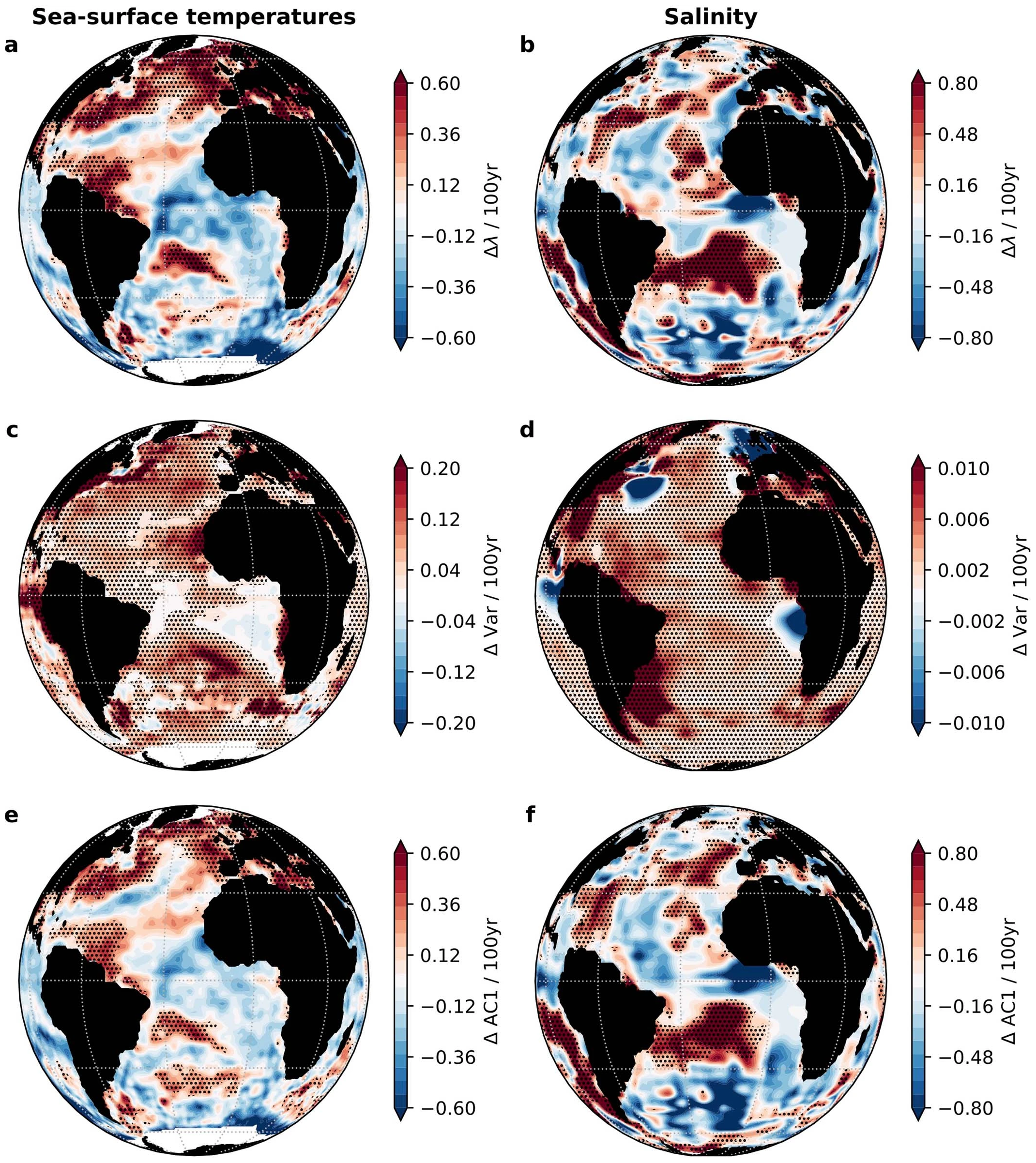
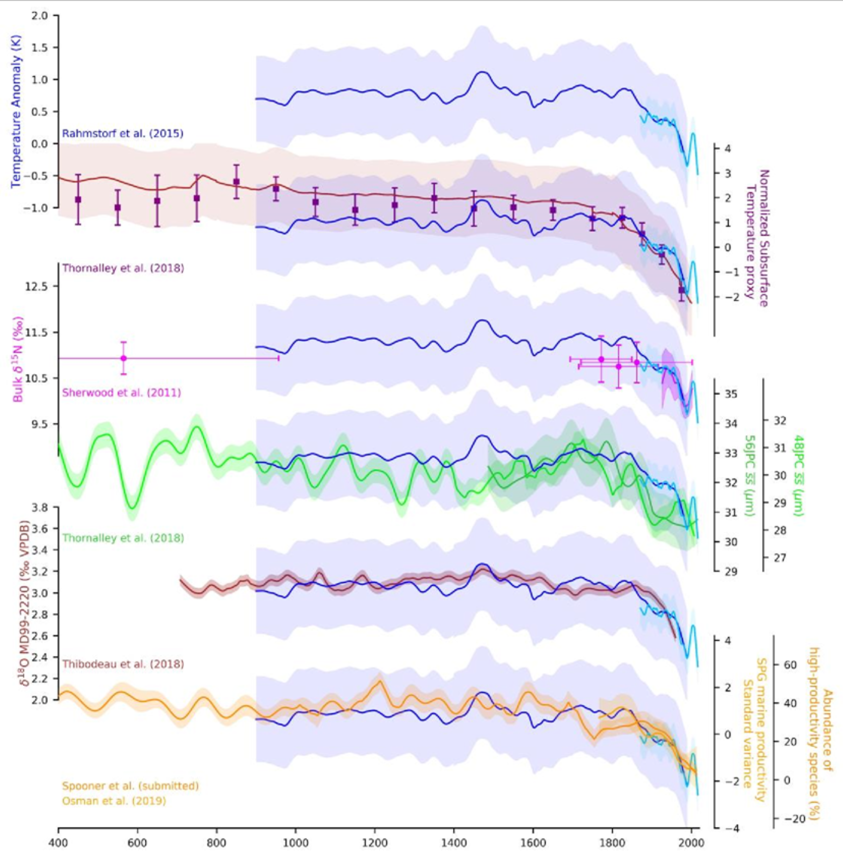
25 February 2021 (PIK) – Never before in over 1000 years the Atlantic Meridional Overturning Circulation (AMOC), also known as Gulf Stream System, has been as weak as in the last decades. This is the result of a new study by scientists from Ireland, Britain, and Germany. The researchers compiled so-called proxy data – taken […]
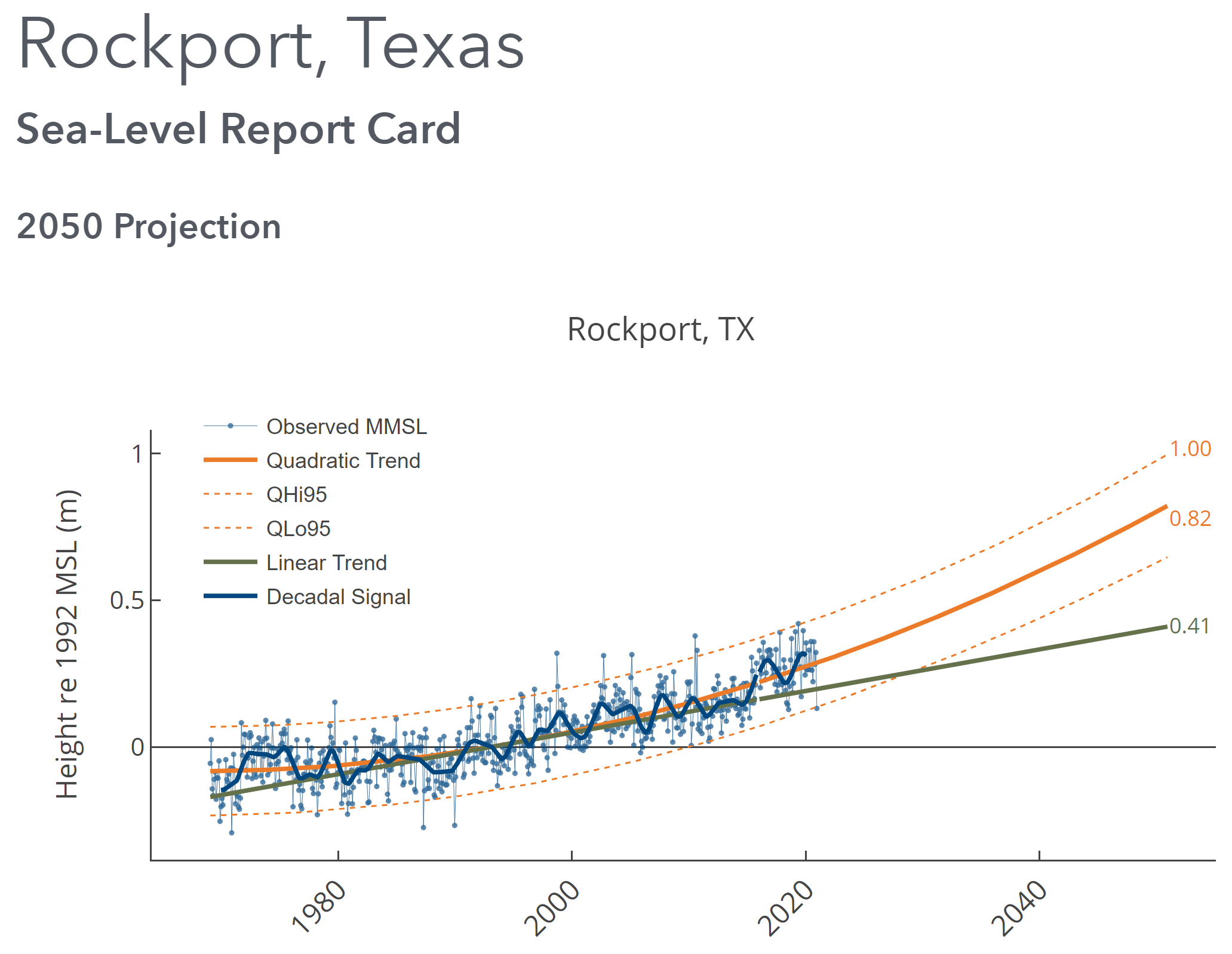
By David Malmquist 24 January 2021 (VIMS) – Sea level “report cards” issued annually by researchers at William & Mary’s Virginia Institute of Marine Science add further evidence of an accelerating rate of sea-level rise during 2020 at nearly all tidal stations along the U.S. coastline. The team’s web-based report cards project sea level to […]
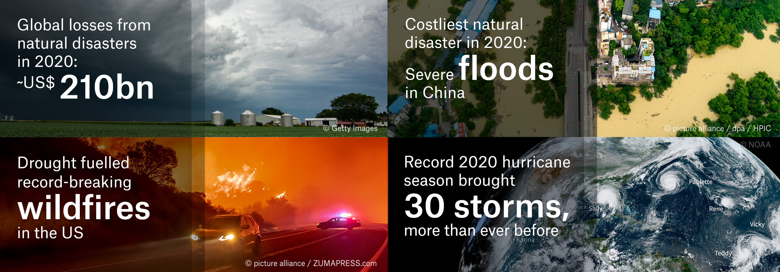
7 January 2021 (Munich Re) – Global losses from natural disasters in 2020 came to US$ 210bn, of which some US$ 82bn was insured. Both overall losses and insured losses were significantly higher than in the previous year (2019: US$ 166bn and US$ 57bn respectively). The US share of losses was rather high: Natural disasters in the […]
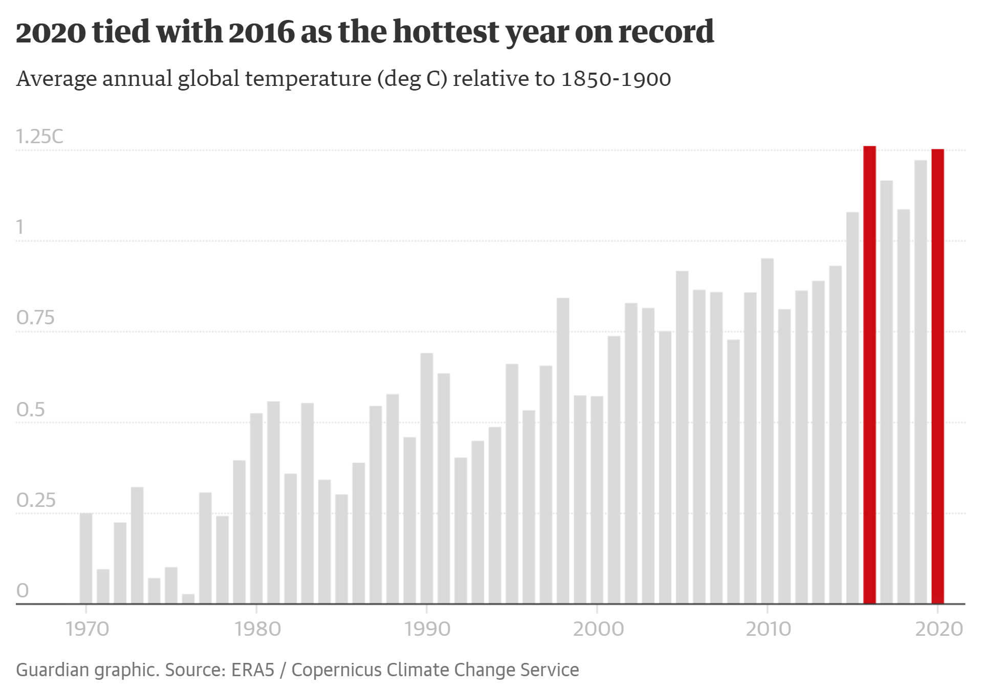
By Damian Carrington 8 January 2021 (The Guardian) – The climate crisis continued unabated in 2020, with the joint highest global temperatures on record, alarming heat and record wildfires in the Arctic, and a record 29 tropical storms in the Atlantic. Despite a 7% fall in fossil fuel burning due to coronavirus lockdowns, heat-trapping carbon dioxide continued to build […]