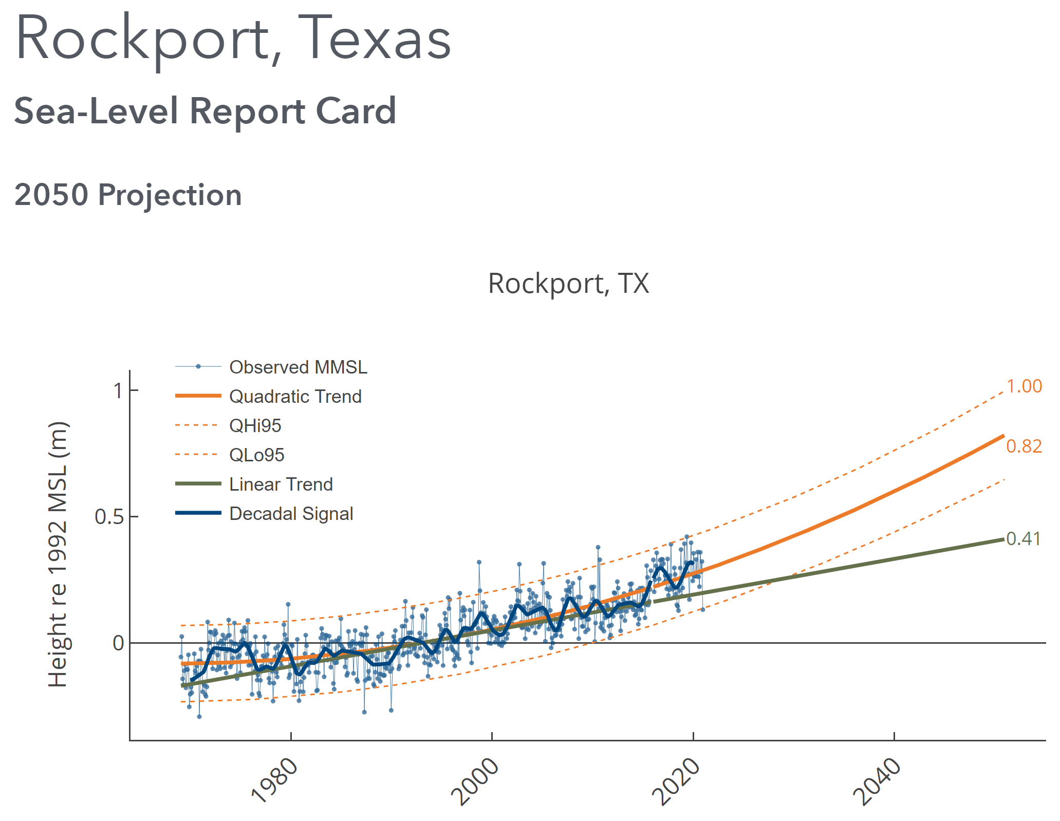
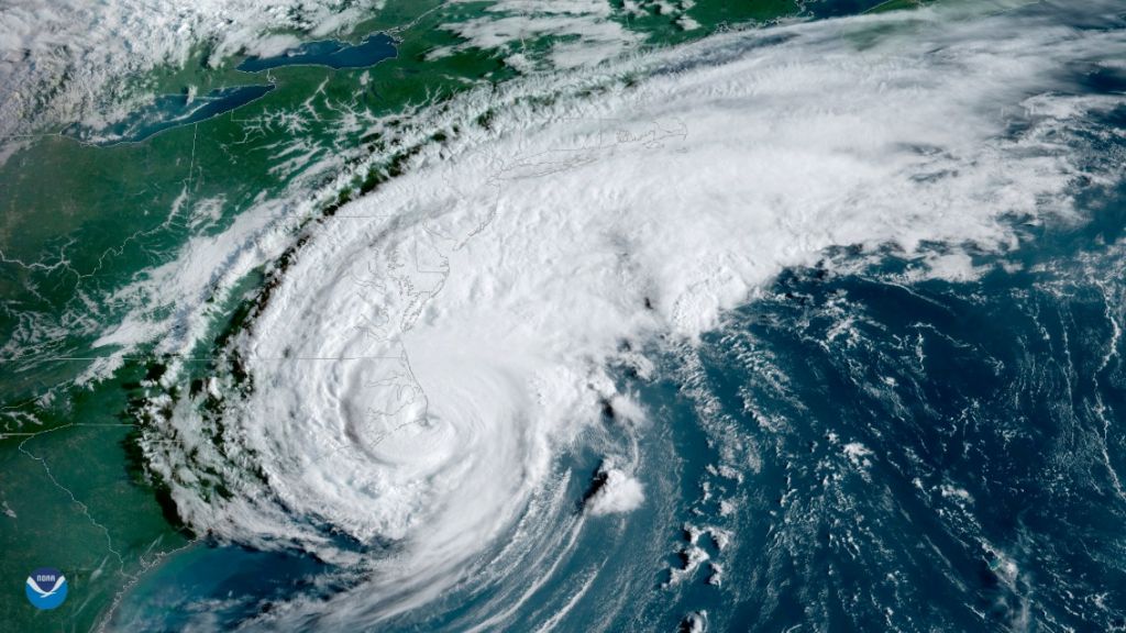
By David Malmquist 24 January 2021 (VIMS) – Sea level “report cards” issued annually by researchers at William & Mary’s Virginia Institute of Marine Science add further evidence of an accelerating rate of sea-level rise during 2020 at nearly all tidal stations along the U.S. coastline. The team’s web-based report cards project sea level to […]
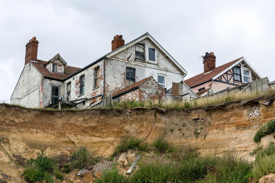
4 March 2020 (Love Property) – Positioned on the frontline of climate change, the world’s most vulnerable shoreline communities face an uncertain future. Plagued by ever-worsening coastal erosion and rising sea levels, their existence hangs precariously in the balance. As the tide continues to draw in, take a look at 15 towns being gradually reclaimed […]
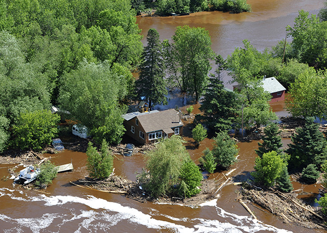
By Ainslie Chandler 10 February 2020 (Bloomberg) – Torrential rains along Australia’s east coast caused widespread power outages and property damage at the weekend, and while the downpour has doused many wildfires there are now concerns that drinking water supplies will be contaminated by the flooding. Sydney experienced its wettest 24 hours since 1992, with […]
10 December 2019 (Utrecht University) – Greenland is losing ice seven times faster than in the 1990s and is tracking the IPCC’s high-end climate warming scenario, which would see 40 million more people exposed to coastal flooding by 2100. The findings, published in Nature today, show that Greenland has lost 3.8 trillion tonnes of ice […]
By Hayley Fowler 20 November 2019 CHARLOTTE, North Carolina (The Charlotte Observer) – Hurricanes aren’t the only hazard lapping at the shores of the Outer Banks, according to a report examining the threat of climate change on some of the country’s most beloved natural landscapes. Thanks to creeping sea levels and erosion rates, Cape Hatteras […]
By Ron Meador 1 November 2019 Minnesota has shoreline on only one Great Lake, but it happens to be the greatest: largest, clearest, coldest and, until recently, seemingly least vulnerable to various environmental afflictions elsewhere in the five-lake basin. The world’s biggest lake by surface area, Superior happens to hold one-tenth of the fresh water […]
29 October 2019 (Climate Central) – Sea level rise is one of the best known of climate change’s many dangers. As humanity pollutes the atmosphere with greenhouse gases, the planet warms. And as it does so, ice sheets and glaciers melt and warming sea water expands, increasing the volume of the world’s oceans. The consequences […]
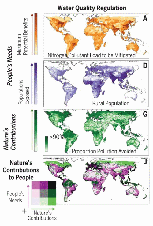
By Stephen Leahy 10 October 2019 (National Geographic) – As many as five billion people, particularly in Africa and South Asia, are likely to face shortages of food and clean water in the coming decades as nature declines. Hundreds of millions more could be vulnerable to increased risks of severe coastal storms, according to the first-ever model […]
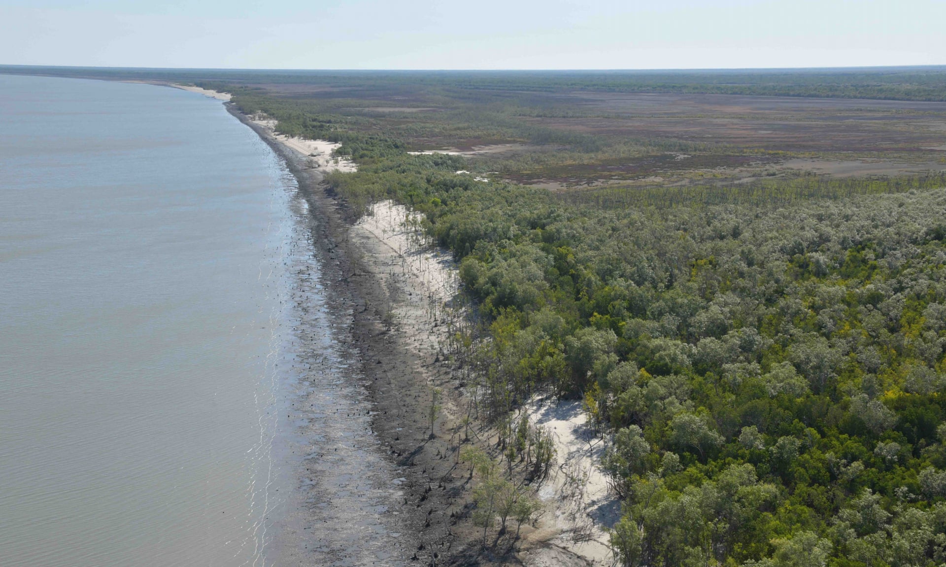
By Graham Readfearn 3 October 2019 (The Guardian) – A cascade of impacts including rising sea levels, heatwaves and back-to-back tropical cyclones has created 400 kilometers [249 miles] of dead and badly damaged mangroves in the Gulf of Carpentaria, a scientific monitoring trip has discovered. Prof Norman Duke, of James Cook University, spent 10 days […]
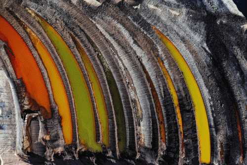
23 September 2019 (CIWEM) – The CIWEM Environmental Photographer of the Year exposes the terrible impacts being wrought on our planet by humans, but also celebrates humanity’s innate ability to survive and innovate, lending hope to us all that we can overcome challenges to live sustainably. [See all of the submissions: Environmental Photographer of the […]