Heaviest rain in decades brings Australia drought, fire relief – Scientists rush to predict mudflows from denuded hillsides
By Ainslie Chandler
10 February 2020
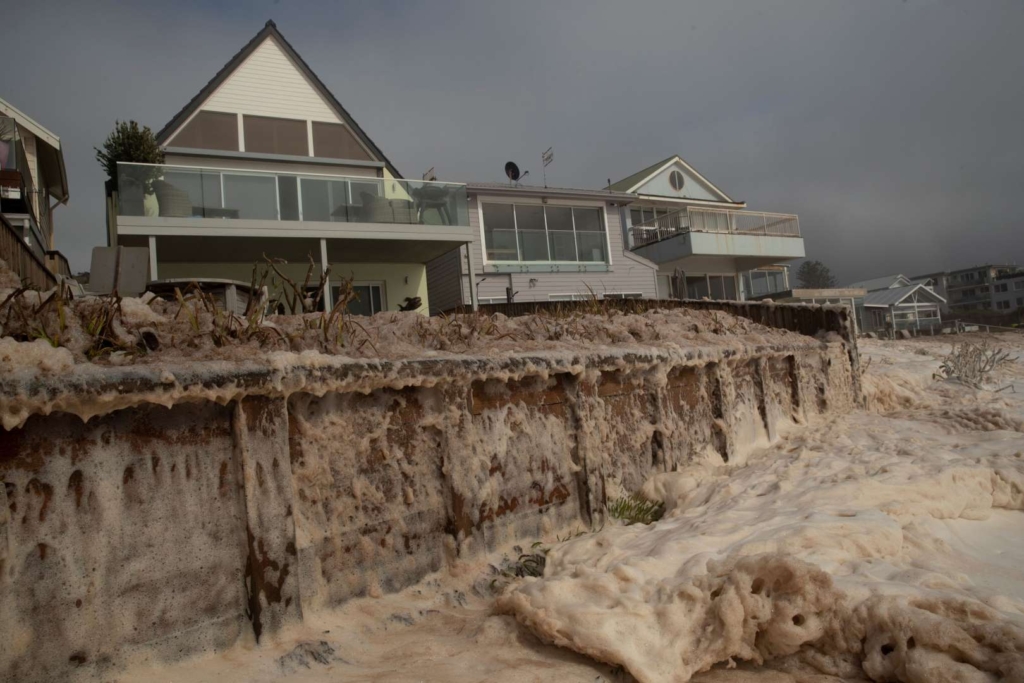
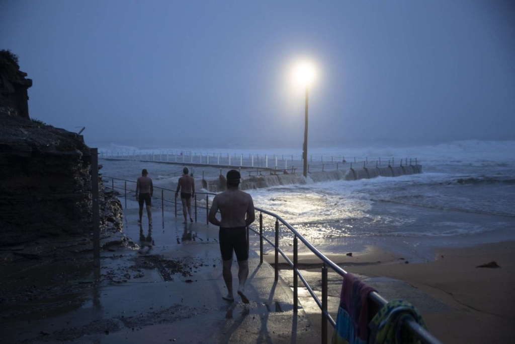
(Bloomberg) – Torrential rains along Australia’s east coast caused widespread power outages and property damage at the weekend, and while the downpour has doused many wildfires there are now concerns that drinking water supplies will be contaminated by the flooding.
Sydney experienced its wettest 24 hours since 1992, with 176 millimeters (7 inches) of rain falling in the city between Sunday and Monday morning, according to the Bureau of Meteorology. And the wild weather is not over yet with another 200 millimeters expected in some areas by next weekend.
The deluge brought welcome inflows into dams in drought-stricken New South Wales state, with reservoirs now at about 64% capacity, up from 42% a week ago. About 206mm of rain fell in the Warragamba Dam catchment, which supplies the bulk of Sydney’s water, in the past week — about 38% of the total fall for the past year.
Normally a 100,000 hectare fire would be a very, very large fire, but in the context of this year it’s actually going to be the smallest of the fires that we’re deployed to.
Charlie Showers, groundwater geologist for the Department of Environment, Land, Water and Planning in the Australian state of Victoria
But there’s now concern that debris and ash from months of devastating wildfires is being swept into the water supply. The country is still grappling with the fallout from its worst fire season in generations, which saw more than 3,000 homes destroyed and claimed at least 31 lives.
The water authority in NSW state said it is monitoring water quality to assess whether extra measures are needed to control ash and sediment. Water could be drawn from deeper in the dam or from elsewhere in the network if there were quality concerns.
The rains extinguished the massive Currowan Fire on the NSW south coast. The blaze had burnt for 74 days and destroyed 499,621 hectares of land, including 312 homes. [more]
Heaviest Rain in Decades Brings Australia Drought, Fire Relief
With Australia’s Hillsides Stripped Bare By Fire, Scientists Rush To Predict Mudflows
By Rebecca Hersher and Meredith Rizzo
10 February 2020
(NPR) – First came the fires, denuding millions of acres of forest in eastern Australia. Now comes the rain, more than 12 inches in just 48 hours over this past weekend in some areas of New South Wales.
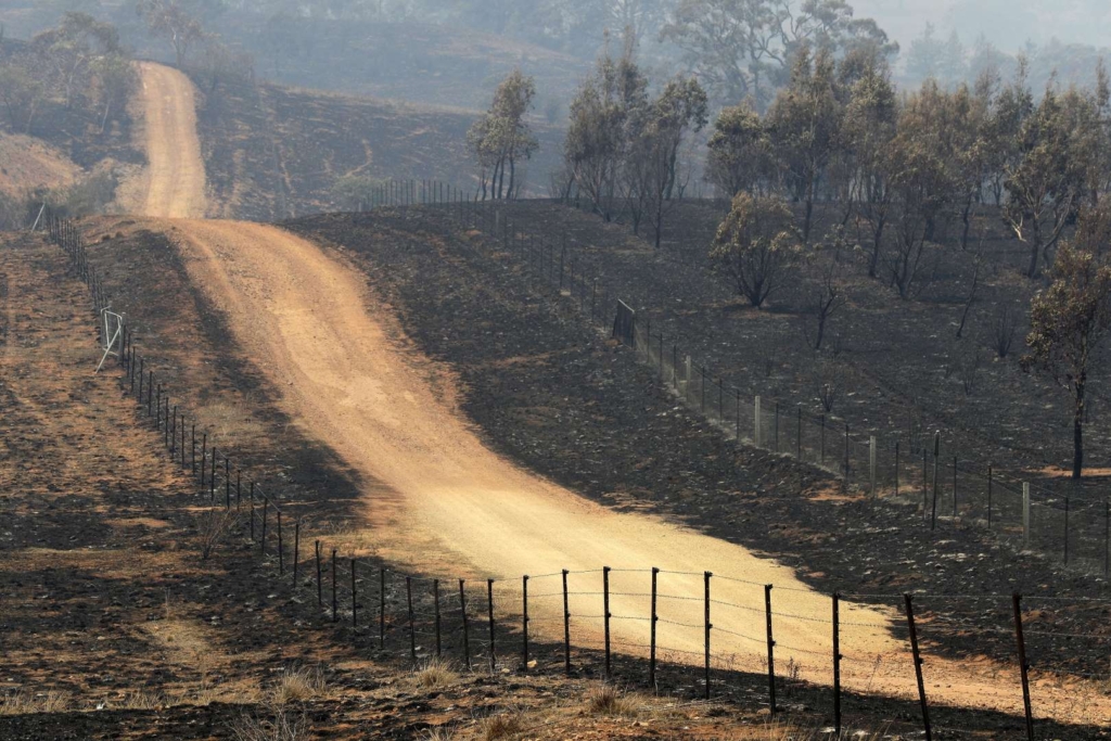
That sequence, severe bushfires followed by torrential rain, is bringing a third cataclysm — landslides and large-scale erosion.
Here’s why. Without leafy trees to offer protection, the water falls directly on hard earth. It pools and rolls, gathering into a torrent. If the hill the rain falls on is just the wrong steepness, the soil just the wrong hardness, the downpour just a little too intense … whoosh.
“Essentially it’s a flash flood that’s full of rocks and logs,” says Charlie Showers, a groundwater geologist for the Department of Environment, Land, Water and Planning in the Australian state of Victoria. Showers is part of a team of government scientists and analysts who are called in after severe bushfires to figure out where so-called debris flows are most likely, and warn local authorities.
But identifying potential landslide areas can be difficult, because there are so many potential places to look. This season’s fires have been very large — millions of hectares have burned in New South Wales and Victoria — and heavy rain is relatively common this time of year in the areas that burned, which means there’s a lot of land with a lot of potential risk for dangerous erosion.
Over the weekend, Showers and his team finished studying the landslide potential after a fire that burned through part of Mount Buffalo National Park in a mountainous part of Victoria that is popular with outdoorsy tourists. The fire started at the end of December, and burned ferociously for weeks, eating up more than 100,000 hectares, or about 380 square miles.
“Normally a 100,000 hectare fire would be a very, very large fire,” he explained, “but in the context of this year it’s actually going to be the smallest of the fires that we’re deployed to.” [more]
With Australia’s Hillsides Stripped Bare By Fire, Scientists Rush To Predict Mudflows