Flooded Future: New elevation maps triple estimates of global risk from sea-level rise and coastal flooding – “By 2100, land now home to 200 million people could sit permanently below the high tide line”
29 October 2019 (Climate Central) – Sea level rise is one of the best known of climate change’s many dangers. As humanity pollutes the atmosphere with greenhouse gases, the planet warms. And as it does so, ice sheets and glaciers melt and warming sea water expands, increasing the volume of the world’s oceans. The consequences range from near-term increases in coastal flooding that can damage infrastructure and crops to the permanent displacement of coastal communities.
Over the course of the twenty-first century, global sea levels are projected to rise between about 2 and 7 feet, and possibly more. The key variables will be how much warming pollution humanity dumps into the atmosphere and how quickly the land-based ice sheets in Greenland and especially Antarctica destabilize. Projecting where and when that rise could translate into increased flooding and permanent inundation is profoundly important for coastal planning and for reckoning the costs of humanity’s emissions.
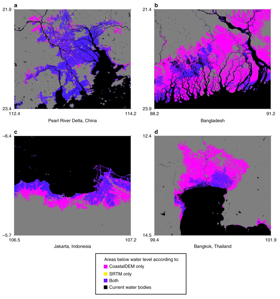
Projecting flood risk involves not only estimating future sea level rise but also comparing it against land elevations. However, sufficiently accurate elevation data are either unavailable or inaccessible to the public, or prohibitively expensive in most of the world outside the United States, Australia, and parts of Europe. This clouds understanding of where and when sea level rise could affect coastal communities in the most vulnerable parts of the world.
A new digital elevation model produced by Climate Central helps fill the gap. That model, CoastalDEM, shows that many of the world’s coastlines are far lower than has been generally known and that sea level rise could affect hundreds of millions of more people in the coming decades than previously understood.
Based on sea level projections for 2050, land currently home to 300 million people will fall below the elevation of an average annual coastal flood. By 2100, land now home to 200 million people could sit permanently below the high tide line.
Adaptive measures such as construction of levees and other defenses or relocation to higher ground could lessen these threats. In fact, based on CoastalDEM, roughly 110 million people currently live on land below high tide line. This population is almost certainly protected to some degree by existing coastal defenses, which may or may not be adequate for future sea levels.
Despite these existing defenses, increasing ocean flooding, permanent submergence, and coastal defense costs are likely to deliver profound humanitarian, economic, and political consequences. This will happen not just in the distant future, but also within the lifetimes of most people alive today. […]
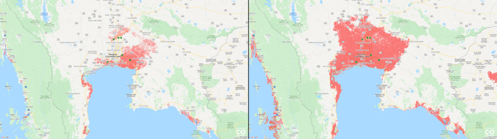
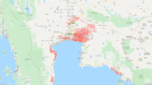
Sea level rise is a global story, and it affects every coastal nation. But in the coming decades, the greatest effects will be felt in Asia, thanks to the number of people living in the continent’s low-lying coastal areas. Mainland China, Bangladesh, India, Vietnam, Indonesia, and Thailand are home to the most people on land projected to be below average annual coastal flood levels by 2050 (table 2). Together, those six nations account for roughly 75 percent of the 300 million people on land facing the same vulnerability at midcentury. […]
A closer look at the cases of mainland China, India, Bangladesh, and Vietnam sheds light on the scope of the problem. [more]
Report: Flooded Future: Global vulnerability to sea level rise worse than previously understood
New elevation data triple estimates of global vulnerability to sea-level rise and coastal flooding
ABSTRACT: Most estimates of global mean sea-level rise this century fall below 2 m. This quantity is comparable to the positive vertical bias of the principle digital elevation model (DEM) used to assess global and national population exposures to extreme coastal water levels, NASA’s SRTM. CoastalDEM is a new DEM utilizing neural networks to reduce SRTM error. Here we show – employing CoastalDEM—that 190 M people (150–250 M, 90% CI) currently occupy global land below projected high tide lines for 2100 under low carbon emissions, up from 110 M today, for a median increase of 80 M. These figures triple SRTM-based values. Under high emissions, CoastalDEM indicates up to 630 M people live on land below projected annual flood levels for 2100, and up to 340 M for mid-century, versus roughly 250 M at present. We estimate one billion people now occupy land less than 10 m above current high tide lines, including 250 M below 1 m.
New elevation data triple estimates of global vulnerability to sea-level rise and coastal flooding