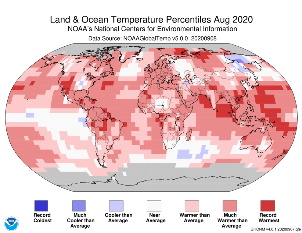
By Jeff Masters, Ph.D. 15 September 2020 (Yale Climate Connections) – August 2020 was the second-warmest August since global record keeping began in 1880, NOAA’s National Centers for Environmental Information, or NCEI, reported September 14. The month was just 0.04 degrees Celsius behind the record set in August 2016. NASA rated the month as the third-warmest August on […]
14 May 2020 (NOAA) – […] The NOAA monitoring program provides high-precision measurements of the global abundance and distribution of long-lived greenhouse gases that are used to calculate changes in radiative climate forcing. Air samples are collected through the NOAA/GML global air sampling network, including a cooperative program for the carbon gases which provides samples […]
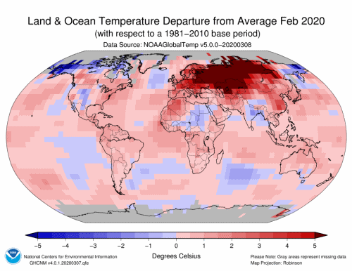
By Bob Henson 13 March 2020 (Weather Underground) – Research groups across the world concur that this past northern winter (December-February) was the second-warmest on record globally, in records going back more than a century. The latest group to confirm this finding is NOAA, in its monthly State of the Climate report issued Friday. The winter result […]
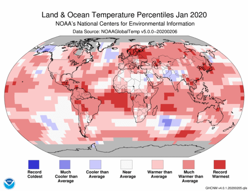
13 February 2020 (NCEI) – The globally averaged temperature departure from average over land and ocean surfaces for January 2020 was the highest for the month of January in the 141-year NOAA global temperature dataset record, which dates back to 1880. This monthly summary, developed by scientists at NOAA National Centers for Environmental Information, is […]
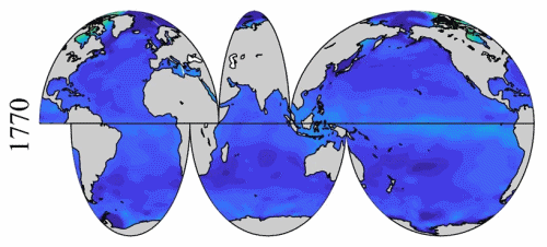
18 December 2019 (NOAA) – New research by NOAA, the University of Maryland, and international partners published in Nature Scientific Reports shows that the changing chemistry of seawater has implications for continued greenhouse gas absorption. The ocean has been playing an important role in helping slow down global climate change by removing the greenhouse gas carbon dioxide […]
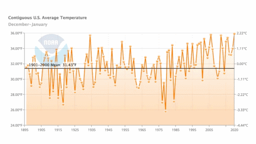
By Bob Henson 6 February 2020 (Weather Underground) – The first two months of meteorological winter (December 2019 – January 2020) were the warmest on record for the contiguous U.S. in data going back to 1895. NOAA provided the January data and images on Thursday ahead of its monthly U.S. climate report. The average national temperature […]
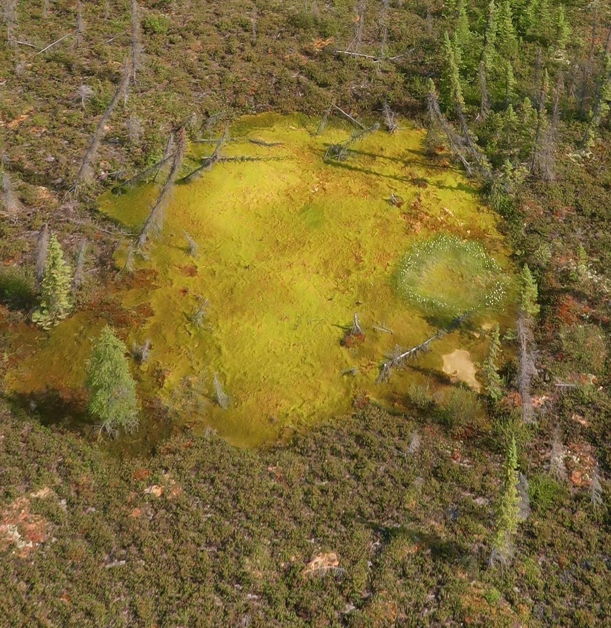
By Natacha Larnaud 4 February 2020 (CBS News) – Rapidly thawing permafrost in the Arctic has scientists worried. According to a new study published Monday in the journal Nature Geoscience, the ice that holds the soil together is melting, causing hillsides to collapse and massive sinkholes to open up as a result. And that dramatic disruption to […]
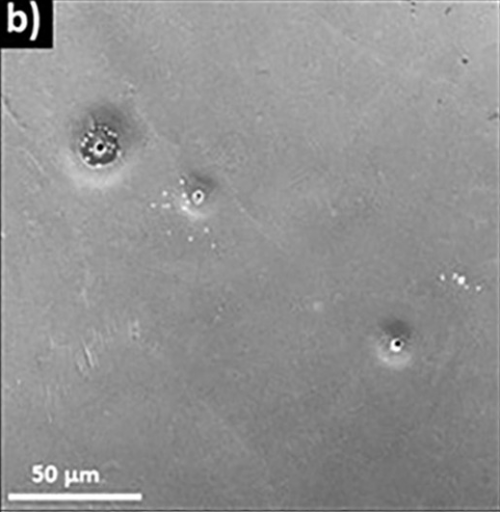
23 January 2020 (NOAA) – A new NOAA-funded study has documented for the first time that ocean acidification along the US Pacific Northwest coast is impacting the shells and sensory organs of some young Dungeness crab, a prized crustacean that supports the most valuable fishery on the West Coast. Analysis of samples collected during a […]
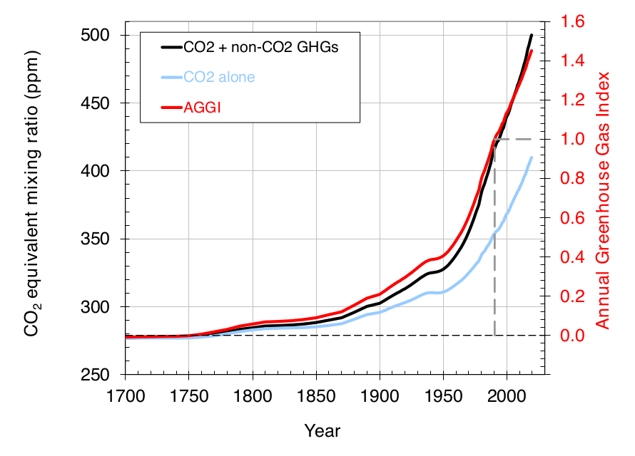
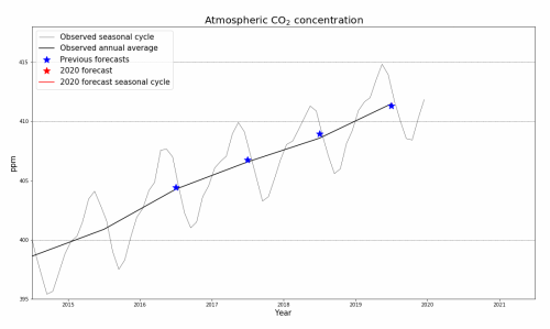
By Grahame Madge 24 January 2020 (Met Office) – A forecast of the atmospheric concentration of carbon-dioxide shows that 2020 will witness one of the largest annual rises in concentration since measurements began at Mauna Loa, in Hawaii, 1958. During the year the atmospheric concentration of CO₂ is expected to peak above 417 parts per […]
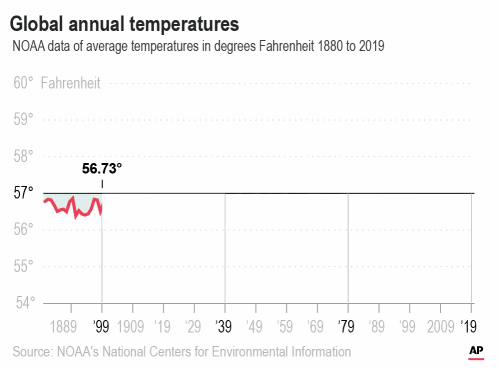
By Seth Borenstein 15 January 2020 WASHINGTON (AP) – The decade that just ended was by far the hottest ever measured on Earth, capped off by the second-warmest year on record, two U.S. agencies reported Wednesday. And scientists said they see no end to the way man-made climate change keeps shattering records. “If you think […]