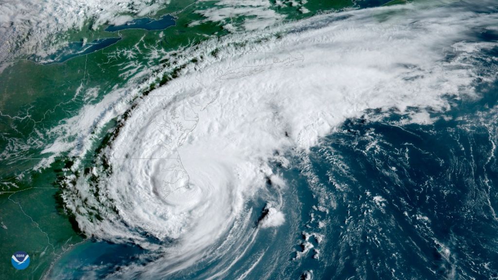
By Hayley Fowler 20 November 2019 CHARLOTTE, North Carolina (The Charlotte Observer) – Hurricanes aren’t the only hazard lapping at the shores of the Outer Banks, according to a report examining the threat of climate change on some of the country’s most beloved natural landscapes. Thanks to creeping sea levels and erosion rates, Cape Hatteras […]
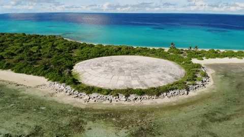
By Susanne Rust 10 November 2019 MAJURO, Marshall Islands (Los Angeles Times) – Five thousand miles west of Los Angeles and 500 miles north of the equator, on a far-flung spit of white coral sand in the central Pacific, a massive, aging and weathered concrete dome bobs up and down with the tide. Here in […]
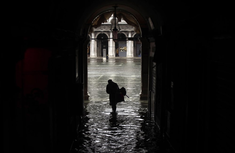
By Colleen Barry and Luca Bruno 17 November 2019 VENICE, Italy (AP) – Venice was hit Sunday by a record third exceptional tide in the same week while other parts of Italy struggled with a series of weather woes, from rain-swollen rivers to high winds to an out-of-season avalanche. Stores and museums in Venice were […]
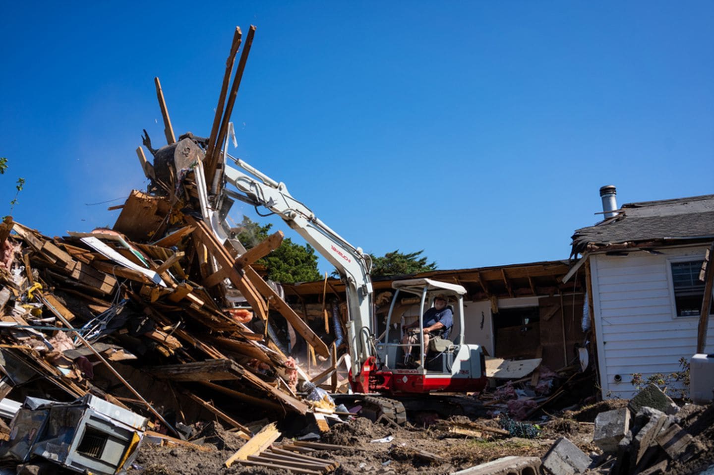
By Frances Stead Sellers 9 November 2019 OCRACOKE, North Carolina (The Washington Post) – On any normal late-fall day, the ferries that ply the 30 miles between Swan Quarter and this barrier island might carry vacationing retirees, sports fishermen and residents enjoying mainland getaways after the busy summer tourist season. But two months ago, Hurricane […]
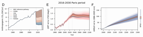
5 November 2019 (PIK) – Unless governments significantly scale up their emission reduction efforts, the 15 years’ worth of emissions released under their current Paris Agreement pledges alone would cause 20 cm of sea-level rise over the longer term, according to new research published today in the Proceedings of the National Academy of Sciences (PNAS). […]
29 October 2019 (Climate Central) – Sea level rise is one of the best known of climate change’s many dangers. As humanity pollutes the atmosphere with greenhouse gases, the planet warms. And as it does so, ice sheets and glaciers melt and warming sea water expands, increasing the volume of the world’s oceans. The consequences […]
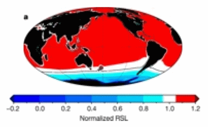
By Georgia Rose Grant and Timothy Naish 2 October 2019 (The Conversation) – We know that our planet has experienced warmer periods in the past, during the Pliocene geological epoch around three million years ago. Our research, published today, shows that up to one third of Antarctica’s ice sheet melted during this period, causing sea levels to rise […]
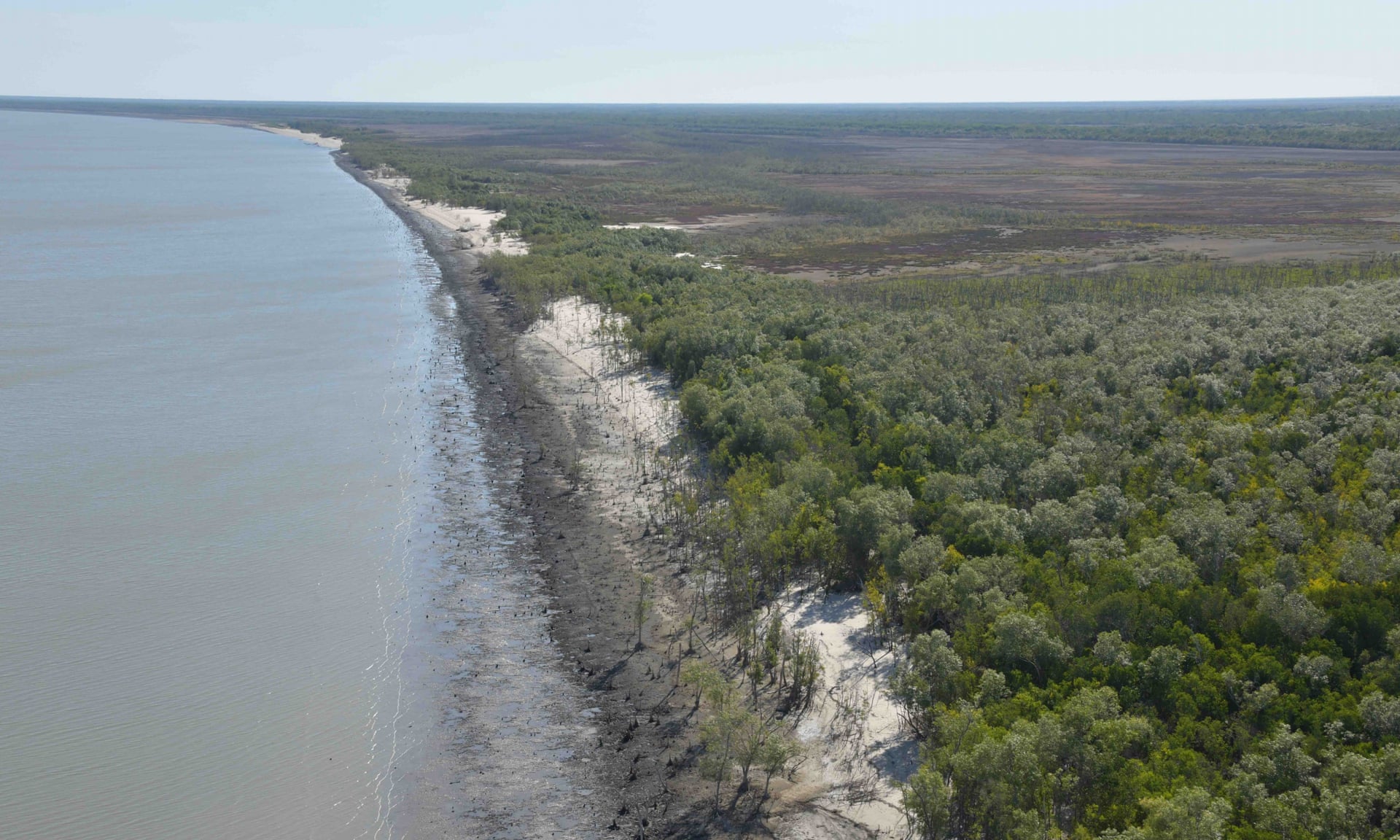
By Graham Readfearn 3 October 2019 (The Guardian) – A cascade of impacts including rising sea levels, heatwaves and back-to-back tropical cyclones has created 400 kilometers [249 miles] of dead and badly damaged mangroves in the Gulf of Carpentaria, a scientific monitoring trip has discovered. Prof Norman Duke, of James Cook University, spent 10 days […]
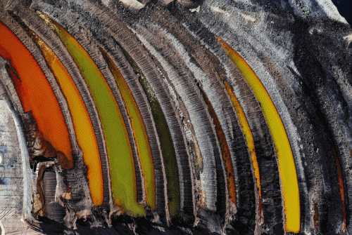
23 September 2019 (CIWEM) – The CIWEM Environmental Photographer of the Year exposes the terrible impacts being wrought on our planet by humans, but also celebrates humanity’s innate ability to survive and innovate, lending hope to us all that we can overcome challenges to live sustainably. [See all of the submissions: Environmental Photographer of the […]
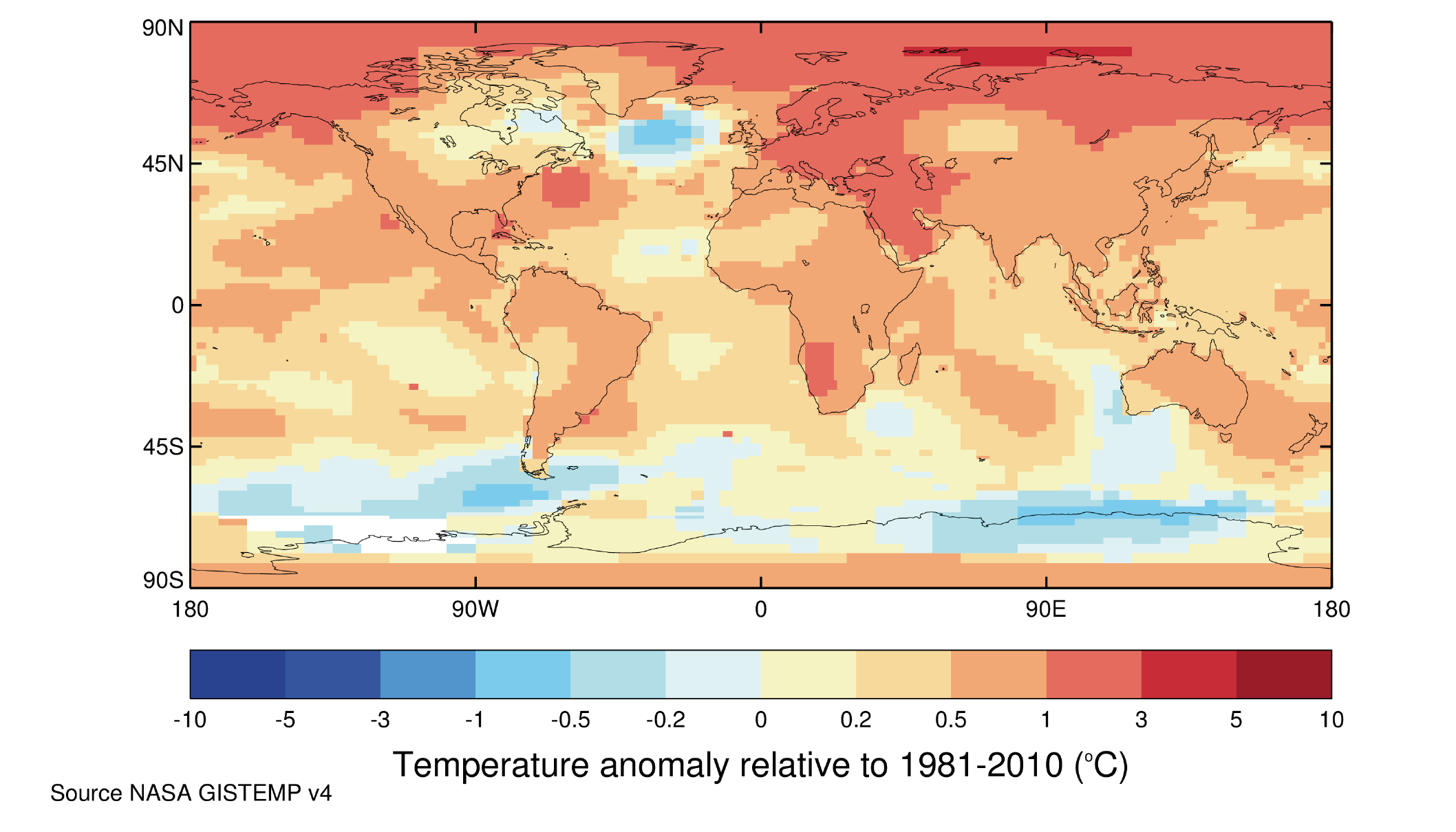
NEW YORK, 22 September 2019 (WMO) – The world’s leading climate science organizations have joined forces to produce a landmark new report [pdf] for the United Nations Climate Action Summit, underlining the glaring – and growing – gap between agreed targets to tackle global warming and the actual reality. The report, United in Science, includes details on the […]