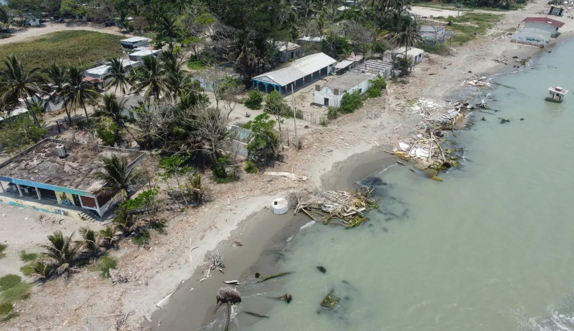
28 May 2024 (Al Jazeera) – Waves wash over abandoned homes in a Mexican village slowly being swallowed by the sea; a symbol of the climate change effects being felt by the major fossil fuel producer. The school where Adrian Perez used to attend classes in the community of El Bosque in the southern state […]
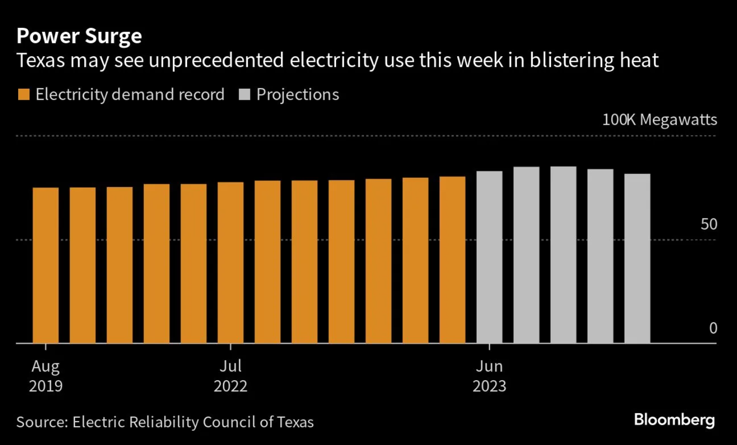
26 June 2023 (Reuters) – Texas’ power grid operator on Monday again projected electricity use would break records this week as homes and business cranked up air conditioning amid soaring temperatures. The Electric Reliability Council of Texas (ERCOT), which operates the grid for more than 26 million customers representing about 90% of the state’s power […]
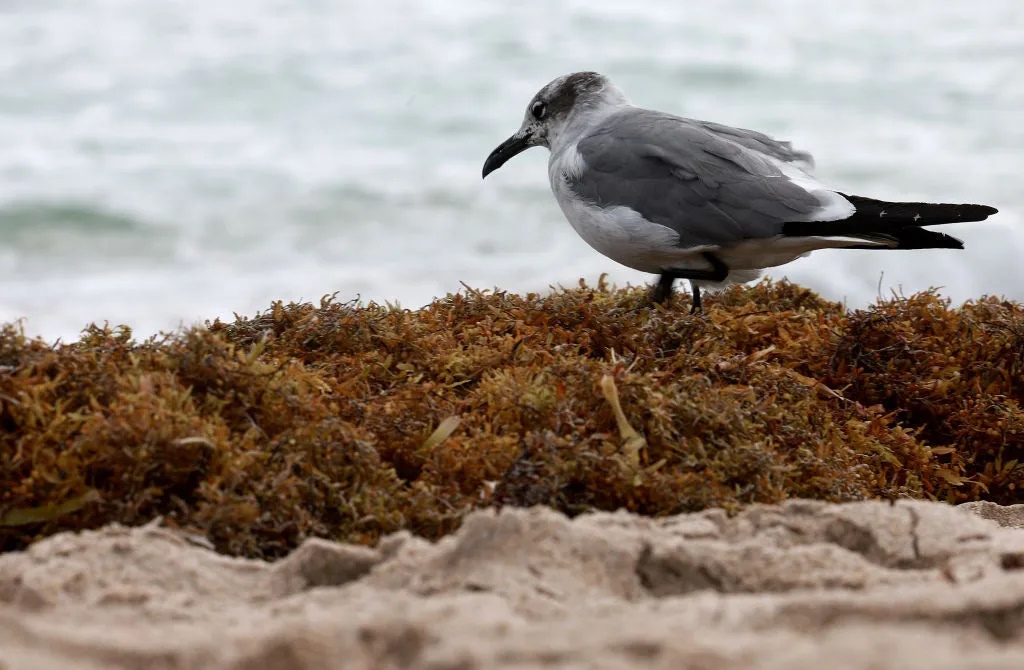
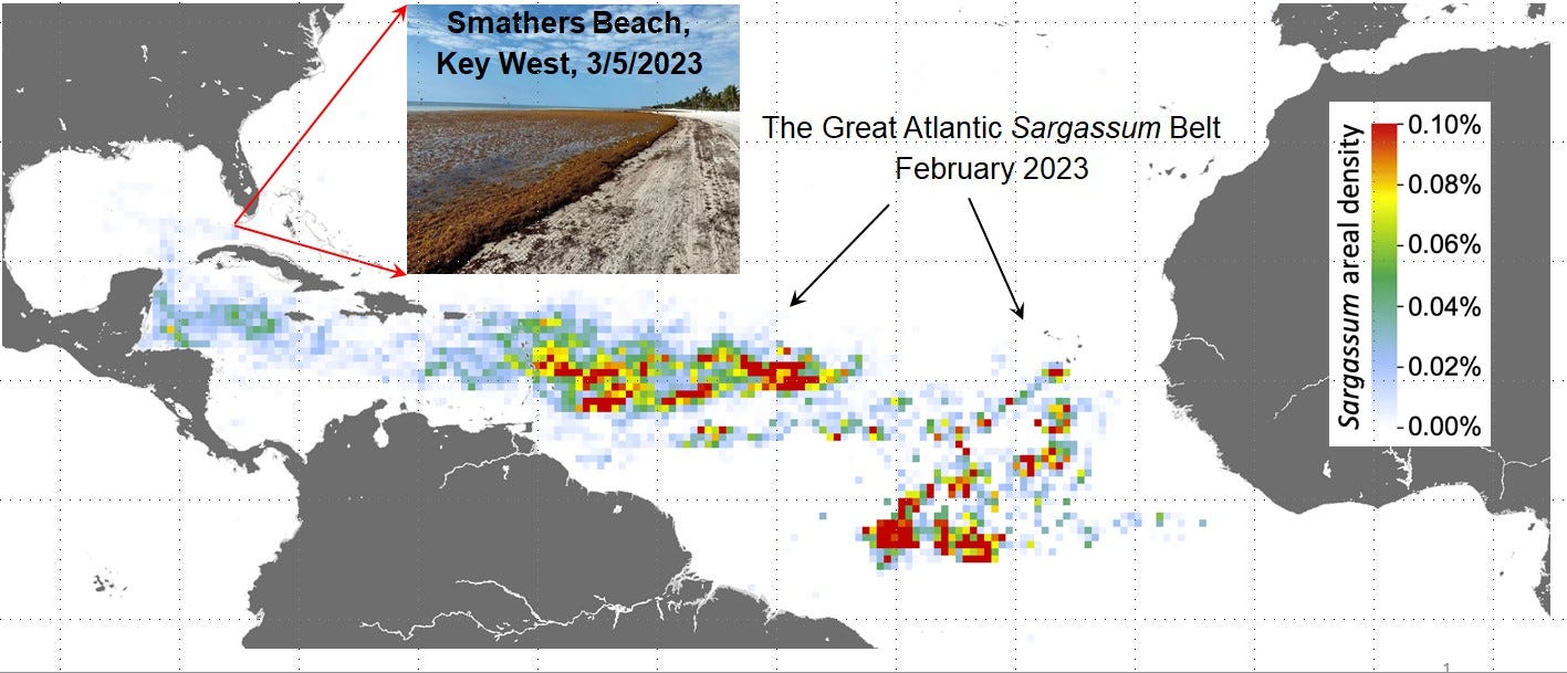
By Richard Burkard 17 April 2023 (Knewz) – It sounds like a B-grade movie title: The approach of the 10-million pound blob. Yet it’s real, and it’s forcing swimmers and owners of beachfront property in Florida to take action. Knewz noted in late March that a giant mass of sargassum seaweed was spotted from space. It […]
By Jim Waymer 12 April 2023 (Florida Today) – We’re already in the weeds. All that stringy stuff that washed up on Brevard County beaches this past week is just the beginning of what scientists predict will grow into the largest-ever bloom of Sargassum seaweed ever recorded. Sargassum, which the Caribbean Sea delivers seasonally to the Gulf Stream […]
By Drew Costley 3 April 2023 (AP) – Offshore oil and gas operations in the Gulf of Mexico are releasing far more climate-changing methane than official estimates show, according to a new study published Monday. Using data collected from aircraft in part, climate scientists found the additional methane coming from oil and gas platforms in the Gulf […]
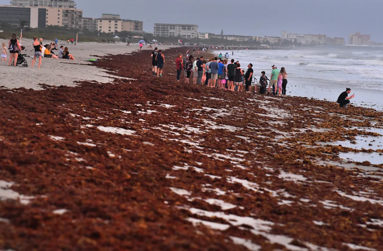
By Dinah Voyles Pulver 14 March 2023 (USA TODAY) – Beachgoers in Florida and the Caribbean could be greeted by heavy blankets of smelly seaweed in the weeks ahead as a 5,000-mile swath of sargassum drifts westward and piles onto white sandy beaches. Sargassum, a naturally occurring type of macroalgae, has grown at an alarming rate this winter. The […]
By Pandora Dewan 24 February 2023 (Newsweek) – By 2100, Florida could see sea levels rise by up to 6 feet, with over 900,000 properties at risk of being underwater. “By 2050, Florida sea levels, like much of the US, are headed for a 1-foot rise on average (above 2020 levels),” William Sweet, an Oceanographer for the […]
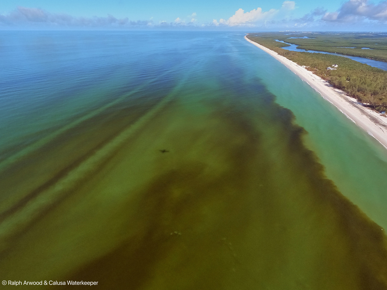
By Dylan Abad 14 November 2022 TAMPA, Florida (WFLA) – Aerial photos revealed massive plumes of red tide stretching along much of southwest Florida’s coast days after Tropical Storm Nicole passed over the state. Photos released by Calusa Waterkeeper showed a deep reddish-brown discoloration of the water near Naples and Sanibel due to the presence […]
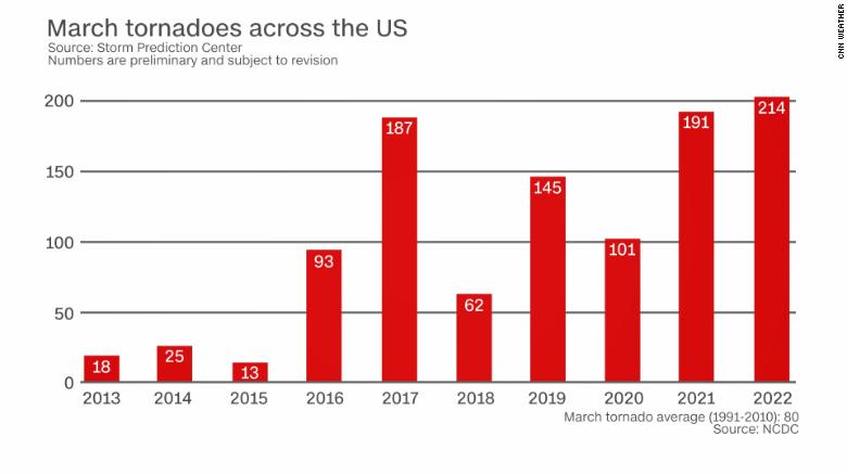
By Caitlin Kaiser and Brandon Miller 31 March 2022 (CNN) – This month has seen more tornadoes in the US than any March on record following this week’s severe weather outbreak. It’s the second year in a row the country has endured a record number of tornadoes in March, solidifying a trend toward more severe weather […]
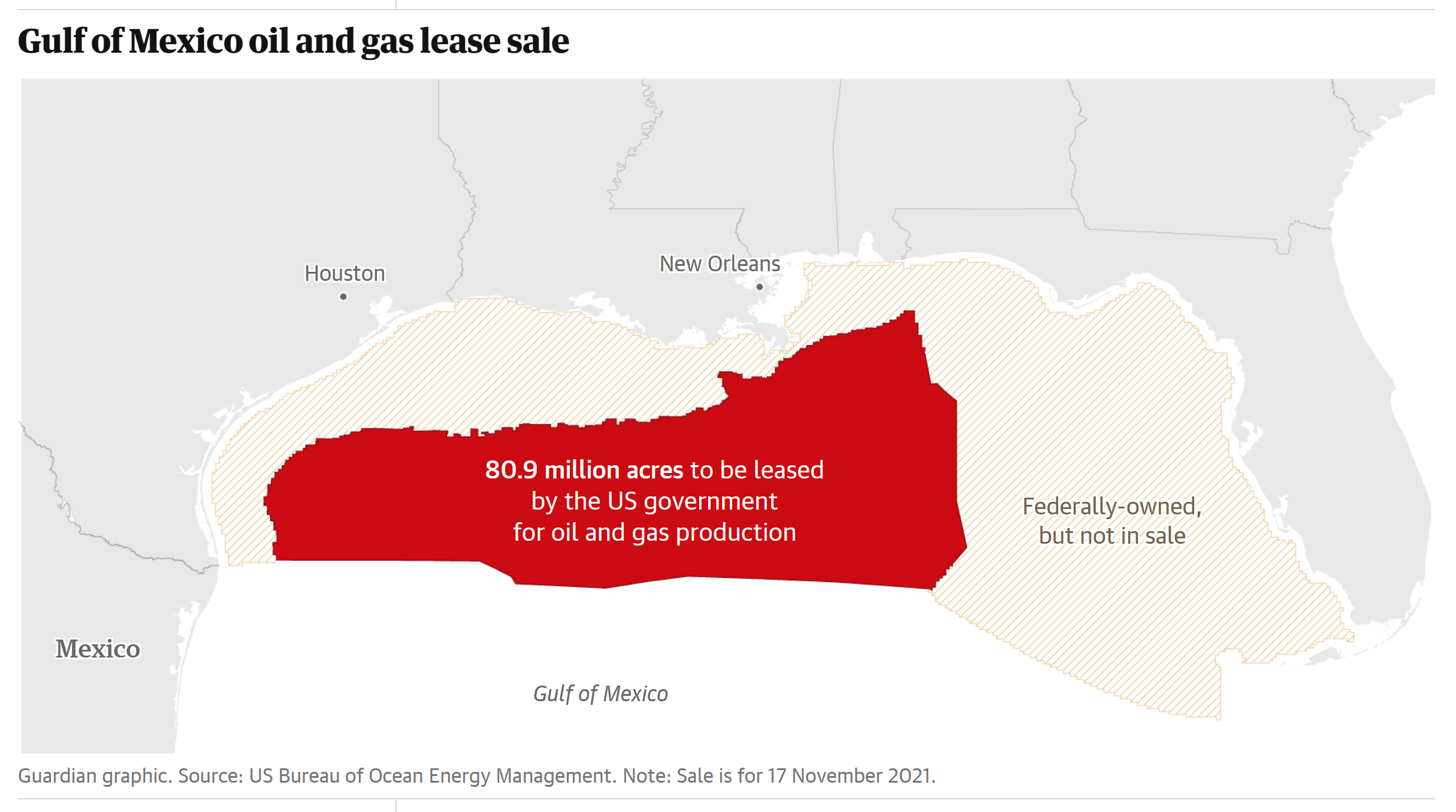
By Oliver Milman 17 November 2021 (The Guardian) – Just four days after landmark climate talks in Scotland in which Joe Biden vowed the US will “lead by example” in tackling dangerous global heating, the president’s own administration is providing a jarring contradiction – the largest ever sale of oil and gas drilling leases in the Gulf […]