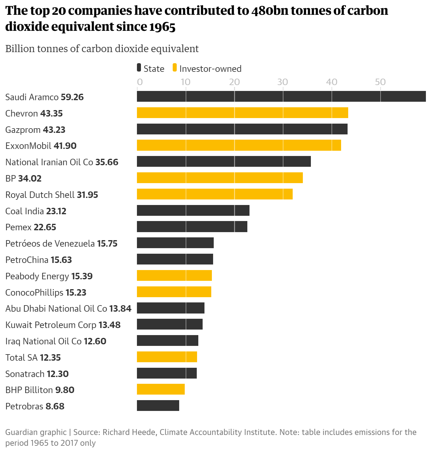
By Matthew Taylor and Jonathan Watts 9 October 2019 (The Guardian) – The Guardian today reveals the 20 fossil fuel companies whose relentless exploitation of the world’s oil, gas and coal reserves can be directly linked to more than one-third of all greenhouse gas emissions in the modern era. New data from world-renowned researchers [Climate […]
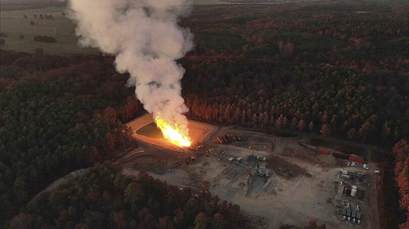
By Julie Dermansky 4 October 2019 (DeSmog) – For the fifth week since the blowout began, a large flare is still burning at the site of GEP Haynesville, LLC’s blown out fracked gas wells in northwestern Louisiana. The blowout occurred on 30 August 2019, shortly after the company began a frack job, igniting two adjacent wells. A state official estimated […]
By Wil Crisp 30 September 2019 (The Independent) – Global shipping companies have spent billions rigging vessels with “cheat devices” that circumvent new environmental legislation by dumping pollution into the sea instead of the air, The Independent can reveal. More than $12bn (£9.7bn) has been spent on the devices, known as open-loop scrubbers, which extract […]
NEW YORK, 22 September 2019 (WMO) – The world’s leading climate science organizations have joined forces to produce a landmark new report [pdf] for the United Nations Climate Action Summit, underlining the glaring – and growing – gap between agreed targets to tackle global warming and the actual reality. The report, United in Science, includes details on the […]
By Raymond Pierrehumbert 16 August 2019 (Bulletin of the Atomic Scientists) – Let’s get this on the table right away, without mincing words. With regard to the climate crisis, yes, it’s time to panic. We are in deep trouble. To understand why, it is necessary to understand something about carbon budgets. Some of the carbon […]
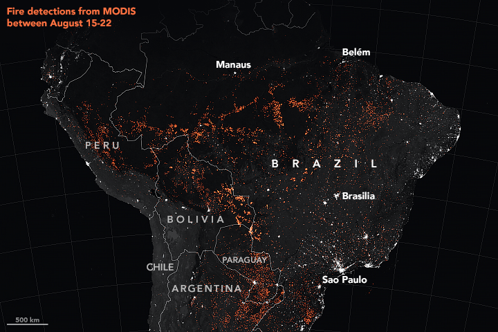
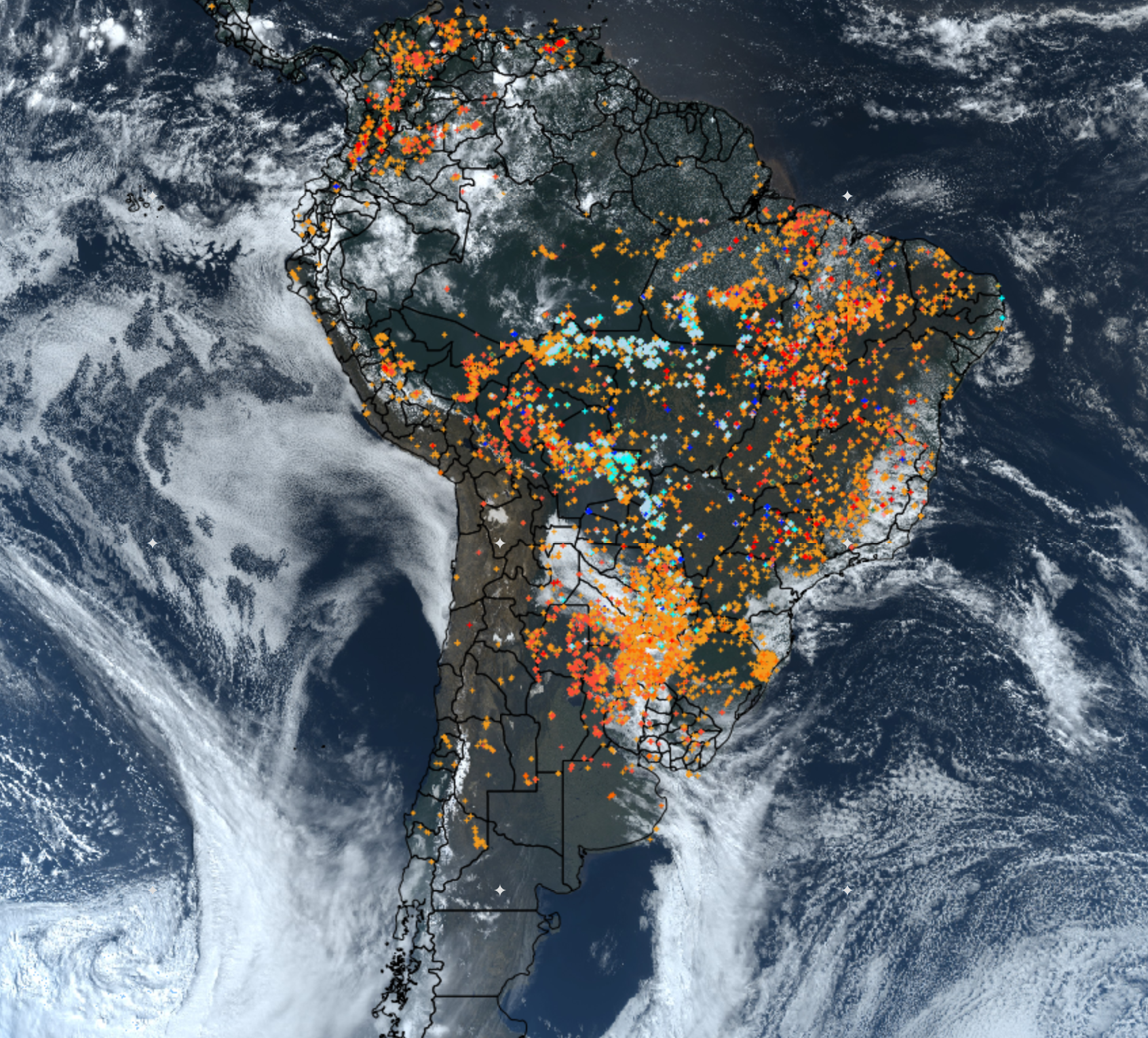
By Passant Rabie 27 August 2019 (Space.com) – As raging fires continue to sweep through the Amazon rainforest in Brazil, NASA satellites and astronauts aboard the International Space Station are tracking the flames from above. Their view confirmed that this is the most active fire year in Brazil since 2010. Fire detections by NASA’s Moderate Resolution Imaging Spectroradiometer (MODIS) […]
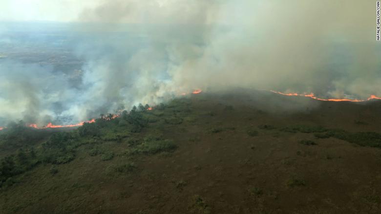
By Nick Paton Walsh and Natalie Gallón 26 August 2019 Porto Velho, Brazil (CNN) – The smoke is so thick, at times the Cessna airplane had to climb to stay out of it. At times your eyes burn and you close the air vents to keep the cabin habitable. Sometimes it is so bad, it […]
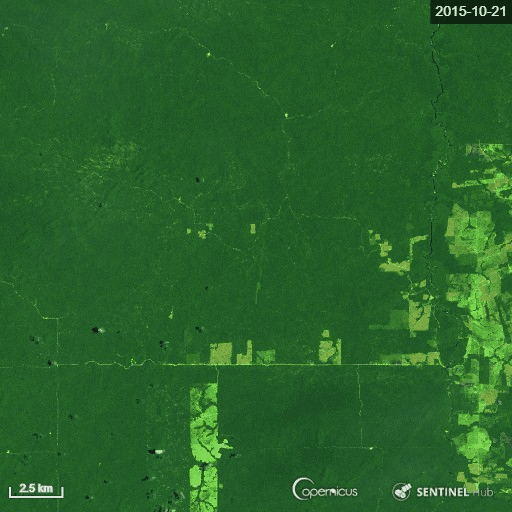
By Andrew Freedman 22 August 2019 (The Washington Post) – The wildfires burning in the Amazon have the potential to release vast quantities of long-stored carbon — thereby accelerating climate change and cause permanent harm to the planet’s most biodiverse ecosystems. A fleet of public and private-sector satellites are keeping tabs on deforestation rates in […]
21 August 2019 (BBC News) – Brazil’s Amazon rainforest has seen a record number of fires this year, new space agency data suggests. The National Institute for Space Research (INPE) said its satellite data showed an 84% increase on the same period in 2018. It comes weeks after President Jair Bolsonaro sacked the head of the […]
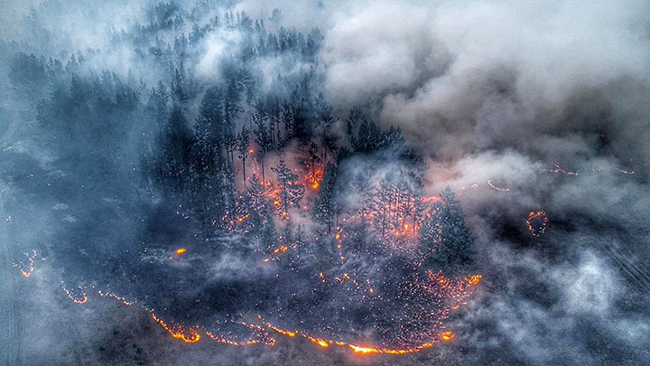
14 August 2019 (The Siberian Times) – Territory covered with wildfires across Russia has reached its peak for the year so far, with some 5.4 million hectares ablaze mostly in Siberia and the country’s far east. The total land destroyed by flames will soon exceed 2018 with weeks of the burning season still to go. […]