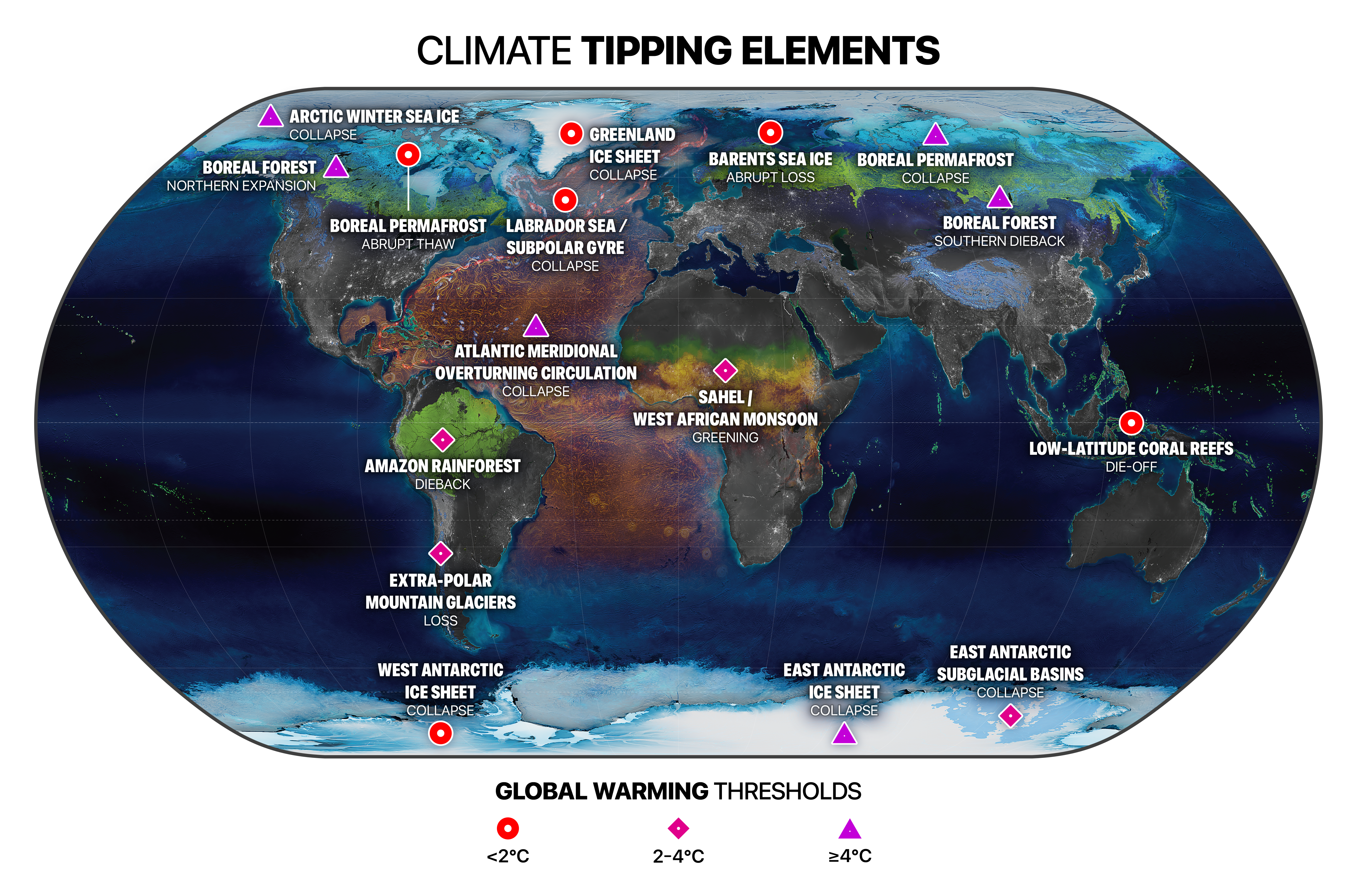
8 September 2022 (Stockholm Resilience Centre) – Multiple climate tipping points could be triggered if global temperature rises beyond 1.5°C above pre-industrial levels, according to a major new analysis published in the journal Science. Even at current levels of global heating the world is already at risk of passing five dangerous climate tipping points, and risks […]
By Matthew Rozsa 7 September 2022 (Salon) – That sea levels will rise as Earth’s ice melts is a prophecy that began to come true long ago, at the dawn of industrial civilization when humans began pumping vast amounts of greenhouse gases into the atmosphere. Yet the timeline for sea level rise is not yet fully understood, nor do we really […]
By Li Cohen 6 September 2022 (CBS News) – The loss of a glacier the size of Florida in Antarctica could wreak havoc on the world as scientists expect it would raise global sea levels up to 10 feet. It’s already melting at a fast rate — and scientists say its collapse may only rapidly […]
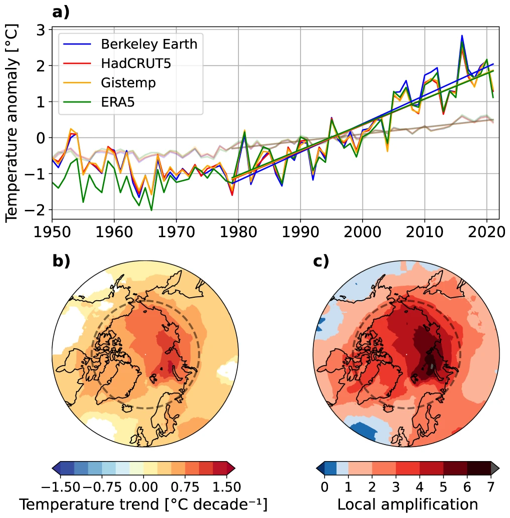
PARIS, 11 August 2022 (AFP) – The Arctic has warmed nearly four times faster than the rest of the planet over the last 40 years, according to research published Thursday that suggests climate models are underestimating the rate of polar heating. The United Nations’ climate science panel said in a special report in 2019 that […]
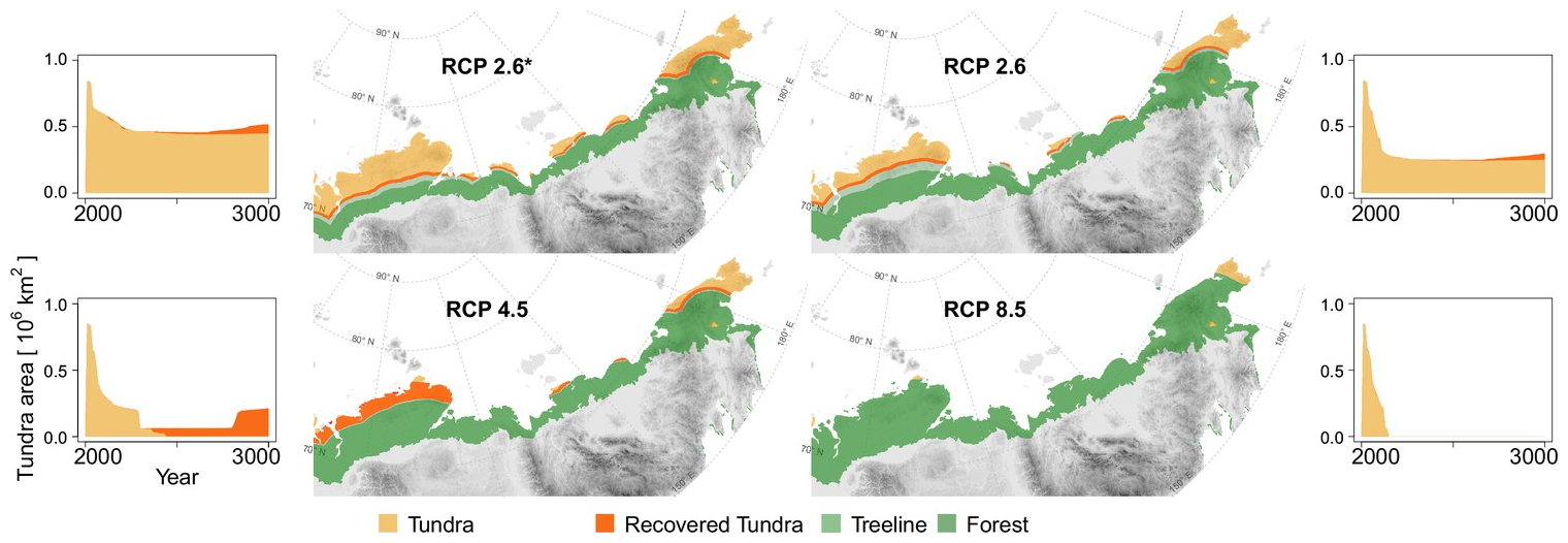
25 May 2022 (AWI) – Due to global warming, temperatures in the Arctic are climbing rapidly. As a result, the treeline for Siberian larch forests is steadily advancing to the north, gradually supplanting the broad expanses of tundra which are home to a unique mix of flora and fauna. Experts from the Alfred Wegener Institute […]
GENEVA, 18 May 2022 (WMO) – Four key climate change indicators – greenhouse gas concentrations, sea level rise, ocean heat and ocean acidification – set new records in 2021. This is yet another clear sign that human activities are causing planetary scale changes on land, in the ocean, and in the atmosphere, with harmful and […]
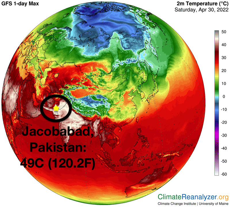
By Hannah Ellis-Petersen and Shah Meer Baloch 2 May 2022 DELHI and ISLAMABAD (The Guardian) – For the past few weeks, Nazeer Ahmed has been living in one of the hottest places on Earth. As a brutal heatwave has swept across India and Pakistan, his home in Turbat, in Pakistan’s Balochistan region, has been suffering […]
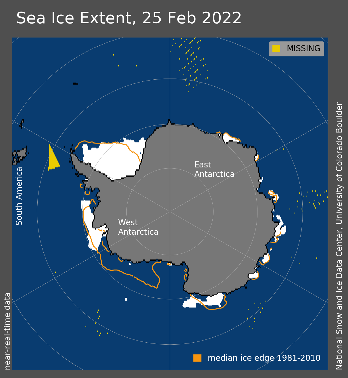
1 April 2022 (WMO) – Record high temperatures, rain and the collapse of an ice shelf in East Antarctica have prompted questions and concern about the possible role of climate change in the coldest and driest part of the world. Record high temperatures, rain and the collapse of an ice shelf in East Antarctica have […]
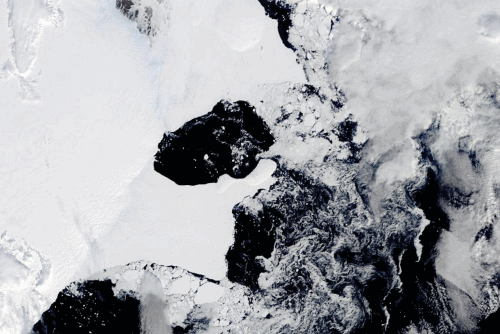
By Isla Binnie 25 March 2022 (Reuters) – An East Antarctica ice shelf disintegrated this month following a period of extreme heat in the region, according to scientists. Satellite images show the 1,200 square-kilometre Conger Ice Shelf collapsed completely on or around March 15. “Possible it hit its tipping point following the #Antarctic #AtmosphericRiver and […]
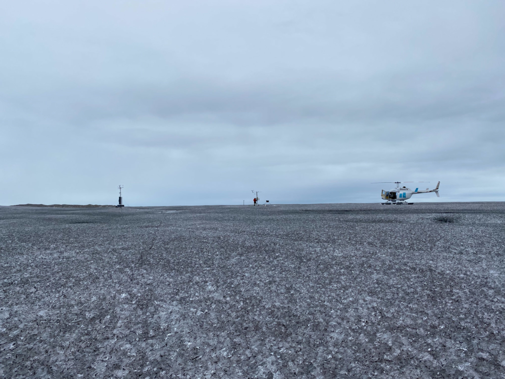
5 January 2022 (PROMICE) – GEUS and PROMICE professor Jason Box recently made the front page in Danish national media with testimony of algal blooms and rain on the Greenland ice sheet. PROMICE field work helps quantify the ice algae blooms and their effect on melting. In Autumn 2021, Professor Jason Box and two PROMICE […]