Interactive map shows United States areas under the sea in 2050 due to climate change

By John O’sullivan
1 January 2024
(Irish Star) – Several parts of The United States could be underwater by the year 2050, according to a frightening map produced by Climate Central. The map shows what could happen if the sea levels, driven by climate change, continue to rise at rates of 2 mm and 4 mm per year.
Coastal areas are more prone to the predicted sea level rises. Many parts of New York and Los Angeles, for example, would be under in just over 25 years, if the same trends continued. Nearby New Jersey, the maps modeling predicts, could be hit hard by the rise of sea levels.
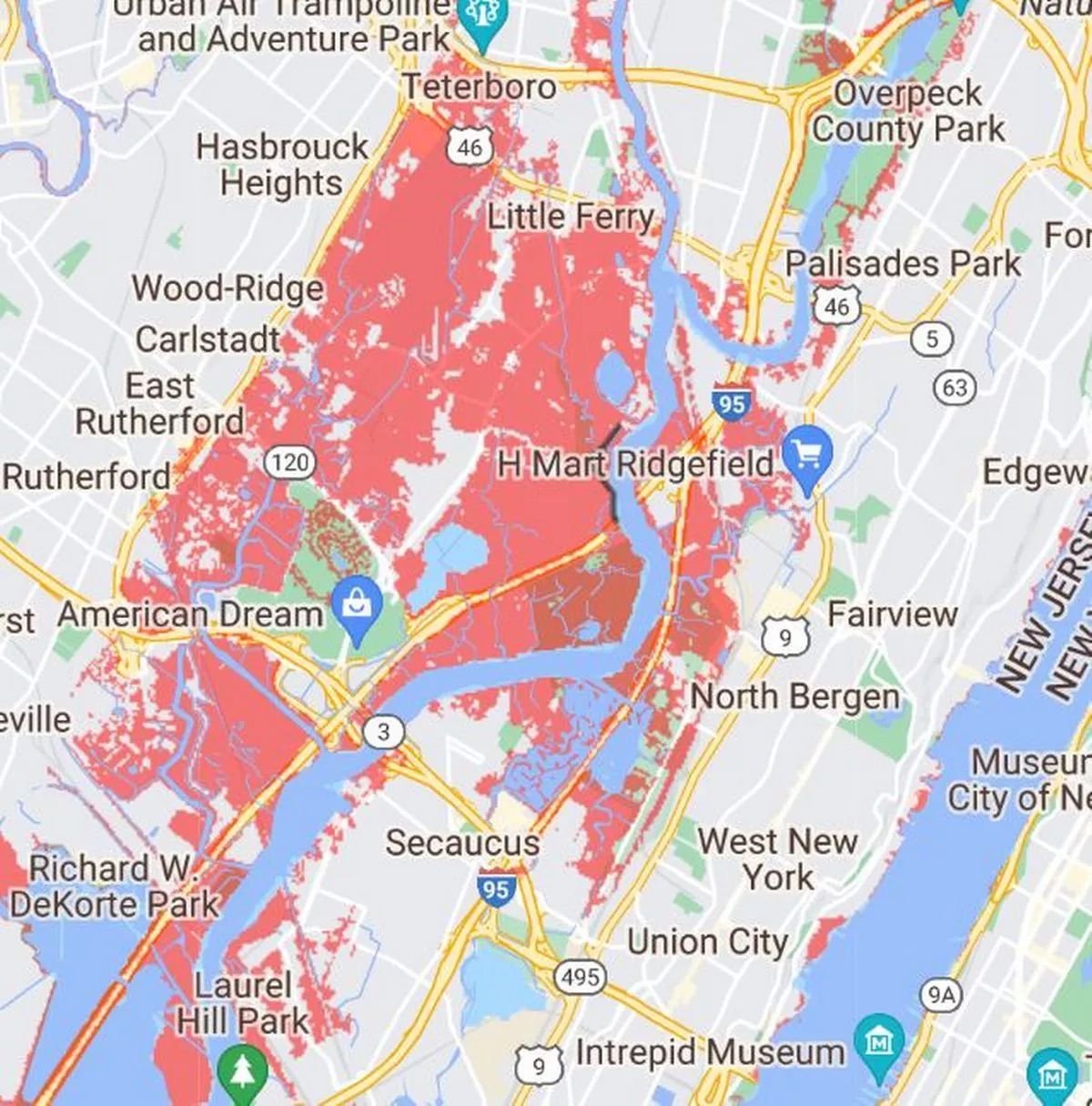
The areas surrounding East Rutherford would by 2050 be below the annual flood level. These areas are represented in red on the map below.
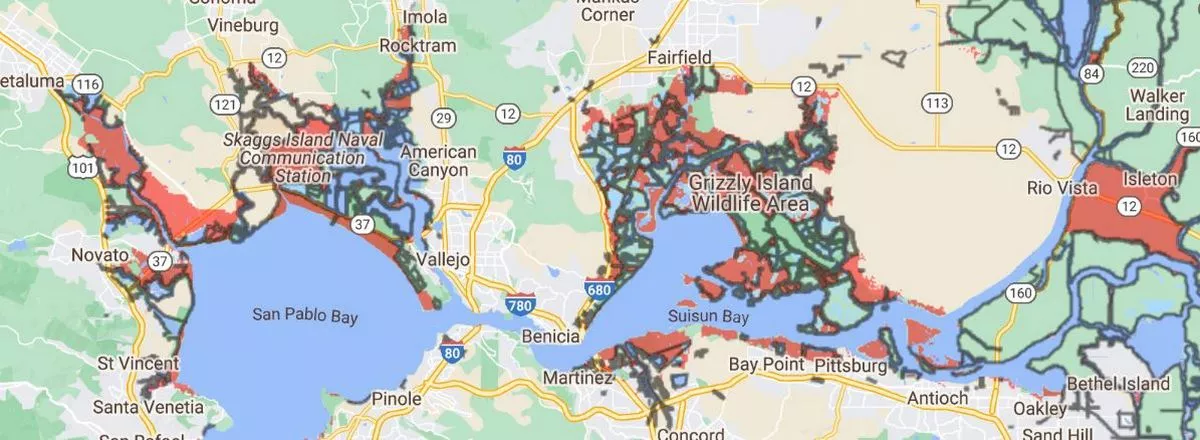
The West Coast is predicted to be similarly impacted, meanwhile. The San Pablo Bay estuary in California would see significant sea rise levels that would leave many areas underwater.
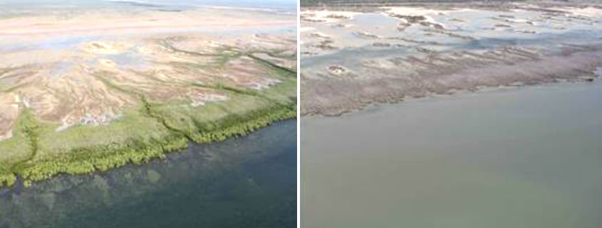
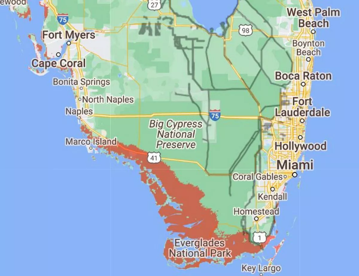
While the impact of the sea level rise on humanity would be profound, animal life would similarly be affected. The Everglades National Park in Florida, which is home to so many species of animals, would be almost entirely engulfed by the water, the map warns.
[more]
Interactive map shows United States areas under the sea in 2050 due to climate change