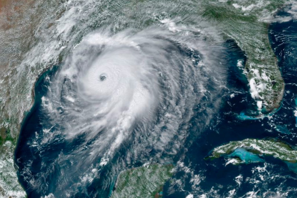
Category 4 Hurricane Laura up to 145 mph, threatens “unsurvivable” 20-foot storm surge – “Some areas, when they wake up Thursday morning, they’re not going to believe what happened”

By Joe Mario Pedersen and Richard Tribou
26 August 2020
(Orlando Sentinel) – Hurricane Laura kept growing into a massive Category 4 storm with 145 mph winds as it’s set to slam into the Gulf Coast on Wednesday night with “catastrophic storm surge, extreme winds and flash flooding,” according to the National Hurricane Center.
The hurricane center warned Laura’s storm surge is capable of penetrating 40 miles inland from the Louisiana-Texas coast, as much as 20 feet high in some places.
As of 6 p.m., the storm had maximum sustained winds accelerate to 145 mph, moving northwest at 15 mph and located 145 miles south of Lake Charles, La., 145 south of Port Arthur, Texas.
Laura’s hurricane-force winds extend up to 60 miles from its center and its tropical-storm-force winds reach up to 205 miles.
“Laura is expected to remain an extremely dangerous Category 4 hurricane through landfall tonight,” forecasters said.
As it approaches the coastline, its winds are forecast to grow even stronger up to 150 mph with higher gusts. That’s just shy of Category 5 status. The storm is predicted to make landfall Wednesday night and move over northwestern Louisiana on Thursday morning and into Arkansas Thursday night.
Rapid weakening should begin once it makes landfall downgrading to Category 1 status Thursday afternoon with maximum sustained winds of 85 mph. But the initial impact to the Gulf Coast is predicted to be devastating, the NHC said.
“Some areas, when they wake up Thursday morning, they’re not going to believe what happened,” said Stacy Stewart, a senior hurricane specialist.
“We could see storm surge heights more than 15 feet in some areas,” Stewart said. “What doesn’t get blown down by the wind could easily get knocked down by the rising ocean waters pushing well inland.” …
In the largest U.S. evacuation of the pandemic, more than half a million people were ordered Tuesday to flee from an area of the Gulf Coast along the Texas-Louisiana state line, according to The Associated Press. More than 385,000 residents were told to evacuate the Texas cities of Beaumont, Galveston and Port Arthur. Another 200,000 were ordered to leave the low-lying Calcasieu and Cameron parishes in southwestern Louisiana, where forecasters said as much as 13 feet of storm surge topped by waves could submerge whole communities. On top of that, up to 15 inches of rain could fall in some spots in Louisiana, said National Weather Service meteorologist Donald Jones. [more]
Category 4 Hurricane Laura up to 145 mph, threatens ‘unsurvivable’ 20 foot storm surge