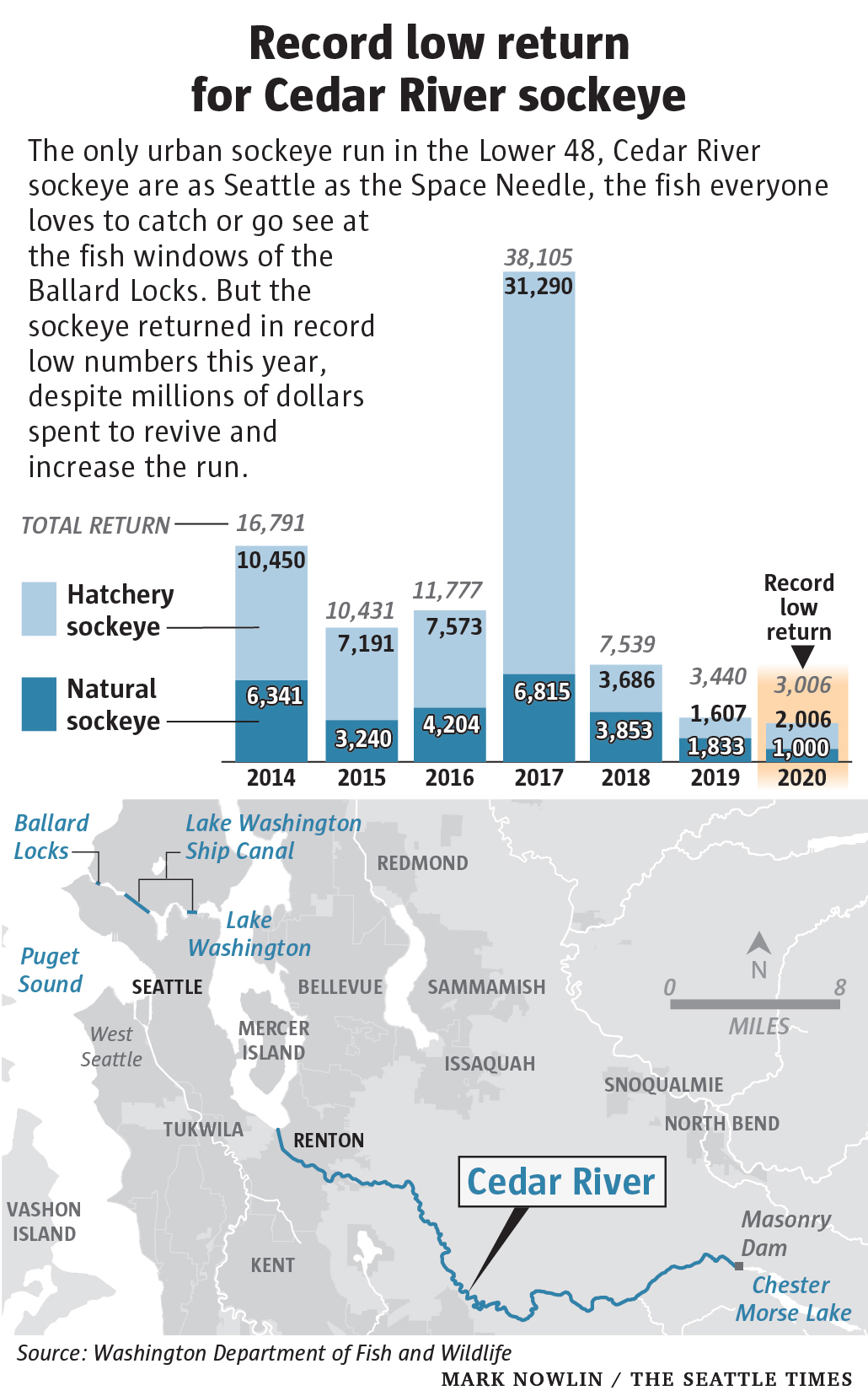
By Lynda V. Mapes 1 January 2021 (The Seattle Times) – They are as Seattle as the Space Needle. But Lake Washington sockeye, once the largest run of sockeye in the Lower 48, are failing. The smallest run on record returned to the Cedar River in 2020, a bottoming out after years of declines. There […]
GLAND, SWITZERLAND, 2 December 2020 (IUCN) – Climate change is now the biggest threat to natural World Heritage, according to a report [pdf] published today by IUCN (International Union for Conservation of Nature). A third (33%) of natural World Heritage sites are threatened by climate change, including the world’s largest coral reef, the Great Barrier […]
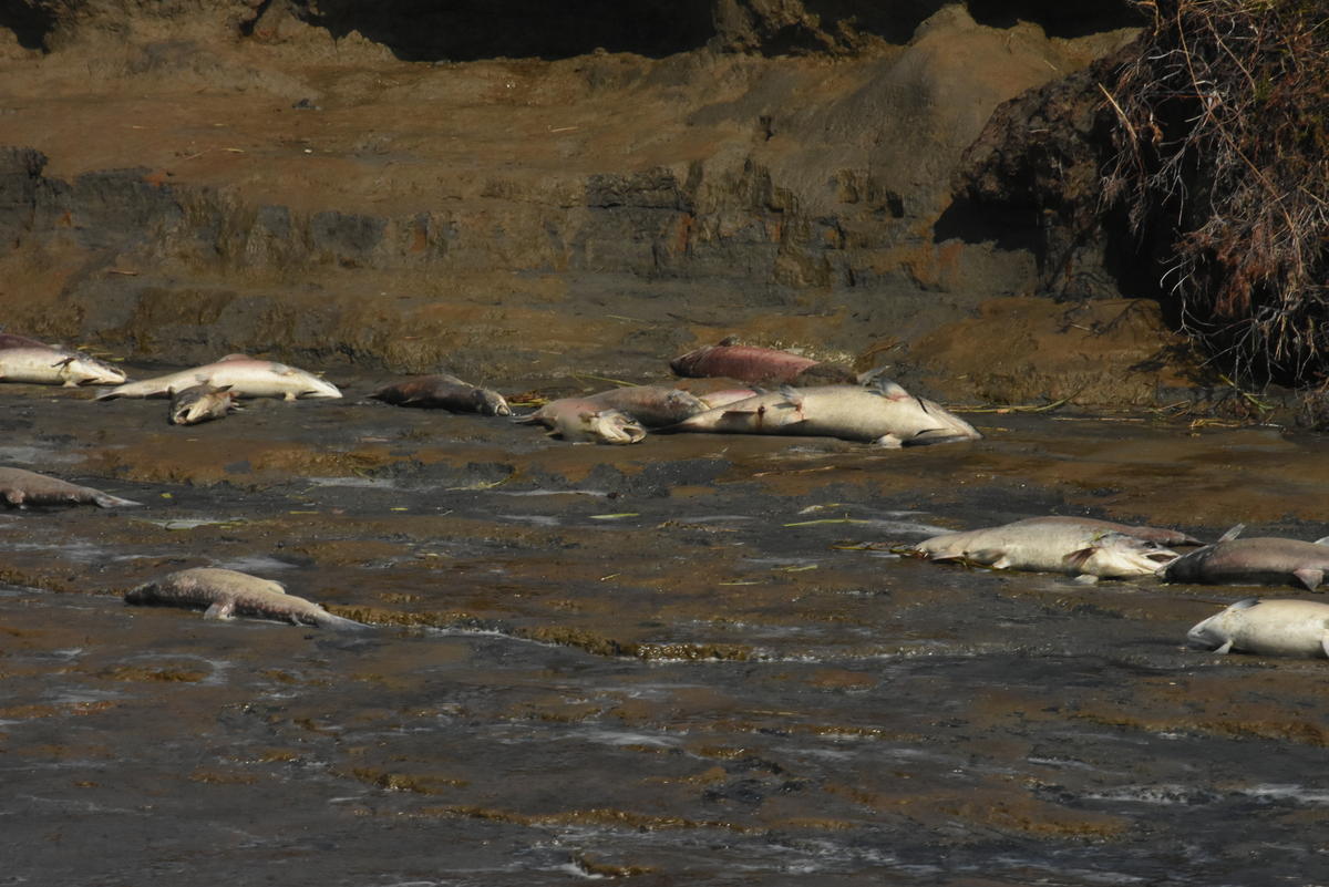
By Lynda V. Mapes 3 December 2020 (Seattle Times) – First they circle. Then they gasp at the surface of the water. Soon they can’t swim. Then they die. For decades now, scientists have known something was killing beautiful, adult coho salmon as soon as they hit Seattle’s urban waters, ready to spawn. They had […]
By Santiago Arcos 9 August 2020 ABOARD ECUADOREAN NAVY AIRCRAFT (Reuters) – Ecuador’s navy is conducting surveillance of a massive Chinese fishing fleet that is operating near the protected waters of the Galapagos Islands, amid concerns about the environmental impact of fishing in the area of the ecologically sensitive islands. The navy conducted a patrol […]
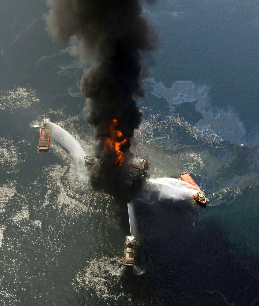
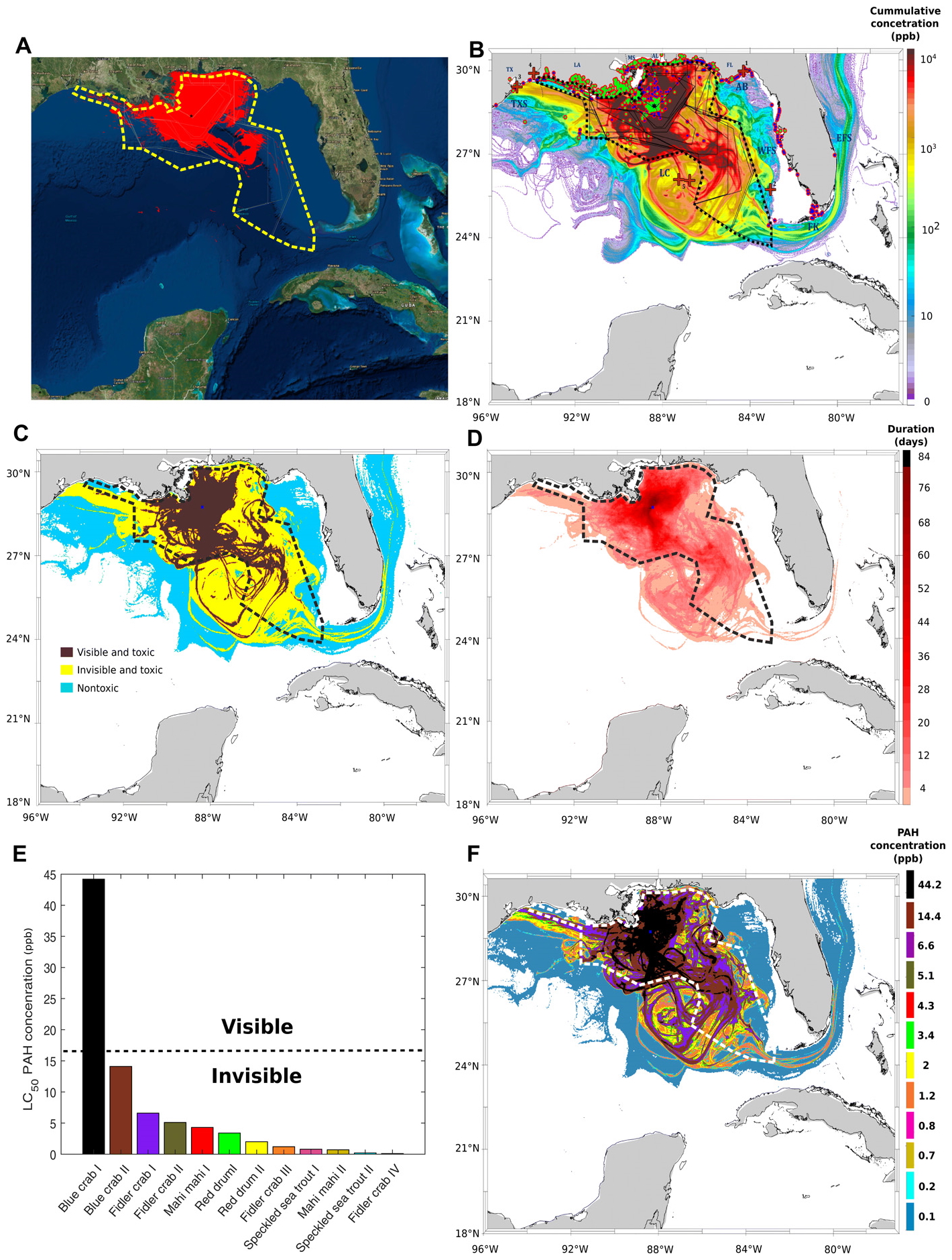
By Kevin Mcgill and Matthew Brown 18 April 2020 NEW ORLEANS (AP) – Ten years after an oil rig explosion killed 11 workers and unleashed an environmental nightmare in the Gulf of Mexico, companies are drilling into deeper and deeper waters, where the payoffs can be huge but the risks are greater than ever. Industry leaders and […]
By Jonathan Watts 10 March 2020 (The Guardian) – Even large ecosystems the size of the Amazon rainforest can collapse in a few decades, according to a study that shows bigger biomes break up relatively faster than small ones. The research reveals that once a tipping point has been passed, breakdowns do not occur gradually […]
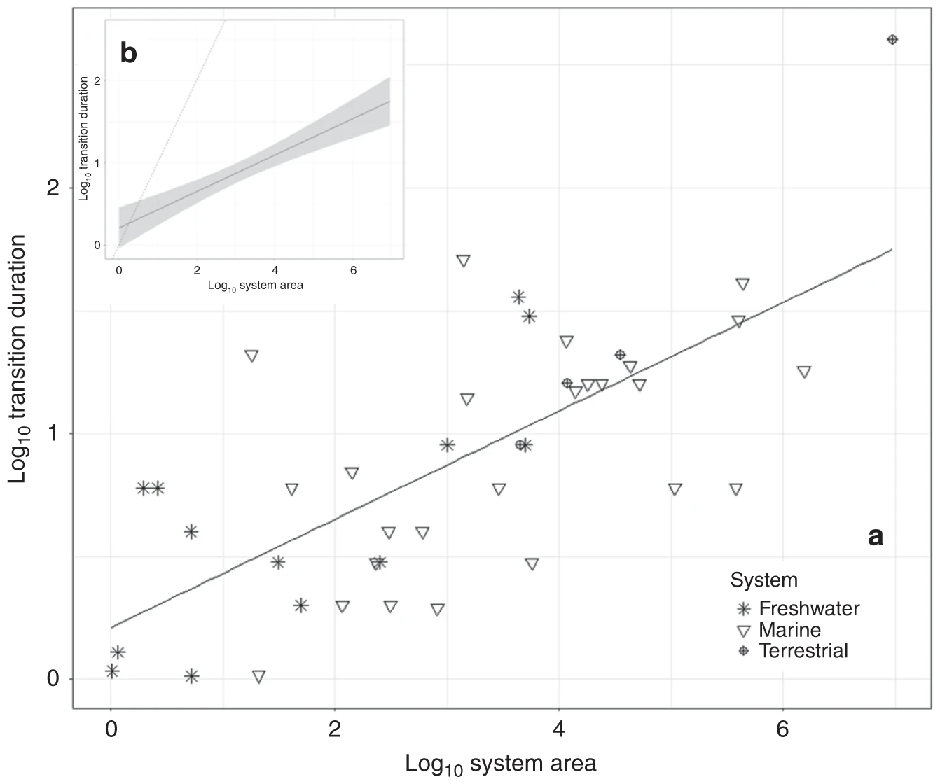
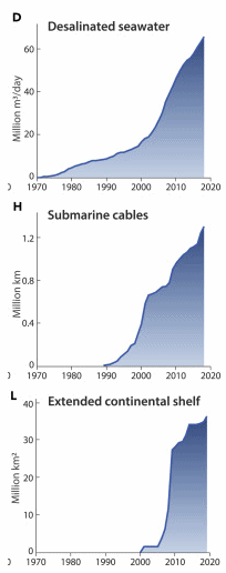
By Grace Dungey 13 February 2020 (Mongabay) – Humanity has depended on the ocean for millennia. Today, however, the rush to the sea is occurring with unprecedented diversity and intensity, propelled by population growth and demand for diminishing terrestrial resources. A study published in January in the new journal One Earth analyzed 50 years of data on 18 kinds […]
By Darryl Fears 12 February 2020 (The Washington Post) – The spread of oil from the Deepwater Horizon disaster in the Gulf of Mexico was far worse than previously believed, new research has found. As the worst offshore oil spill in U.S. history approaches its 10th anniversary in April, a study by two University of Miami researchers […]
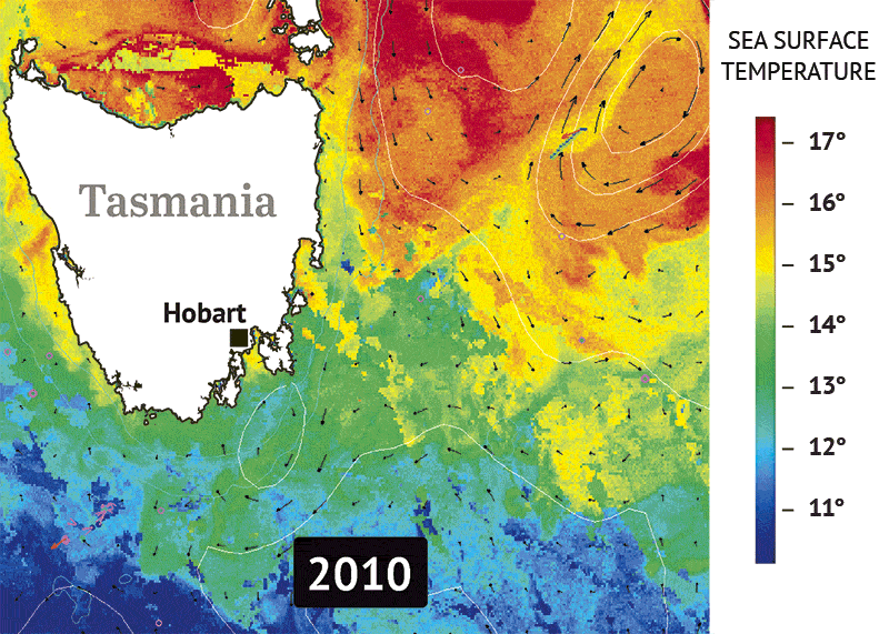
By Royce Millar and Chris Vedelago 31 January 2020 (The Sydney Morning Herald) – Rising temperatures and climate change have been blamed for the failure of stocks of some of the most popular eating fish in Australia’s Southern Ocean to recover from declines despite more than a decade of protection. The troubling findings come as […]
By Isabelle Ross 15 January 2020 DILLINGHAM, Alaska (Alaska Public Media) – The sun beat down relentlessly on Bristol Bay this summer, heating up the rivers and lakes where millions of sockeye salmon returned to spawn. July was the region’s hottest month on record, and in some rivers, that heat was lethal. Tim Sands, an […]