By Matthew Cappucci 8 July 2021 (The Washington Post) – Last week, a “thousand-year” heatwave baked the Pacific Northwest and adjacent British Columbia with widespread highs topping 100 degrees, resulting in a death toll in the hundreds. Lytton, Canada, climbed to 121 degrees and established new national records three days in a row before the town burned […]
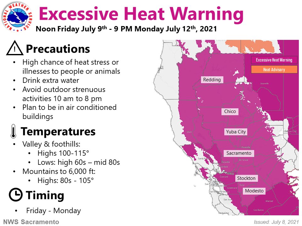
8 July 2021 (Reuters) – California’s power grid operator on Thursday issued a “flex” alert for Friday, asking consumers to conserve energy from 4 p.m. to 9 p.m. as high demand driven by extreme heat could trigger a capacity shortfall on the state’s electric grid. If the grid is still unable to meet power needs […]
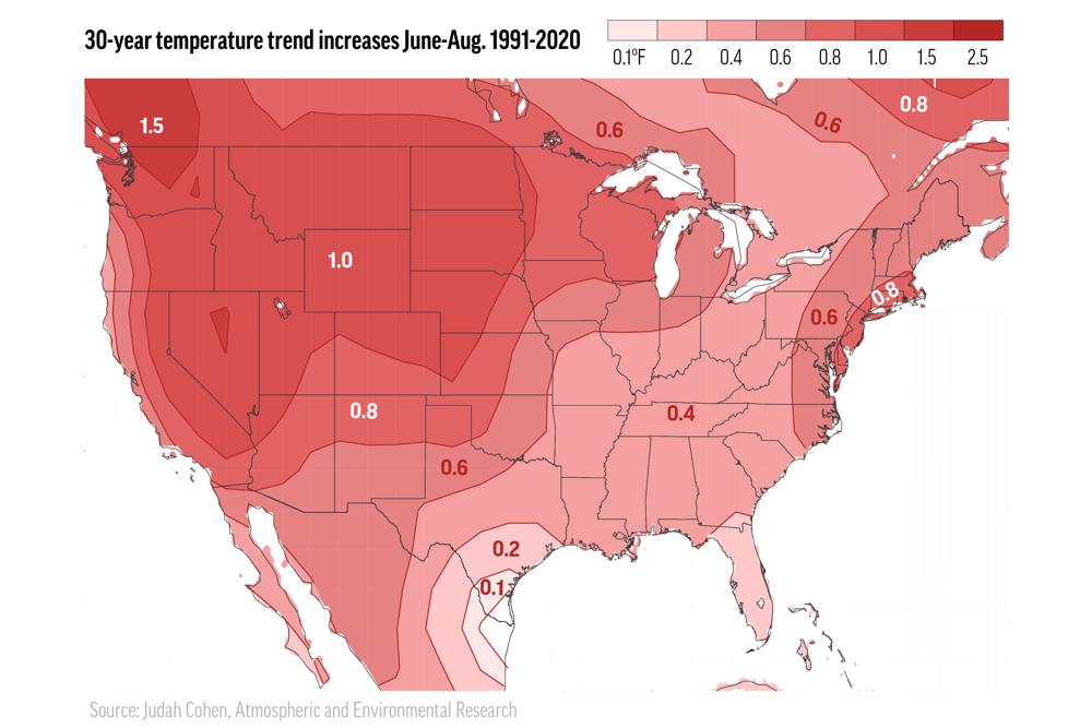
By Seth Borenstein 4 July 2021 (AP) – As outlandish as the killer heatwave that struck the Pacific Northwest was, it fits into a decades-long pattern of uneven summer warming across the United States. The West is getting roasted by hotter summer days while the East Coast is getting swamped by hotter and stickier summer […]
By Zachary B. Wolf 20 June 2021 (CNN) – The incredible pictures of a depleted Lake Mead, on the Nevada-Arizona border, illustrate the effects of drought brought on by climate change. Later this year, the US government will almost certainly declare the first-ever water shortage along the Colorado River. Maps show more than a quarter of the US […]
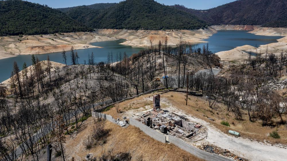
By Adam Beam 17 June 2021 OROVILLE, Califorina (AP) – Each year Lake Oroville helps water a quarter of the nation’s crops, sustain endangered salmon beneath its massive earthen dam and anchor the tourism economy of a Northern California county that must rebuild seemingly every year after unrelenting wildfires. But the mighty lake — a […]
By Kimmy Yam 9 March 2021 (NBC News) – An analysis of police department statistics has revealed that the United States experienced a significant hike in anti-Asian hate crimes last year across major cities. The analysis released by the Center for the Study of Hate and Extremism at California State University, San Bernardino, this month examined hate […]
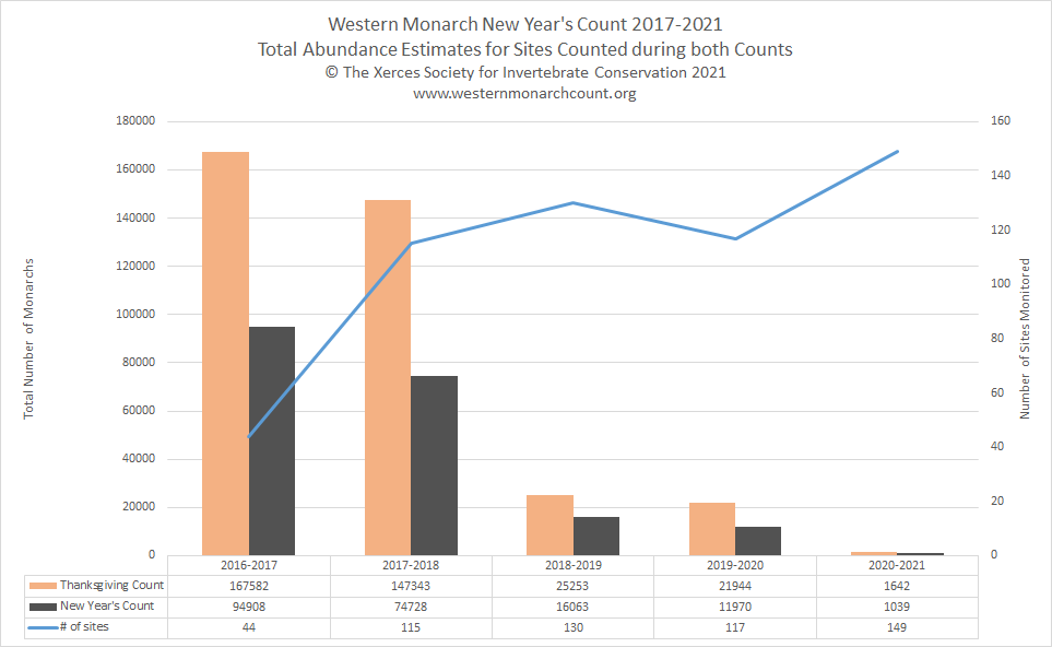
PORTLAND, Oregon, 19 January 2021 – The Xerces Society today announced that only 1,914 monarch butterflies were recorded overwintering on the California coast this year. This critically low number follows two years with fewer than 30,000 butterflies—the previous record lows—indicating that the western monarch butterfly migration is nearing collapse. The final results from the 24th annual Western […]
By Joel Shannon and Doyle Rice 2 March 2021 (USA TODAY) – Soaring mountains on one side of the road and the Pacific Ocean on the other: It was 1956 and Gary Griggs was experiencing California State Route 1 for the first time. He was a child, but in the following decades he would drive […]
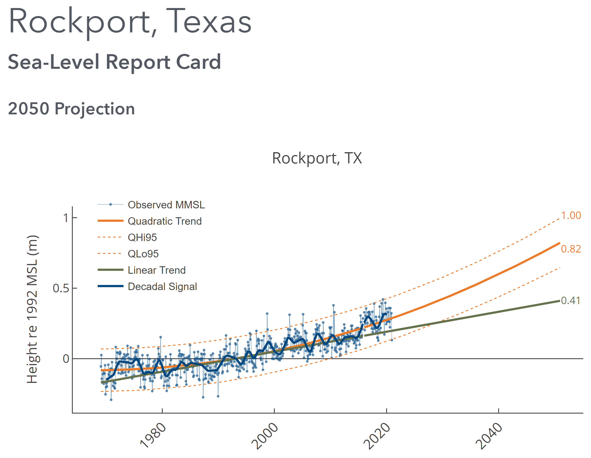
By David Malmquist 24 January 2021 (VIMS) – Sea level “report cards” issued annually by researchers at William & Mary’s Virginia Institute of Marine Science add further evidence of an accelerating rate of sea-level rise during 2020 at nearly all tidal stations along the U.S. coastline. The team’s web-based report cards project sea level to […]
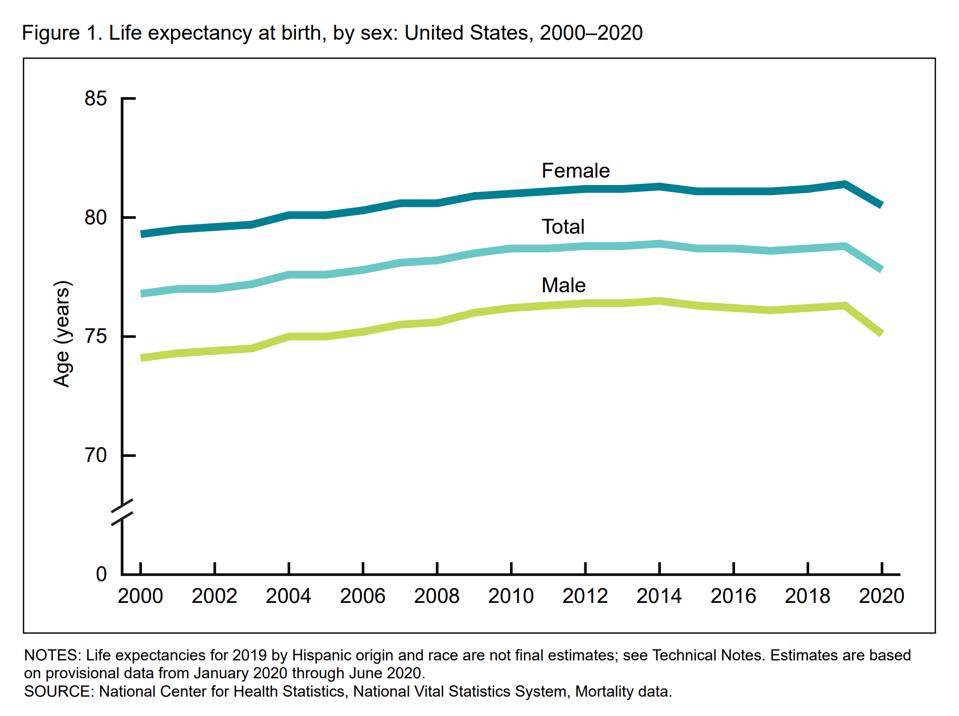
By Sabrina Tavernise and Abby Goodnough 18 February 2021 (The New York Times) – Life expectancy in the United States fell by a full year in the first six months of 2020, the federal government reported on Thursday, the largest drop since World War II and a grim measure of the deadly consequences of the coronavirus […]