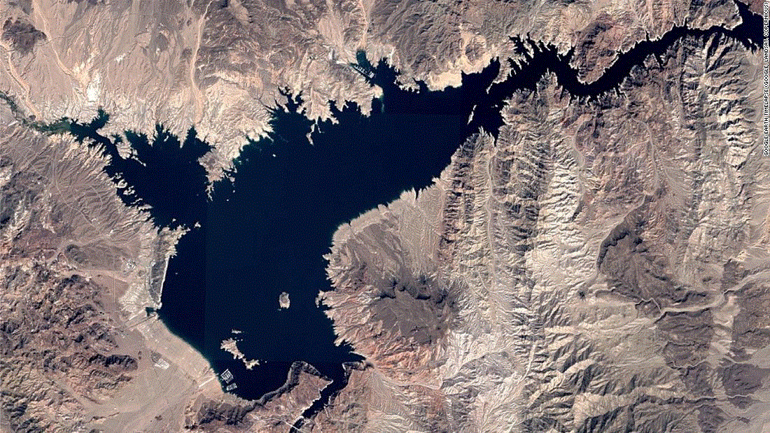
The American West is drying out – Lake Mead, largest reservoir in U.S., drops to lowest level on record since it was filled in the 1930s
By Zachary B. Wolf
20 June 2021
(CNN) – The incredible pictures of a depleted Lake Mead, on the Nevada-Arizona border, illustrate the effects of drought brought on by climate change.
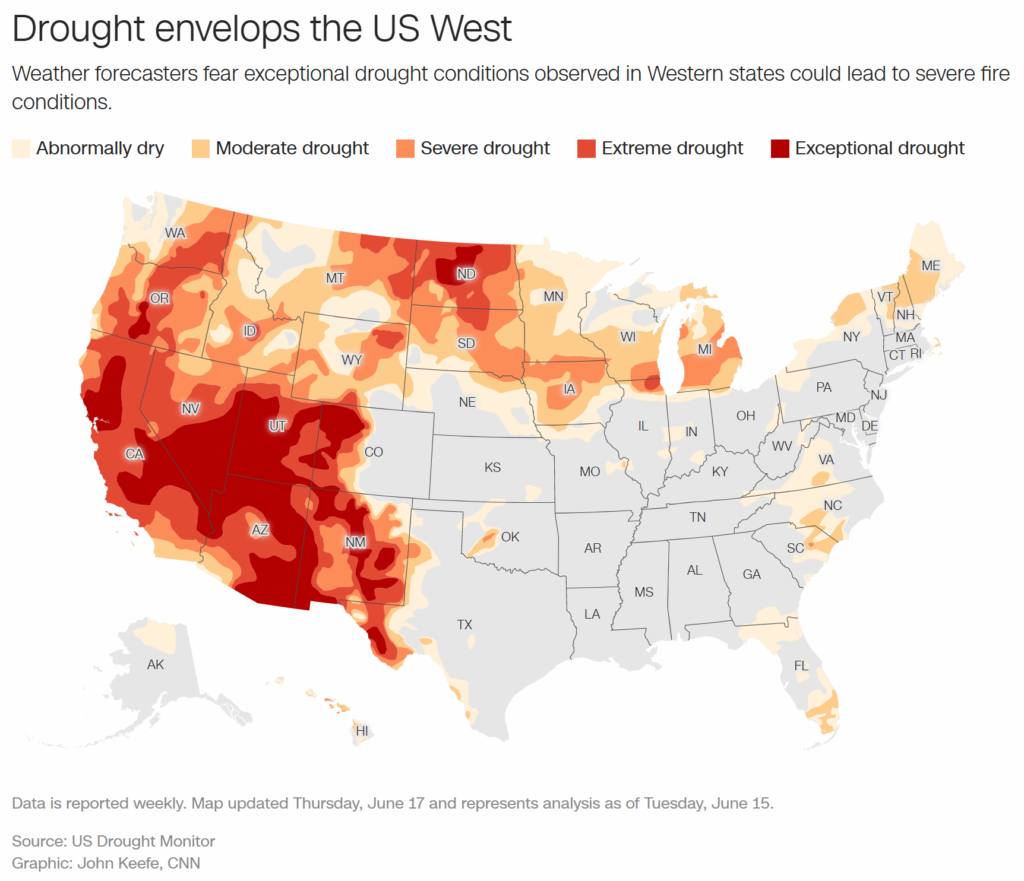
Later this year, the US government will almost certainly declare the first-ever water shortage along the Colorado River. Maps show more than a quarter of the US is in “exceptional drought,” underscoring the scope of a decades-long dry-out.
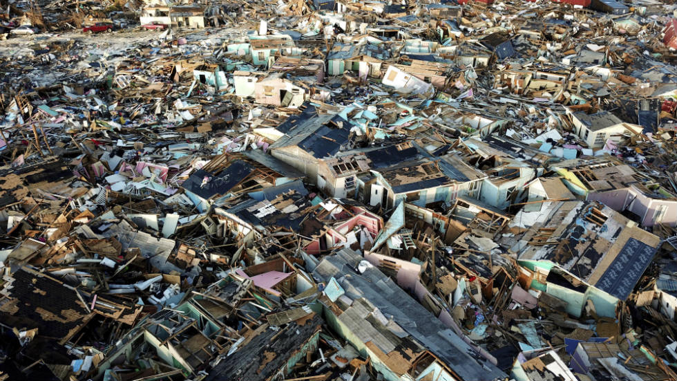
Stories are popping up across the West of possible rationing, coming restrictions, and looming standoffs between farmers and the government over the most precious natural resource. […]
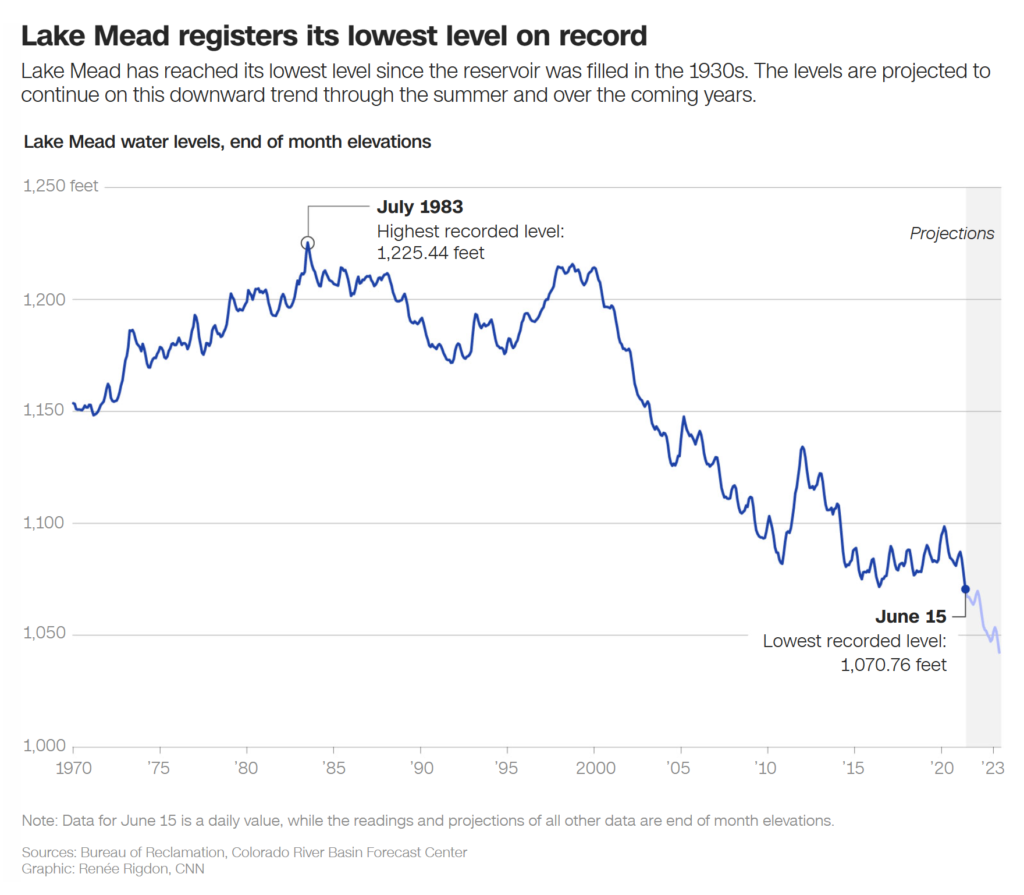
The most visible and striking effect of the heat and drought is at Lake Mead, which is at its lowest levels since it was filled during construction of the Hoover Dam in the 1930s.
Less snowpack and more evaporation from hot temperatures have taken their toll over the course of decades to the point where it has dropped more than 140 feet since 2000 and sits at not much more than a third of its capacity. […]
The water at Lake Mead has been slowly falling for years. In 2015, CNN went to see St. Thomas, a former town of 500 people that was bought out by the government and submerged under 60 feet of water for the sake of Lake Mead. St. Thomas emerged from the depths as the water lowered. And kept lowering.
The 2000 vs. 2020 image comparison is incredible.
The entire West is dry
CNN’s climate team put together three maps to bring perspective to the historic drought.
The current drought map shows 88% of the Western part of the country in some shade of red and the East almost entirely unfazed.
The upcoming rainfall outlook is just as grim, suggesting there will be no relief out West. And a look at stream and river flow demonstrates a lack of water moving across the region.
They could have added a fourth with this heat map as the West bakes in record temperatures.
Decades of drought
The Intermountain West — between the Rockies, the Cascades, and the Sierra Nevada Mountains — has technically been in a drought for decades, since 2000. It’s a vicious cycle: Hot weather leads to drought, and drought leads to hot weather. […]
We know the short-term effects of this drought will be restrictions and new rules. What’s harder to see is the longer-term effects, although it’s a broader look at water and drought that makes the dire predictions of climate refugees fleeing parts of the country that become too hot or arid, or the breakdown of water sharing systems and agreements.
That seems both a long way off as humans turn their attention toward using less water and finding new ways to capture it, store it and reuse it. But those far-fetched predictions seem all too close when the nation’s largest reservoir is literally drying up. [more]