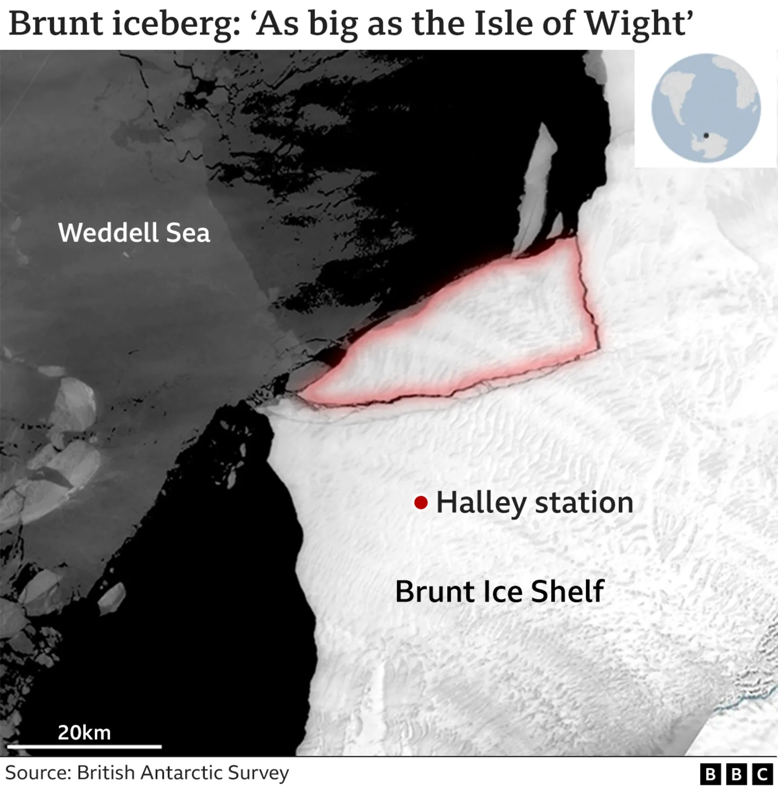
The calving front of the Thwaites Glacier in the Amundsen Sea in 2019, viewed from the R/V Nathaniel B. Palmer. Photo: Elizabeth Rush

We reached the glacier just as it collapsed – The world’s widest glacier is melting and changing predictions about our planet’s future – “It looks nearly as dramatic as the Larsen B collapse”

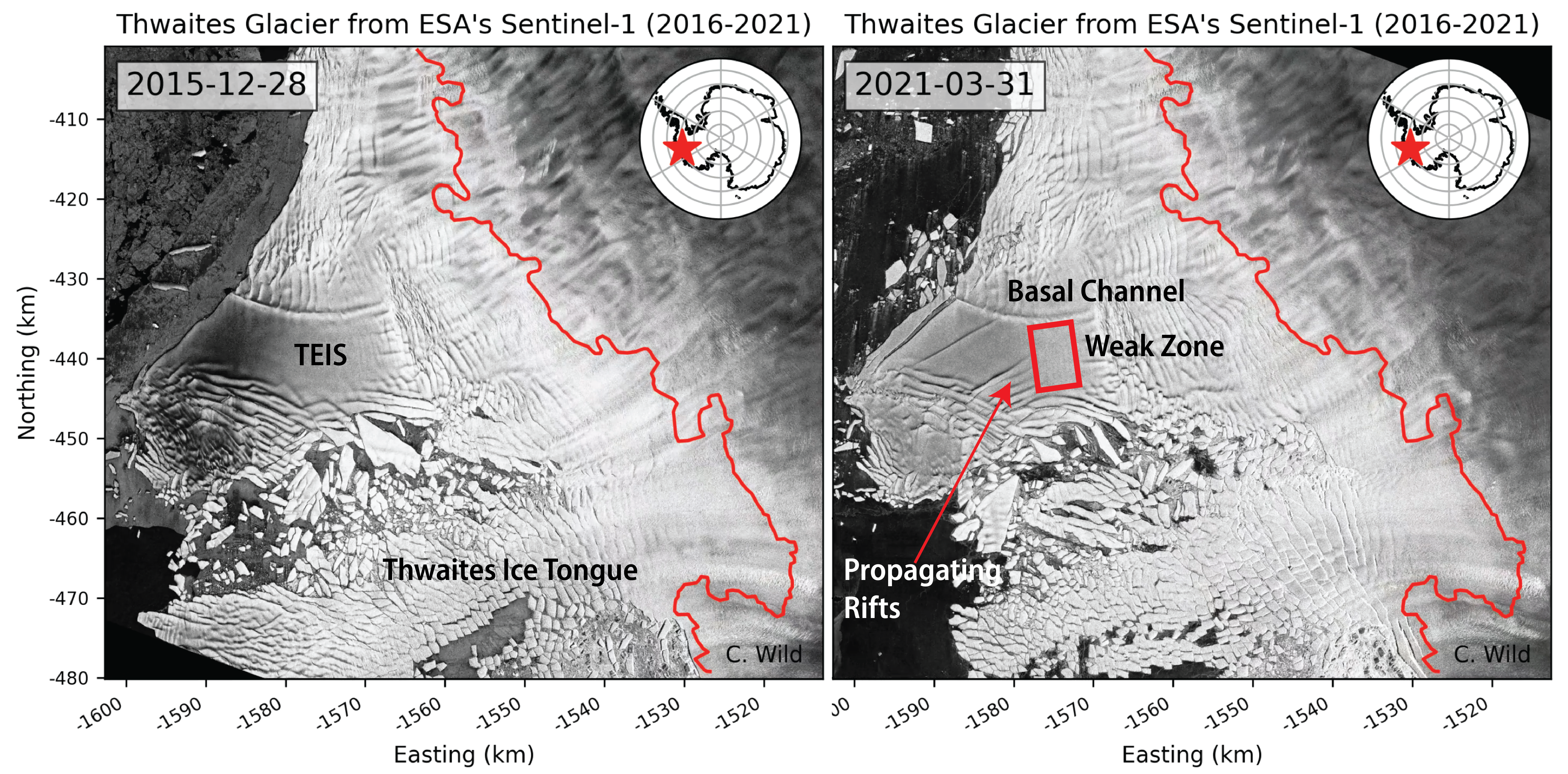
By Elizabeth Rush 13 August 2023 (The Atlantic) – Out on the bow of the R/V Nathaniel B. Palmer, the air is dense and almost warm. We have punched through miles of Antarctic ice floes to reach the Amundsen Sea’s foggy interior. I want to honor the remaining distance between us and Thwaites Glacier’s calving […]

Antarctic sea ice extent for 25 February 2022, was 1.92 million square kilometers (741,000 square miles). The orange line shows the 1981 to 2010 average extent for that day. Graphic: National Snow and Ice Data Center

WMO: Antarctic heat, rain, and ice prompt concern – “This event is rewriting record books and our expectations about what is possible in Antarctica”

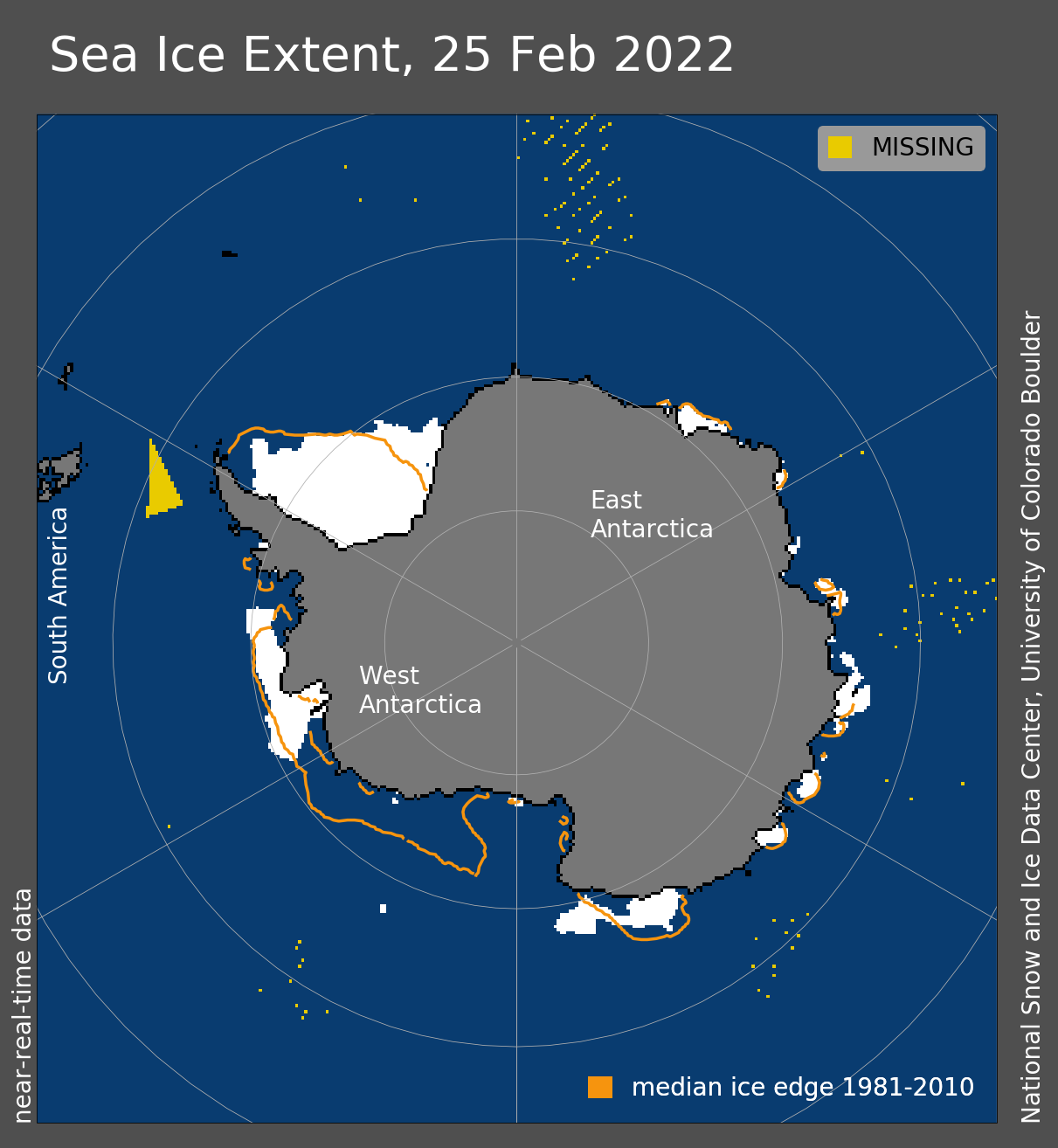
1 April 2022 (WMO) – Record high temperatures, rain and the collapse of an ice shelf in East Antarctica have prompted questions and concern about the possible role of climate change in the coldest and driest part of the world. Record high temperatures, rain and the collapse of an ice shelf in East Antarctica have […]

Satellite view of the Conger/Glenzer (Bowman Island) ice shelf collapse in March 2022. Scientists are concerned because the ice shelf collapsed in East Antarctica, an area that had long been thought to be stable. The collapse in March 2022 was the first time scientists have ever seen an ice shelf collapse in this cold area of Antarctica. Photo: NASA / AP

Thinning Antarctic ice shelf finally crumbles after extreme heatwave – “The Glenzer Conger ice shelf presumably had been there for thousands of years, and it’s never going to be there again”

By Isla Binnie 25 March 2022 (Reuters) – An East Antarctica ice shelf disintegrated this month following a period of extreme heat in the region, according to scientists. Satellite images show the 1,200 square-kilometre Conger Ice Shelf collapsed completely on or around March 15. “Possible it hit its tipping point following the #Antarctic #AtmosphericRiver and […]

Satellite view of Antarctica’s Thwaites Glacier on 28 December 2015 (left) and 31 March 2021 (right). On 13 December 2021, Ice scientists at the American Geophysical Union (AGU) meeting in New Orleans warned that great cracks and fissures had opened up both on top of and underneath the Thwaites glacier, one of the biggest in the world, and it may fracture and collapse, possibly within five years. Photo: ESA Sentinel-1

Antarctica’s “doomsday” glacier: how its collapse could trigger global floods and swallow islands – “If Thwaites were to collapse, it would drag most of West Antarctica’s ice with it”

By Ella Gilbert 22 December 2021 (The Conversation) – The massive Thwaites glacier in West Antarctica contains enough ice to raise global sea levels by 65 centimeters if it were to completely collapse. And, worryingly, recent research suggests that its long-term stability is doubtful as the glacier haemorrhages more and more ice. Adding 65 centimeters to global sea levels […]

Deep water underneath the Thwaites ice shelf front is lighter than water outside the ice shelf. (A) Map of trough T3 showing the AUV path color coded by latitude. Shaded region indicates the ice shelf front, and black contours are depth contours. (B) Conservative temperature θ (in degrees Celsius) versus absolute salinity SA (in grams per kilogram) for the AUV data points shown in (A), colors as in (A). Contours show potential density (9) relative to 900 m, and blue arrow indicates isopycnal mixing, i.e., water that has the same density but different temperatures and salinities. Green circles in (A) and (B) show the dense saline deep water found in trough T3 discussed in the main text. (C) Absolute salinity SA (in grams per kilogram) as a function of depth for the AUV data in trough T3 and the CTD data (colors indicate station as in Fig. 3). (D) Potential density (in kilograms per cubic meter) as a function of depth for the AUV data in trough T3 and the CTD data (colors indicate station as in Figs. 3 and 4). Red and blue arrows indicate the two deep water masses discussed in the main text from Pine Island Bay and Thwaites Trough. Dissolved oxygen versus θ and SA is shown in fig. S6. Graphic: Wåhlin, et al., 2021 / Science Advances

Exploration of ocean currents beneath the “Doomsday Glacier” by an autonomous underwater vehicle – Net melting of 75 cubic km of ice per year means “the glacier is not stable over time”

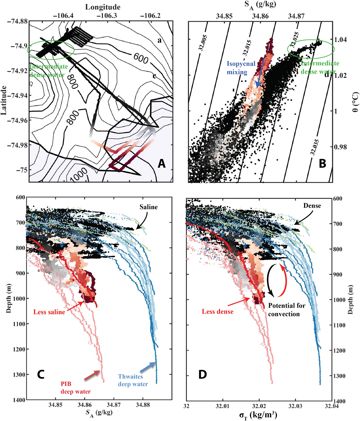
9 April 2021 (University of Gothenburg) – For the first time, researchers have been able to obtain data from underneath Thwaites Glacier, also known as the “Doomsday Glacier”. They find that the supply of warm water to the glacier is larger than previously thought, triggering concerns of faster melting and accelerating ice flow. With the […]

Radar images from the Sentinel-1 satellite of the Milne Ice Shelf breakup at the end of July 2020. Photo: Dr. Adrienne White / Canadian Ice Service

Canada’s last fully intact Arctic ice shelf collapses – “This was the largest remaining intact ice shelf, and it’s disintegrated, basically”

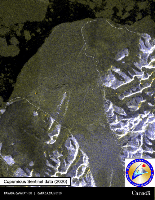
By Moira Warburton 6 August 2020 (Reuters) – The last fully intact ice shelf in the Canadian Arctic has collapsed, losing more than 40% of its area in just two days at the end of July, researchers said on Thursday. The Milne Ice Shelf is at the fringe of Ellesmere Island, in the sparsely populated […]

Global surface temperature anomalies, 1880-2019, compared with the 1880-1899 average. The year 2019 was the second warmest year on record, capping the warmest decade since measurements began. Data: Gavin Schmidt / NASA GISTEMP. Graphic: InsideClimate

2010-2019: Earth’s hottest decade on record marked by extreme storms, deadly wildfires – “The climate of the 20th Century is gone. We’re in a new neighborhood.”

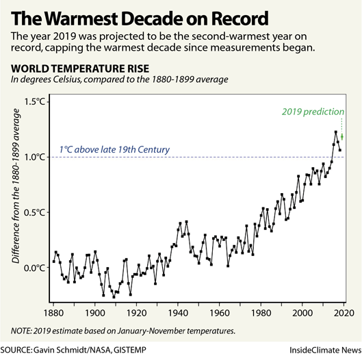
By Bob Berwyn 19 December 2019 (InsideClimate News) – Deadly heat waves, wildfires and widespread flooding punctuated a decade of climate extremes that, by many scientific accounts, show global warming kicking into overdrive. As the year drew to a close, scientists were confidently saying 2019 was Earth’s second-warmest recorded year on record, capping the warmest […]

Global sea level rise with the Thwaites Glacier and the ice of the West Antarctic Ice Sheet. Graphic: PRI

Scientists race against time to find out if Antarctica’s Thwaites Glacier is doomed – “This is where rapid change is really happening, and we’re actually standing and looking at the bit that’s rapidly changing”

By Carolyn Beeler 13 May 2019 (PRI) – Peter Sheehan, an oceanographer on the Nathaniel B. Palmer, was one of the first people on Earth to get this view of Thwaites Glacier — the part that juts out to sea. He’s pored over plenty of Google images of ice shelves, but there’s nothing like the […]

Social media & sharing icons powered by UltimatelySocial