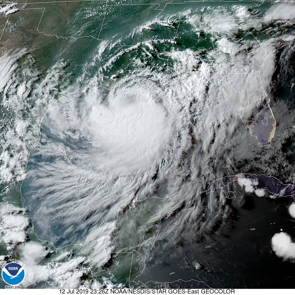
Devastating floods possible as Tropical Storm Barry sloshes into Louisiana – “It doesn’t matter what the storm is called. We are still expecting a major rainfall flood event.”
By Bob Henson
12 July 2019
(Weather Underground) – Residents of southeast Louisiana need to finalize preparations for widespread and severe flooding this weekend with the approach of Tropical Storm Barry. Packing top sustained winds of 65 mph, slow-moving Barry will push its way onshore Saturday, possibly as a Category 1 hurricane. What matters most with Barry isn’t a Saffir-Simpson rating, though, but instead the massive rains it will dump on a highly vulnerable region—most of it arriving well after landfall from Saturday into Sunday.
“It doesn’t matter what the storm is called,” emphasized weather.com’s Jon Erdman. “We are still expecting a major rainfall flood event.” […]
Given the very rare juxtaposition of a late-season flood and an early-season tropical storm, the Mississippi will bear close watching this weekend. For more on this topic, see the nola.com article published Friday and Jeff Masters’ detailed look at how surge can affect the Mississippi in southeast Louisiana. […]
Mammoth amounts of rain headed for southern Louisiana and beyond
What appears near-certain is that the lower Mississippi Valley is in for a massive, potentially devastating rainfall event. From Saturday into Sunday morning, “significant flooding and life-threatening flash flooding are likely across eastern Louisiana and southwest Mississippi,” said the NOAA/NWS Weather Prediction Center in its Day 2 high-risk outlook for excessive rain.
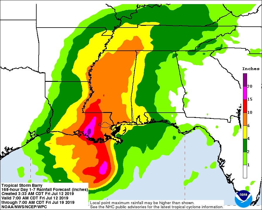
According to WPC, the convective core now on Barry’s south side will gradually pivot around the surface center and push into southeast Louisiana on Saturday, a scenario depicted in multiple runs of the European model. The very heaviest rains, with a corridor of 10-15” amounts and pockets of 20-25” or more, are likely to be within the convective core just east of the surface center, most likely falling somewhere between Lafayette and New Orleans. Exactly how far to the east or west this corridor develops will be crucial to where the worst flooding impacts occur—and these details are still too far out to predict with confidence. Short-range models should give us a better sense starting Friday night of where the heaviest rainbands will set up. Even locations well outside the heaviest rain corridor will be prone to intense downpours and very dangerous flash flooding.
The “no-name” storm that hammered southeast Louisiana in August 2016 should serve as a reminder that a hurricane is not required for devastating floods in this area. Despite never being classified as a tropical cyclone, this slow-moving low deposited widespread rains of 20″+, including a storm total of 31.39″ at Watson. Damages topped $10 billion, and 13 deaths were reported. [more]
Devastating Floods Possible as Tropical Storm Barry Sloshes into Louisiana
