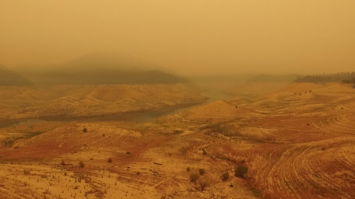
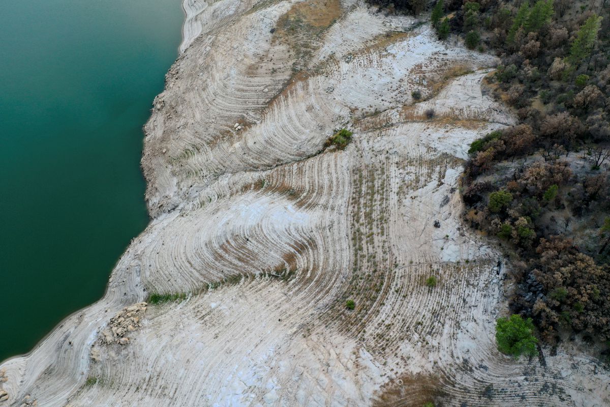
OROVILLE, California, 20 August 2021 (Action News Now) – The reach of the drought emergency has a shocking look at as Lake Oroville drains to dirt. With a surface area of just over 15,000 acres – Lake Oroville provides water and electricity and impacts the local economy as recreation is big on this lake. California’s […]
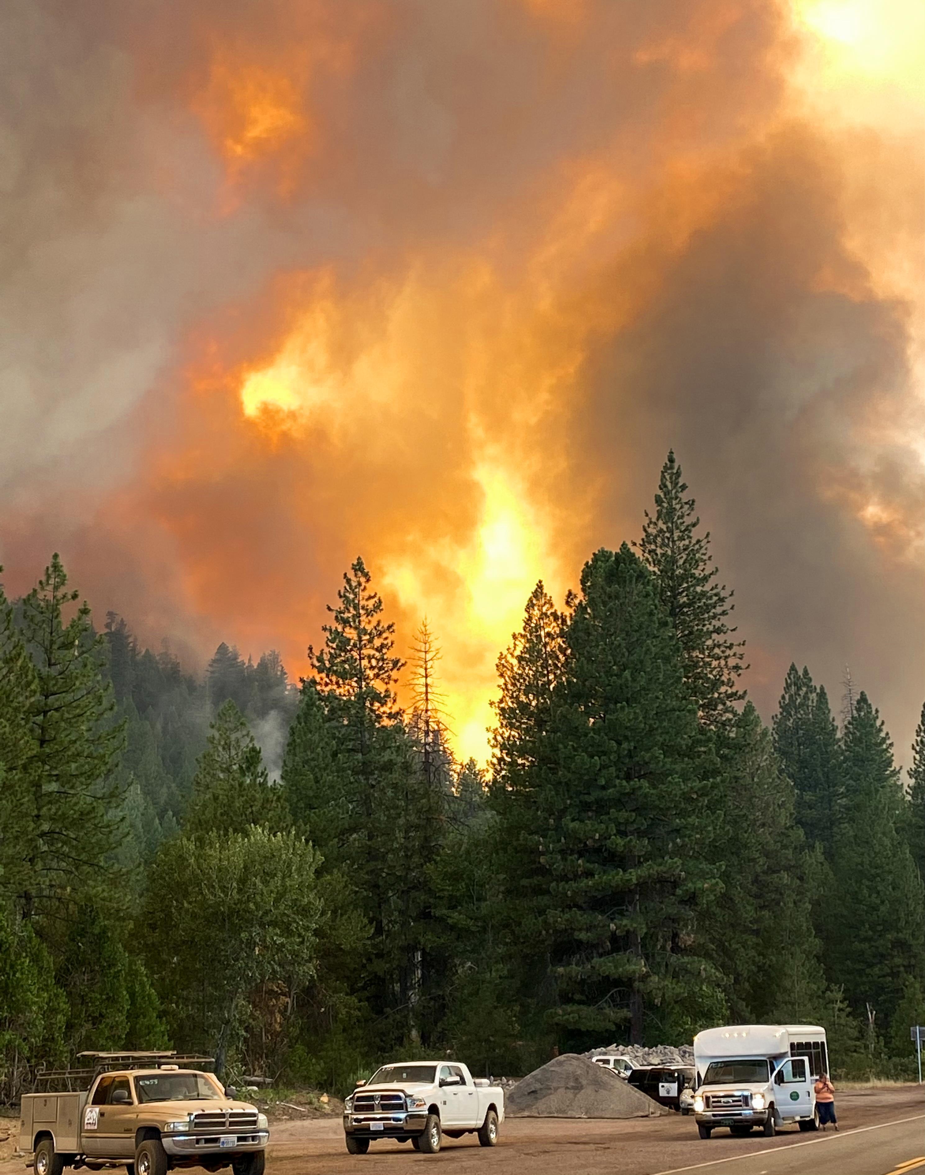
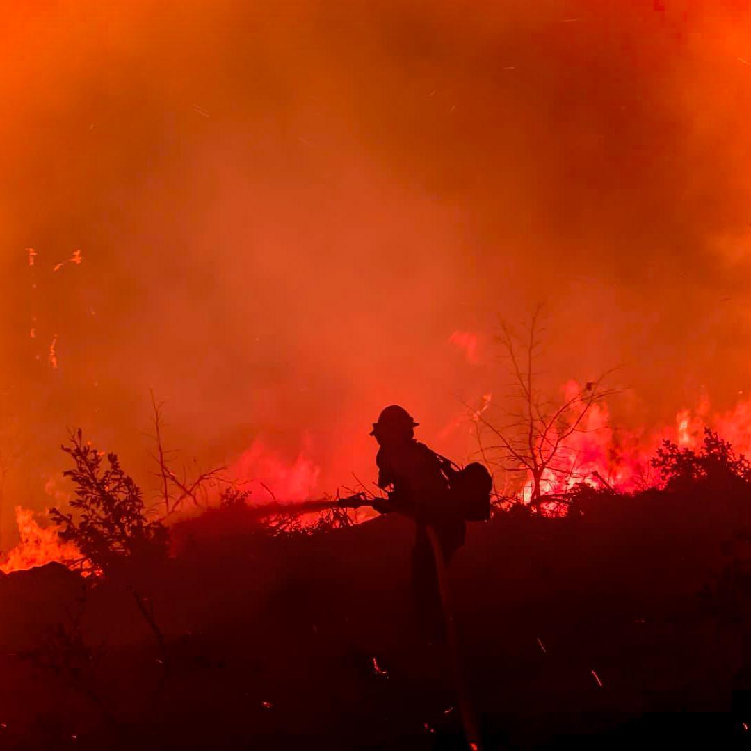
By Tim Stelloh 8 August 2021 (NBC News) – The Dixie Fire became the second largest wildfire in California history Sunday as thousands of residents remained under evacuation orders and more than 10,000 buildings stood in the blaze’s path. The fire, which began July 14 and leveled much of the historic Sierra Nevada town of Greenville […]
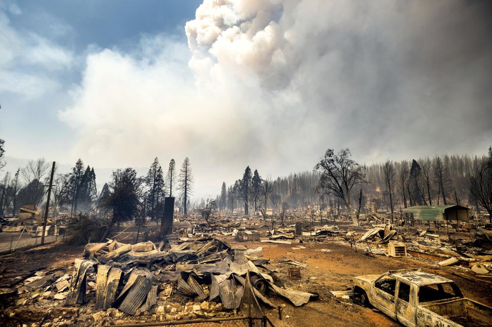
By Daisy Nguyen and Noah Berger 6 August 2021 GREENVILLE, California (AP) – A Northern California wildfire that is now the third-largest in state history had burned for weeks, mostly in remote wildland areas with few people, before it roared through the little mountain community of Greenville, driven by shifting winds and bone-dry vegetation. Eva […]
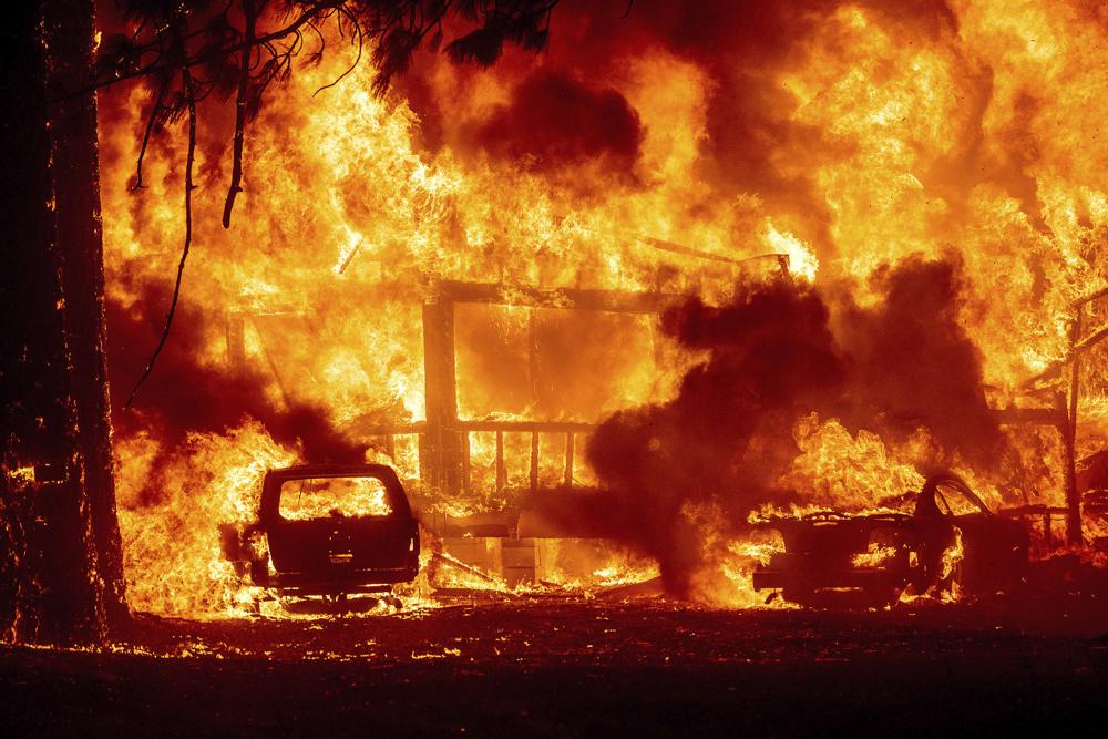
By Christopher Weber and Noah Berger 5 August 2021 GREENVILLE, California (AP) – A 3-week-old wildfire engulfed a tiny Northern California mountain town, leveling most of its historic downtown and leaving blocks of homes in ashes, while a new wind-whipped blaze destroyed homes as crews braced for another explosive run of flames Thursday amid dangerous […]
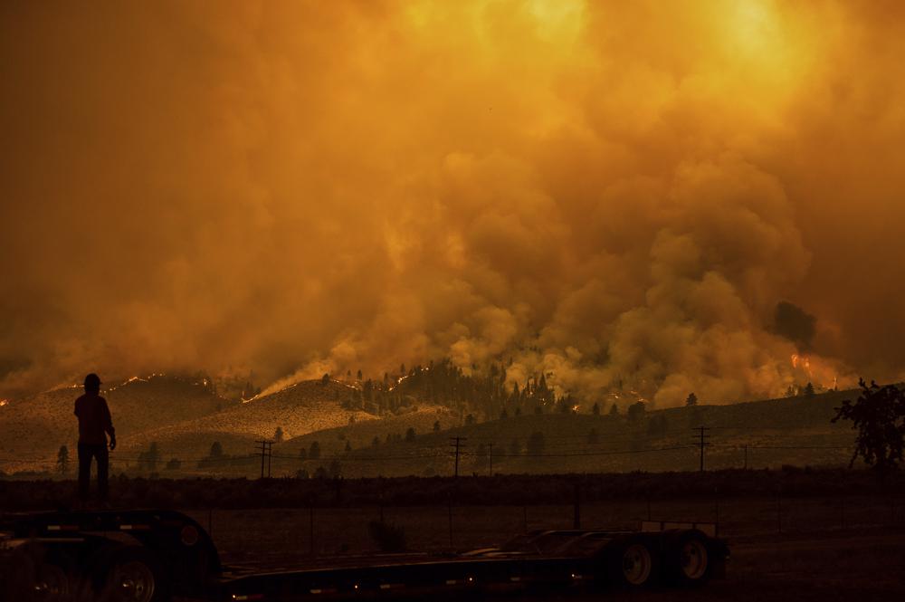
By Maria Caspani 25 July 2021 (Reuters) – Crews and officials battling a large fire that has incinerated more than 190,000 acres (77,000 hectares) in northern California braced for the possibility on Sunday that smoke columns could spawn lightning storms capable of igniting more blazes. The swarming Dixie fire in Butte County, north of Sacramento, […]
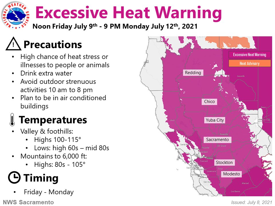
By Christopher Weber 12 July 2021 (AP) – Firefighters working in searing heat struggled to contain the largest wildfire in California this year while state power operators urged people to conserve energy after a huge wildfire in neighboring Oregon disrupted the flow of electricity from three major transmission lines. A large swath of the West […]
By Jaaweed Kaleem and Thomas Curwen 11 July 2021 LAKE MEAD, Nevada (Los Angeles Times) – Eric Richins looked out from his pontoon boat to the shallows on the lake’s western edge. He squinted and paused as if he had come upon a foreign shore. For the first time in a career navigating the waters […]
By Matthew Cappucci 8 July 2021 (The Washington Post) – Last week, a “thousand-year” heatwave baked the Pacific Northwest and adjacent British Columbia with widespread highs topping 100 degrees, resulting in a death toll in the hundreds. Lytton, Canada, climbed to 121 degrees and established new national records three days in a row before the town burned […]
8 July 2021 (Reuters) – California’s power grid operator on Thursday issued a “flex” alert for Friday, asking consumers to conserve energy from 4 p.m. to 9 p.m. as high demand driven by extreme heat could trigger a capacity shortfall on the state’s electric grid. If the grid is still unable to meet power needs […]
By Zachary B. Wolf 20 June 2021 (CNN) – The incredible pictures of a depleted Lake Mead, on the Nevada-Arizona border, illustrate the effects of drought brought on by climate change. Later this year, the US government will almost certainly declare the first-ever water shortage along the Colorado River. Maps show more than a quarter of the US […]