Satellite view shows Europe drying out in the drought of Summer 2022
By Ed Browne
7 September 2022
(Newsweek) – Scientists have released images of Europe from space that show just how arid the landscape has become as part of what may be the region’s worst drought in 500 years.
Europe, like large swathes of the United States, is currently in the grip of extraordinary drought conditions that are putting vegetation under stress.
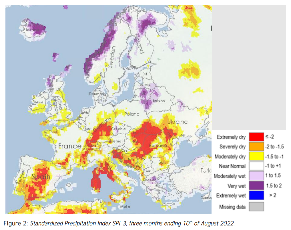
A report from the European Commission’s Global Drought Observatory published on 22 August 2022 warned that, in the first 10 days of the month, 47 percent of all of Europe was under drought warning conditions, with the hazard becoming increasingly severe in countries including Italy, Spain, France, Germany, and the United Kingdom.
Soil moisture and vegetation were both “severely affected,” and photosynthesis amongst plant life was lower than normal in several countries. Meanwhile, a reduced volume of stored water has had severe impacts on the energy sector, affecting hydropower generation and cooling systems of other power plants, the report said.
Referring to the report, European Commission spokesperson Johannes Bahrke said on August 23 that the drought may be the worst “for at least 500 years,” according to news outlet DW—though Bahrke said this would have to be confirmed at the end of the season.
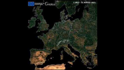
On 5 September 2022, the European Union‘s Earth observation satellite program Copernicus took to Twitter to release images of Europe from space that show how the drought has affected the landscape on a huge scale.
The images can be seen in the following clip, which compares two snapshots of the region, consisting of a mosaic of images taken between July and August—one from 2021 and the other from the same time in 2022.
In the first, the predominant color is a lush green, particularly in central and northern regions, with more arid earthy-colored areas seen towards the south.
But in the second photo, large swathes of the continent appear dry and arid in contrast to the year before. Stark changes can be seen in regions including the east of England, France, and Germany.
Annamaria Luongo, a data expert in the Copernicus team, told Newsweek: “The images are mosaics obtained combining all the Copernicus Sentinel-2 images acquired in the selected reference time period: 1 July – 31 August 2021, and 1 July – 31 August 2022, respectively.” [more]