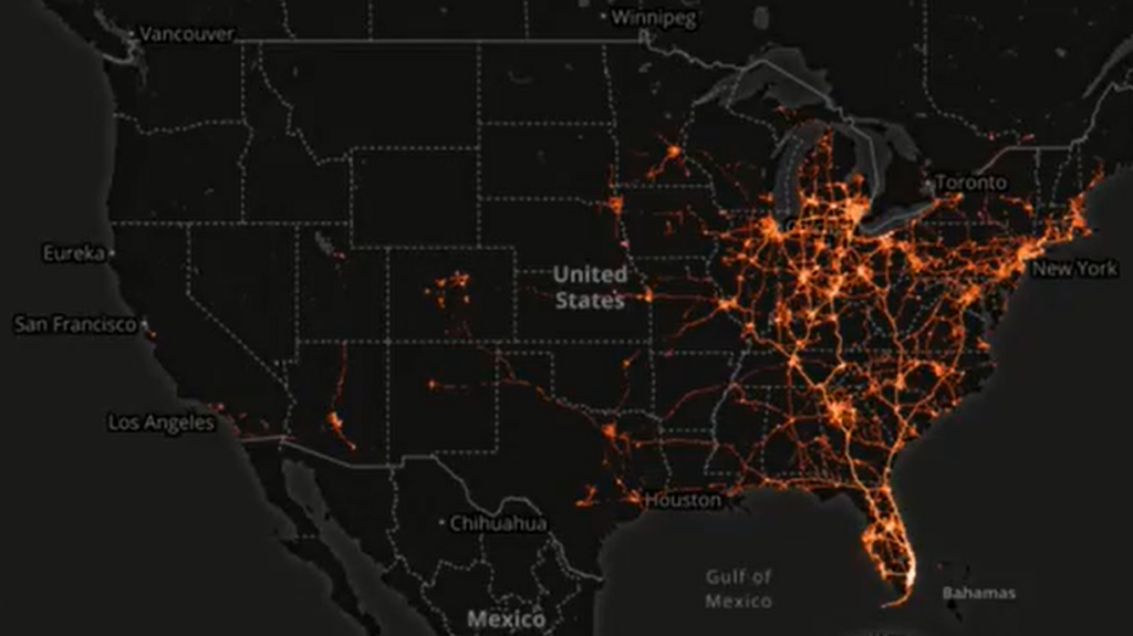
Tracking mobile phone location data of Florida beachgoers during Spring break shows potential coronavirus spread

By Jason Murdock
27 March 2020
(Newsweek) – Heat maps created using data from citizens’ mobile devices are demonstrating just how quickly potential novel coronavirus cases can spread throughout the U.S.
Location data from U.S. mobile technology company X-Mode is being fed into a mapping platform called Tectonix to analyze human movements during the COVID-19 pandemic, with videos of the results posted to Twitter showing how easily containment efforts can rapidly spiral out of control.
In one test, first reported by The Daily Dot, the team analyzed devices that were active on a single Florida beach during Spring break and tracked where they ended up.
A second experiment looked at social distancing efforts in New York, showing devices leaving the region, traveling “all the way across our country and throughout the world.”
It’s a glimpse into the power and scope of mobile tracking data, which the tech companies claim is anonymized to not reveal information about the owner of the device. […]
“We wanted to see the true footprint social gatherings like Spring break beach crowds could really have on our society in the face of a global pandemic,” the video narration explained.
The clip continued: “Each of the data points shown on the map corresponds to a unique mobile device active on a given day. You can see clearly that device activity spikes during the two week stretch of early to mid March, corresponding to Spring Break. No surprise.
“As we zoom [out] it becomes clear the massive potential impact just one single beach gathering can have in spreading this virus across our nation. It can be hard for us to realize sometimes just how connected our world really is, until the data tells the stories that we just can’t see.” [more]

