January 2020 sees warmest winter in U.S. history so far
By Bob Henson
6 February 2020
(Weather Underground) – The first two months of meteorological winter (December 2019 – January 2020) were the warmest on record for the contiguous U.S. in data going back to 1895. NOAA provided the January data and images on Thursday ahead of its monthly U.S. climate report.
The average national temperature for the first two of winter’s three months was 35.95°F, topping the 35.82°F observed in Dec. 2005 – Jan. 2006.
Across the contiguous U.S., this winter so far is running about 4.5°F warmer than the average winter of the 20th century.
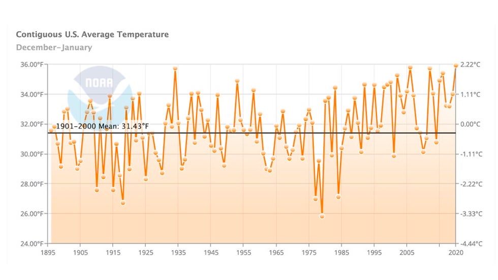
The nation saw its fifth warmest January on record, following the sixth warmest December.
Even though neither month was record-warm on a national or state level, the mild conditions were prolonged enough to top the national list when the two months are combined.
The warmth was also usually widespread. Not a single one of the Lower 48 states had a temperature significantly below average in December, and the same was true in January. Thirteen states had a top-ten-warmest January, including every New England state except Vermont. [more]
Warmest Winter in U.S. History So Far
January 2020 was 5th warmest on record for the U.S.
6 February 2020 (NOAA) – The new year kicked off with a balmy start for the U.S., making January 2020 the fifth warmest January on record. All 48 contiguous states saw above- to much-above-average temperatures last month.
January was also quite damp for the Lower 48 and ranked in the wettest third of the 126-year climate record.
Here are more U.S. highlights for the month from NOAA’s National Centers for Environmental Information:
Climate by the numbers
January 2020
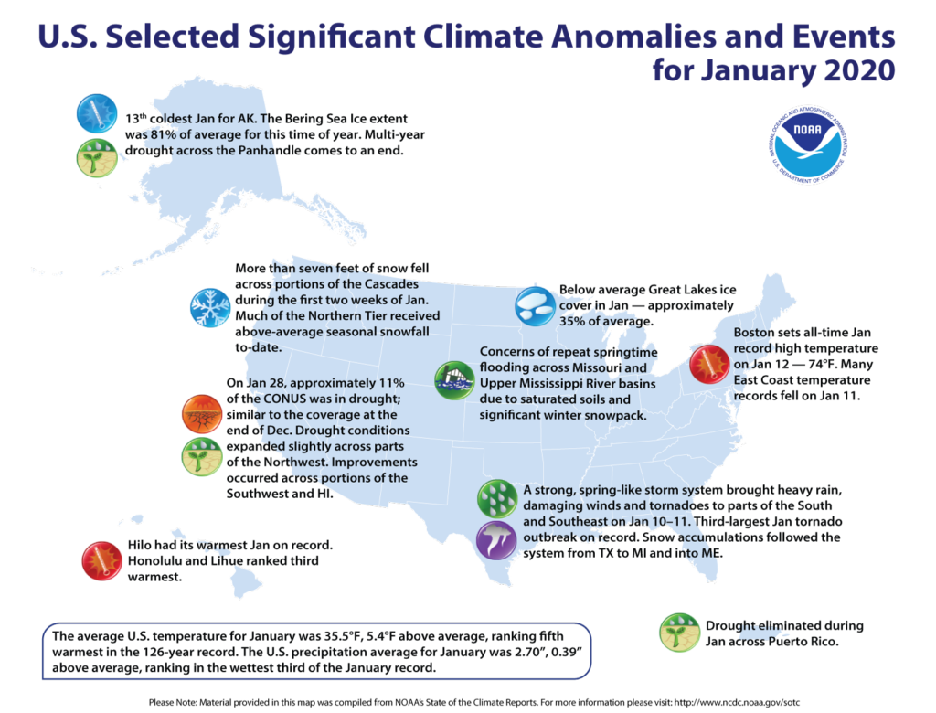
The average January temperature across the contiguous U.S. was 35.5 degrees F (5.4 degrees above the 20th-century average) and ranked fifth warmest in the 126-year record.
January’s precipitation for the contiguous U.S. was 2.70 inches (0.39 of an inch above average), which ranked it in the wettest third of all the Januarys on record. January precipitation extended a rather wet 12-month stretch: February 2019 through January 2020 was the third-wettest such period ever recorded, 4.99 inches above average.
Much-above-average temperatures were observed across much of the Great Lakes and Northeast as well as parts of the Mid-Atlantic, Southeast, West and southern Plains.
Last month, much-above-average wetness was observed across the Pacific Northwest as well as portions of the central and southern U.S.
Washington state experienced its fourth-wettest January, while Oklahoma saw its sixth wettest on record.
More notable climate events for the month:
- A January that forgot it was winter: No state in the Lower 48 ranked average or below average temperature-wise for January 2020. The month ranked as the fifth warmest January on record for Michigan, and the sixth warmest for Wisconsin and Rhode Island.
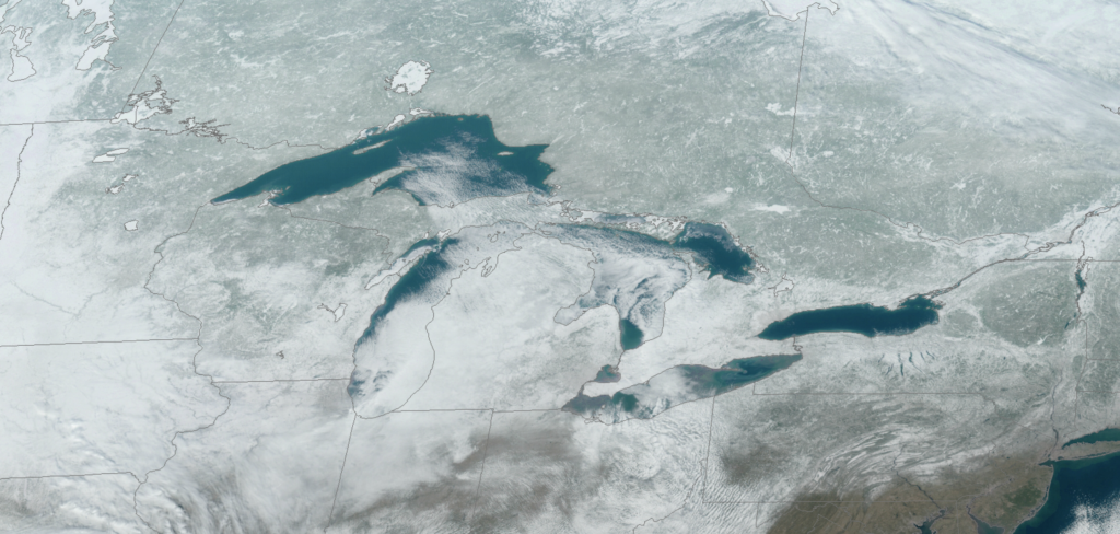
- Great Lakes saw relatively low ice coverage: Ice coverage was approximately 35 percent of average for January. Lake Erie, normally about 50 percent ice-covered by January 31, was only 0.4% frozen this year.
- Alaska chilled out (brrrrr!): In stark contrast to the record warmth experienced during 2019, Alaska’s average January temperature was a very frigid -6.2 degrees F — 8.4 degrees colder than the long-term mean. It was Alaska’s coldest January since 2012.
- Drought remained stable: According to NOAA’s U.S. Drought Monitor, approximately 11 percent of the contiguous U.S. was in drought by the end of January, similar to the extent observed at the end of December 2019.
Contact
- John Bateman, (301) 713-9604
