Photo gallery: Satellite view of “unprecedented” Arctic wildfires, July 2019
By Brian Kahn
18 July 2019
(Gizmodo) – Vast stretches of Earth’s northern latitudes are on fire right now. Hot weather has engulfed a huge portion of the Arctic, from Alaska to Greenland to Siberia. That’s helped create conditions ripe for wildfires, including some truly massive ones burning in remote parts of the region that are being seen by satellites.
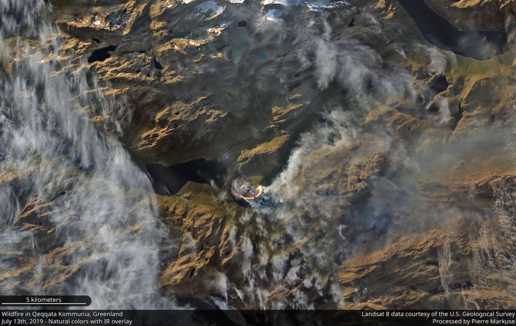
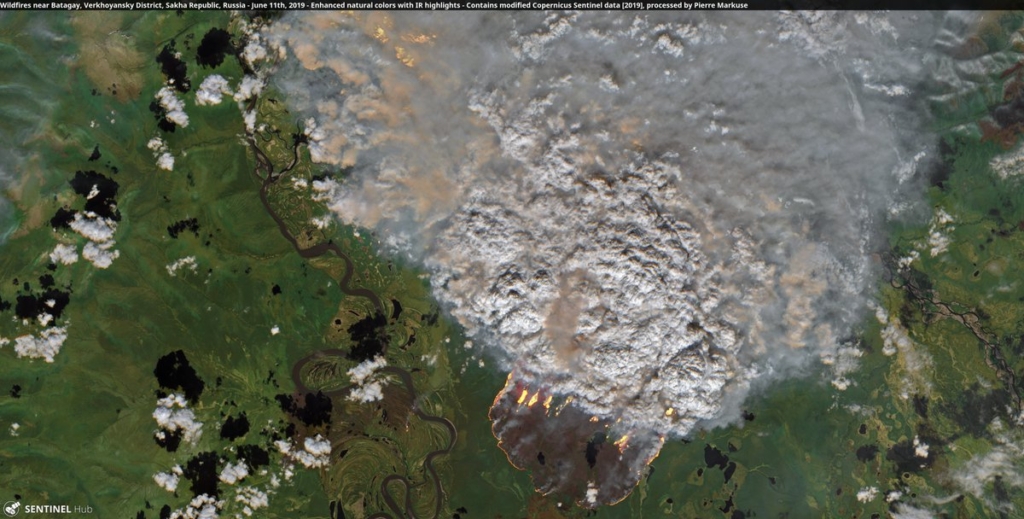
Pierre Markuse, a satellite imagery processing guru, has documented some of the blazes attacking the forests and peatlands of the Arctic. The imagery reveals the delicate landscapes with braided rivers, towering mountains, and vast swaths of forest, all under a thick blanket of smoke.
In Alaska, those images show some of the damage wrought by wildfires that have burned more than 1.6 million acres of land this year. Huge fires have sent smoke streaming cities earlier this month, riding on the back of Anchorage’s first 90 degree day ever recorded. The image below show some of the more remote fires in Alaska as well as the Swan Lake Fire, which was responsible for the smoke swallowing Anchorage in late June and earlier this month. […]
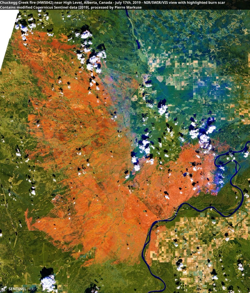
All told, northern fires released as much carbon dioxide in June 2019 as the entire country of Sweden does in a year, according to data crunched by the European Union’s Copernicus program. The agency said the wildfire activity is “unprecedented” amidst what was, incidentally, the hottest June ever recorded for the planet with the Arctic particularly sweltering. [more]