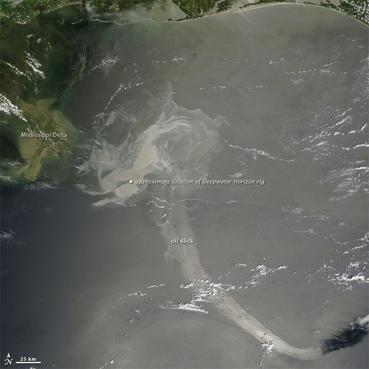
Image of the Day: BP Oil Spill Viewed From Orbit, 17 May 2010
Caption by Michon Scott Nearly a month after a deadly explosion at the Deepwater Horizon oil rig, the damaged well on the bottom of the Gulf of Mexico continued to spill oil. In the weeks since the accident occurred, the oil slick has periodically drifted northeast toward the Mississippi Delta and reached the the Chandeleur Islands. On May 17, 2010, when the Moderate Resolution Imaging Spectroradiometer (MODIS) on NASA’s Terra satellite acquired this natural-color image, a large patch of oil was visible near the site of the accident, and a long ribbon of oil stretched far to the southeast. Oil slicks are not always visible in natural-color satellite images. A thin sheen of oil on an already dark background may be impossible to detect. On this day, however, the slick was located in the sunglint part of the image, which makes the slick stand out. …
