Super typhoon Usagi, strongest storm on Earth in 2013, may strike Hong Kong Sunday
By Jason Samenow
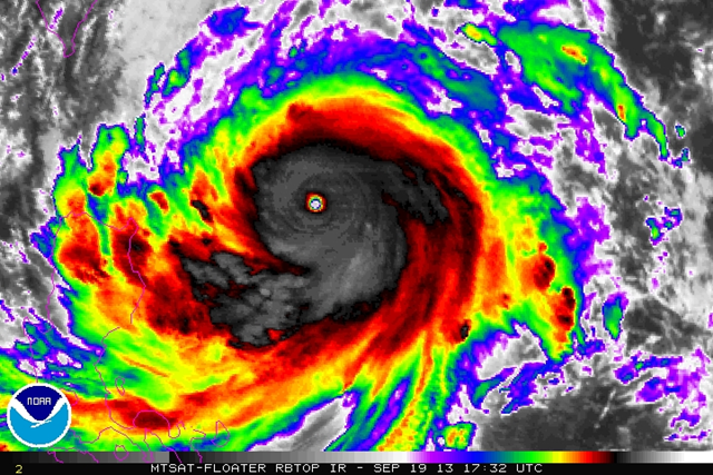
19 September 2013 (Washington Post) – In the last 24 hours, a cyclone in the west Pacific has explosively intensified, and is on a track towards Hong Kong. The storm – named Usagi – has achieved super typhoon status, after an amazing burst in its peak winds from 75 mph Tuesday to over 160 mph today. (Typhoons become “super typhoons” if their peak winds reach 150 mph or higher). It is now equivalent to a category 5 hurricane. Usagi is now the strongest storm to form on Earth in 2013, more intense than Utor (peak winds of 150 mph) and Soulik (peak winds of 145 mph), also west Pacific typhoons. The storm’s satellite presentation is immaculate, perfectly symmetric and accentuated with a pin-hole eye. As it heads due west, it is expected to maintain its strength for the next 24 hours. Then it might bend a bit to the north and begin to gradually weaken according to the Joint Typhoon Warning Center. [more]
Super typhoon Usagi, strongest storm on Earth in 2013, may strike Hong Kong Sunday
