Third heatwave in 2021 building across Western U.S. – “Confidence is very high for a dangerous heatwave to persist through Monday and maybe into Tuesday”
By Matthew Cappucci
8 July 2021
(The Washington Post) – Last week, a “thousand-year” heatwave baked the Pacific Northwest and adjacent British Columbia with widespread highs topping 100 degrees, resulting in a death toll in the hundreds. Lytton, Canada, climbed to 121 degrees and established new national records three days in a row before the town burned in heat-intensified wildfires.
Now the West is bracing for another heatwave, albeit not quite as severe, that could challenge records and bring dangerously hot temperatures from California and the Desert Southwest to the Great Basin and Oregon. It will mark the third punishing heatwave in the West this summer, counting the record-breaking event in mid-June.
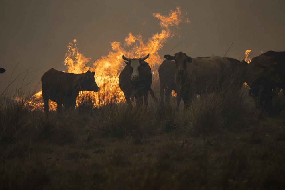
The relentless heat is also reinforcing drought that continues to reshape landscapes and severely burden water resources, while simultaneously setting the stage for a potentially disastrous wildfire season.
The big picture
On Thursday, the heat was already beginning to gather, but the worst was expected Friday into Monday. At least 28 million people are slated to experience highs in the triple digits over the upcoming week.
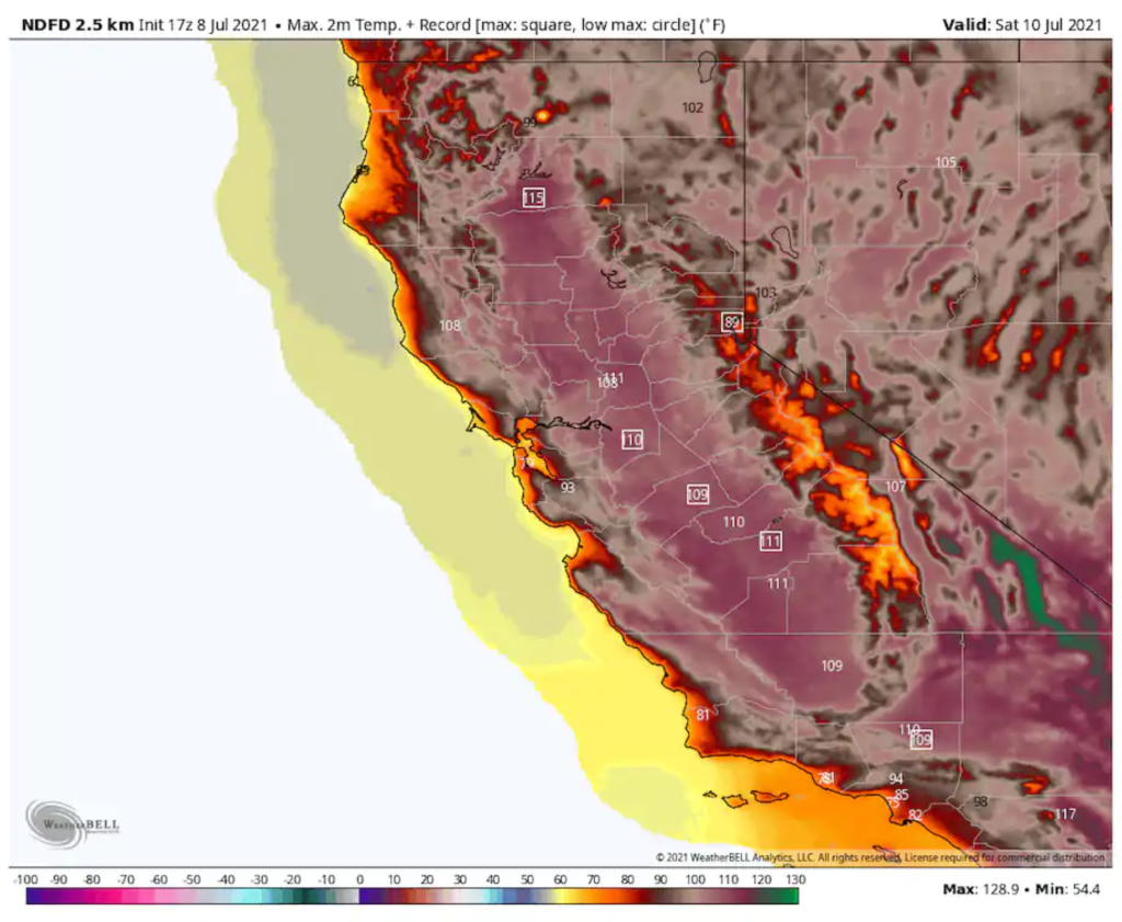
The exceptional temperatures are thanks to a “heat dome,” or a ridge of high pressure, becoming established over the Four Corners region. It will meander west in the coming days, reinforced by a secondary zone of high pressure cresting to the north in southwest Canada on Friday. By Saturday, that additional high pressure will swing through Alberta and Saskatchewan; the synergy between the two will yield a multiday stretch of highs 20 degrees or more above average.
Excessive heat warnings blanket most of California, Nevada, western Arizona, and western Utah, while watches cover interior parts of Oregon and southern Idaho.
“Extreme heat will significantly increase the potential for heat-related illnesses,” warned the National Weather Service in Hanford, Calif., which serves the Golden State’s Central Valley. “Confidence is very high for a dangerous heatwave to persist through Monday and maybe into Tuesday.”
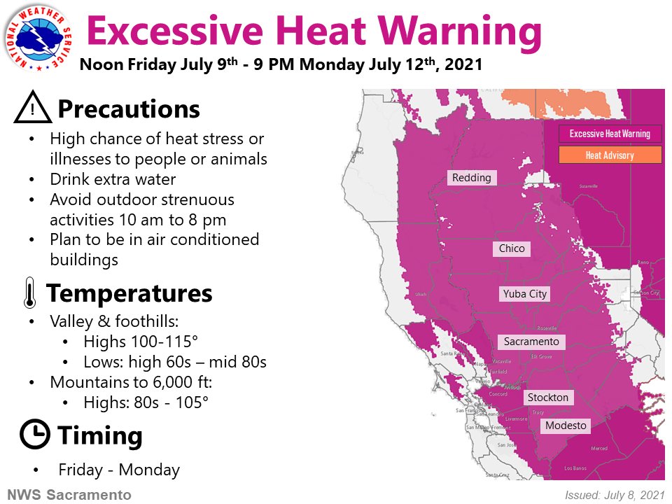
In Hanford itself, temperatures could hit 110 degrees Friday, Saturday, Sunday, and Monday. Records in Hanford date to 1899, and show that highs of 110 degrees or greater have occurred on four or more consecutive days on only five occasions. That makes the duration and magnitude of the episode a once in roughly 20-year event.
Sacramento is looking at a five-day stretch with highs in the triple digits, including a forecast 110 degrees Saturday. Redding is likely to hit 113 degrees Friday, 115 on Saturday, and 113 on Sunday. Highs Monday may be a slightly less inhospitable 110 degrees. The city has never recorded more than three consecutive days at 113 degrees or greater.
Modesto, Calif., will see highs around 108 degrees both weekend days.
Potentially more concerning will be the overnight lows, which won’t be very low at all — temperatures may dip only into the upper 70s or lower 80s in some spots. On Saturday night, Modesto is projected to fall only to 80 degrees before temperatures skyrocket again in the morning. In fact, most of the Central Valley will not fall beneath 80 degrees during the overnight period on Saturday.
Central Valley locations “will be extremely warm overnight, where high minimum temp records may be achieved as well,” wrote the Weather Service in Sacramento. Warm overnight lows are especially dangerous for anyone without air conditioning because they make it difficult for the body to enter its natural cooling phase. [more]
