“Sub-alpine savannas” replace forests in the Victorian Alps as global warming drives fire frequency
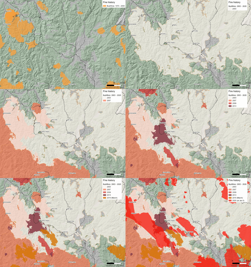
5 January 2020 (Desdemona Despair) – Dr. Tom Fairman, forest scientist at the Victoria Department of Environment, Land, Water, and Planning has posted a series of burn maps for the Victorian Alps showing the extent of bushfires from the 1970-2000 period to 5 January 2020. The maps reveal how much of the forest has been subjected to reburning from the increased fire frequency caused by global warming.
- 1970-2000: The first map shows the extent of major bushfires in the 1970-2000 period. Usually, fires occurred at lower elevations, like the 1998 Caledonia fire in the south.
- 2003: Large Alpine fires burned from Canberra to halfway through the Victorian Alps, the largest fires in Victoria since 1939.
- 2007: The Great Divide fires reburned extensive areas of forest, causing the collapse of some Alpine ash forests.
- 2009: The “Black Saturday” fires impacted some parts of the Alps and reburned some areas of 2003 burn.
- 2013: The Harrietville fires reburned forest that was burned in 2003 and 2007, so some areas of forest burned three times within a decade.
- March 2019: A series of dry lightning storms reburned areas of forest that burned in 2003, 2007, and 2013.
- 5 January 2020: More double- and triple-burned forest.
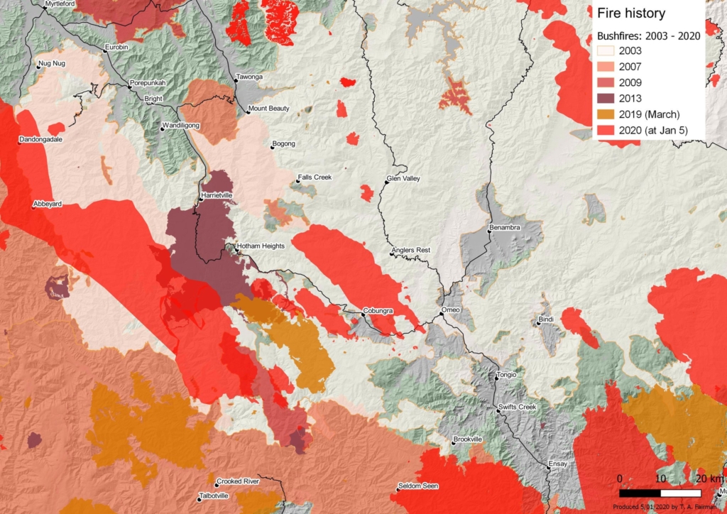
Dr. Fairman observes that these forests “are unlikely to persist after two high severity fires under 15-20 years – the age regenerating stems begin to produce seed. […] High fire frequency increases mortality, while seeming to favour grasses. My supervisors and I began to call these ‘sub-alpine savannas’.”
The prognosis for the forests of the Victorian Alps isn’t good: “There’s probably few other ways to describe this than as a landscape of change.”
Does not seem to be any mention of which country the Victorian Alps is in.