These NASA satellite images show stunning toll of global warming
By Joe McCarthy
5 January 2017
(Global Citizen) – Climate change rarely transforms an environment overnight. By the time ice shelves disappear, ocean waves creep onto main streets, and forests shrivel, the forces of climate change have been at work for decades. Fortunately, NASA is tracking these environmental changes with satellites so that the public knows the full scale of transformations taking place. From one month to the next, an environmental change might seem slight, but when you zoom out to the level of years and decades, the combined shifts paint a devastating portrait. Of course, there are also sudden, dramatic events like flash floods that overwhelm a region overnight. But these, too, are the result of weather patterns that have morphed over decades. Here are seven transformations that NASA has captured.
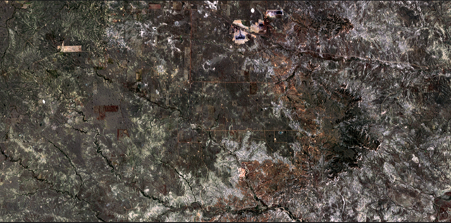
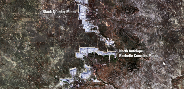
Coal Mine Growth in Powder River Basin, Wyoming 29 June 1984  21 June 2016
[more]
These NASA Satellite Images Show the Stunning Toll of Climate Change