Vermont flood damage is so severe it can be seen from space
By Anna Skinner
12 July 2023
(Newsweek) – Flooding in Vermont this week was so severe that it showed up on satellite images.
A long-duration rainstorm overwhelmed state creeks and rivers and pushed the Wrightsville Dam to its limits, severely flooding Mountpelier, Vermont’s capital. Water rose quickly, destroying roads and causing evacuations. Some people felt they couldn’t abandon their homes and businesses and chose to stay, while others are just now returning to assess the damage to their property.
In some areas, the flooding surpassed that from Hurricane Irene in 2011, which caused $733 million in damage to the state, which had up to 11 inches of rain in some places. Some business owners who didn’t experience flooding during Hurricane Irene battled more than 6 feet of flooding in their basements. At the Kitty Korner Café in Barre, the owner resorted to chiseling a hole in the first floor with a screwdriver and a hammer to divert floodwater away from her cats.
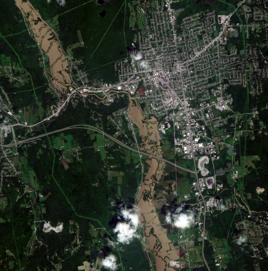
The worst of the flooding occurred in such places as Newport, Montpelier, Middlebury and Springfield, according to a Tuesday flood warning from the National Weather Service. The flooding severity was second to conditions during the Great Vermont Flood of 1927—which is considered Vermont’s worst natural disaster—and was spotted by satellites in space, images of which were shared on Twitter.
“Satellite views of the Vermont floods are just out, and they show some of the historic damage to roads and infrastructure,” a Twitter user said on Tuesday night. “Here, the muddy Otter Creek causes extensive flooding by Rutland, VT. The normal channel is a thin line through the floodwaters. from midday July 11.”
In the satellite image, the creek winds through the landscape in a thick line much wider than normal.
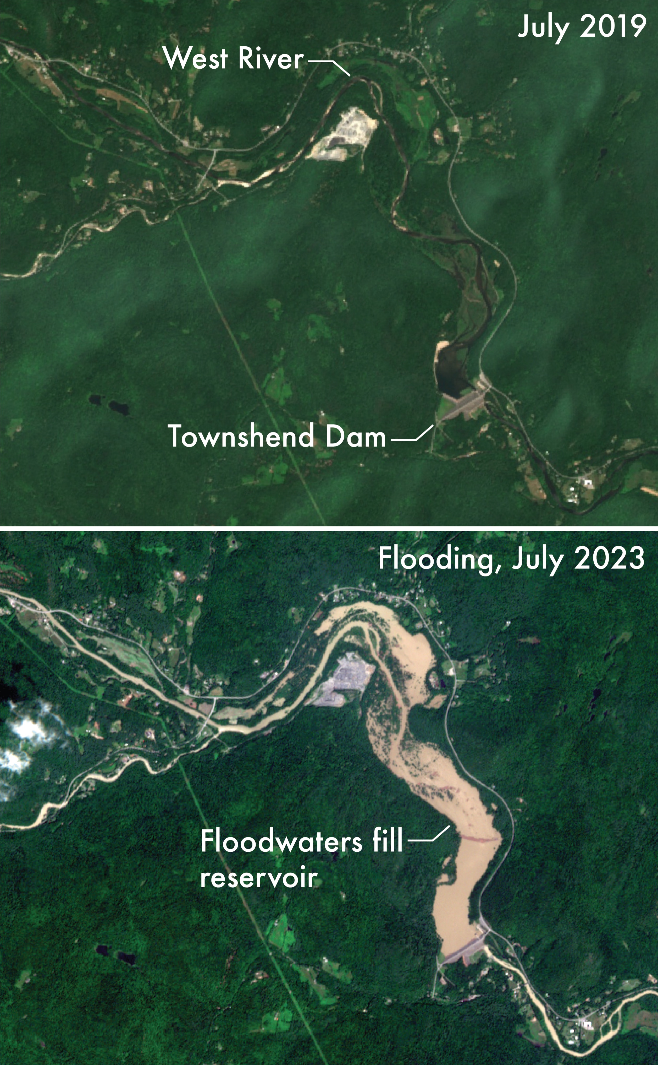
In a follow-up tweet, the user shared a satellite image near Okemo, a ski resort in the Green Mountains, where some of the worst floods occurred.
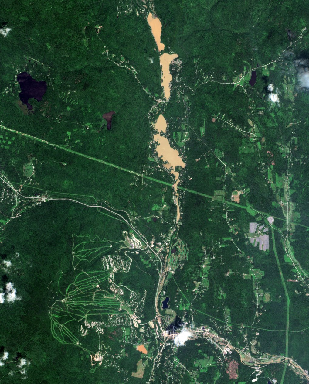
“As much as 10″ of rain may have fallen here. Satellite images show flooding has receded somewhat after 24 hours, but rivers and lakes remain muddy from landslides and other erosion,” the user tweeted.
AccuWeather senior meteorologist Tom Kines told Newsweek that not all floods are picked up by satellite imagery.
“You wouldn’t see it for every flood, just the bad ones,” he said. “It’s a big deal that you can actually pick that kind of stuff out, the flooding, on satellite pictures. It’s not a common occurrence.”
Kines called the Vermont floods “devastating.” [more]