Australia flood crisis enters third week as heavy rains lash east – Sydney records wettest year since 1858 – “The damage is horrific and extensive”
By Lewis Jackson and Renju Jose; editing by Kenneth Maxwell
24 October 2022
SYDNEY (Reuters) – Already-flooded towns across Australia’s east were on high alert on Monday after a weekend of heavy rains, with authorities warning a wild weather system could persist until later this week and trigger renewed riverbank bursts.
Thousands of homes and farms over a wide swathe of New South Wales and Victoria, Australia’s two most populous states, have been inundated and five people in the country have lost their lives as the year’s fourth flooding crisis in the east enters its third week.
About 200 flood warnings remained in place in both states as of Monday morning, with 132 of those in New South Wales.
“The flood warnings are incredible … there are so many rivers experiencing flooding from southern Queensland all the way down into Northern Victoria,” Bureau of Meteorology forecaster Dean Narramore said.
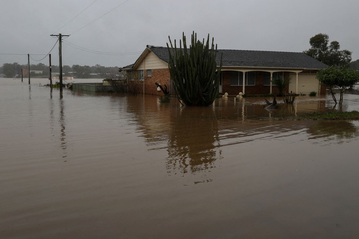
Residents in parts of Lismore, a town of 77,000 about 700 kilometres (435 miles) north of Sydney already devastated by floods in March, faced another deluge after up to 200 millimetres (8 inches) of heavy rain over the weekend. A severe weather warning was cancelled on Monday, but the region is still on flood alert.
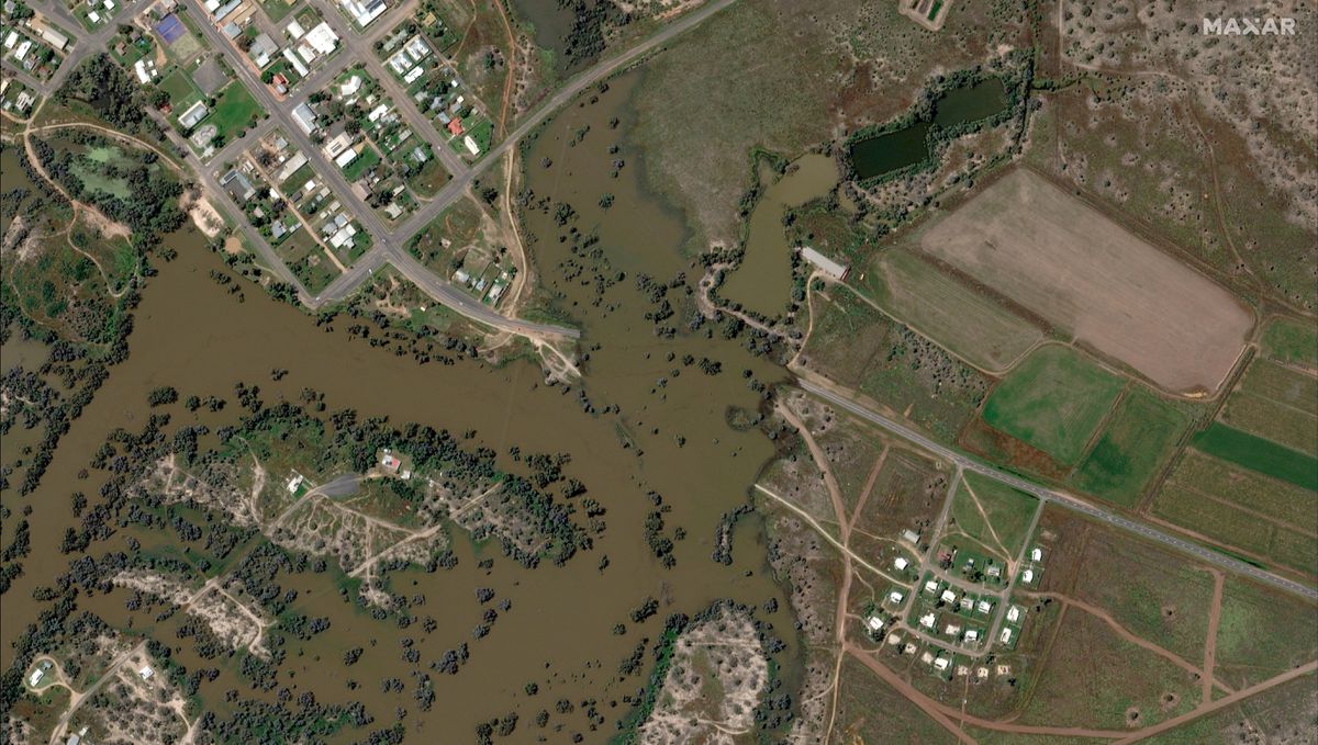
Many agricultural regions have been severely impacted, including Moree where the local river peaked near historic flooding levels.
“The damage is horrific and extensive,” Moree Mayor Mark Johnson told ABC television. “There will be some farmers who will get some crops but there will be a lot … who won’t get anything this year.”
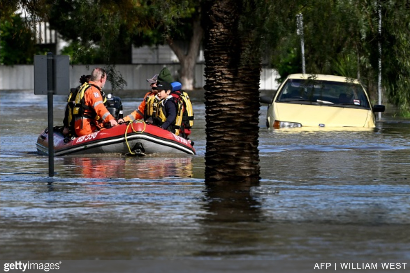
Emergency crews urged residents to avoid driving on flooded roads as they searched for a woman who was reportedly trying to escape a vehicle stuck in flood waters near the town of Mudgee.
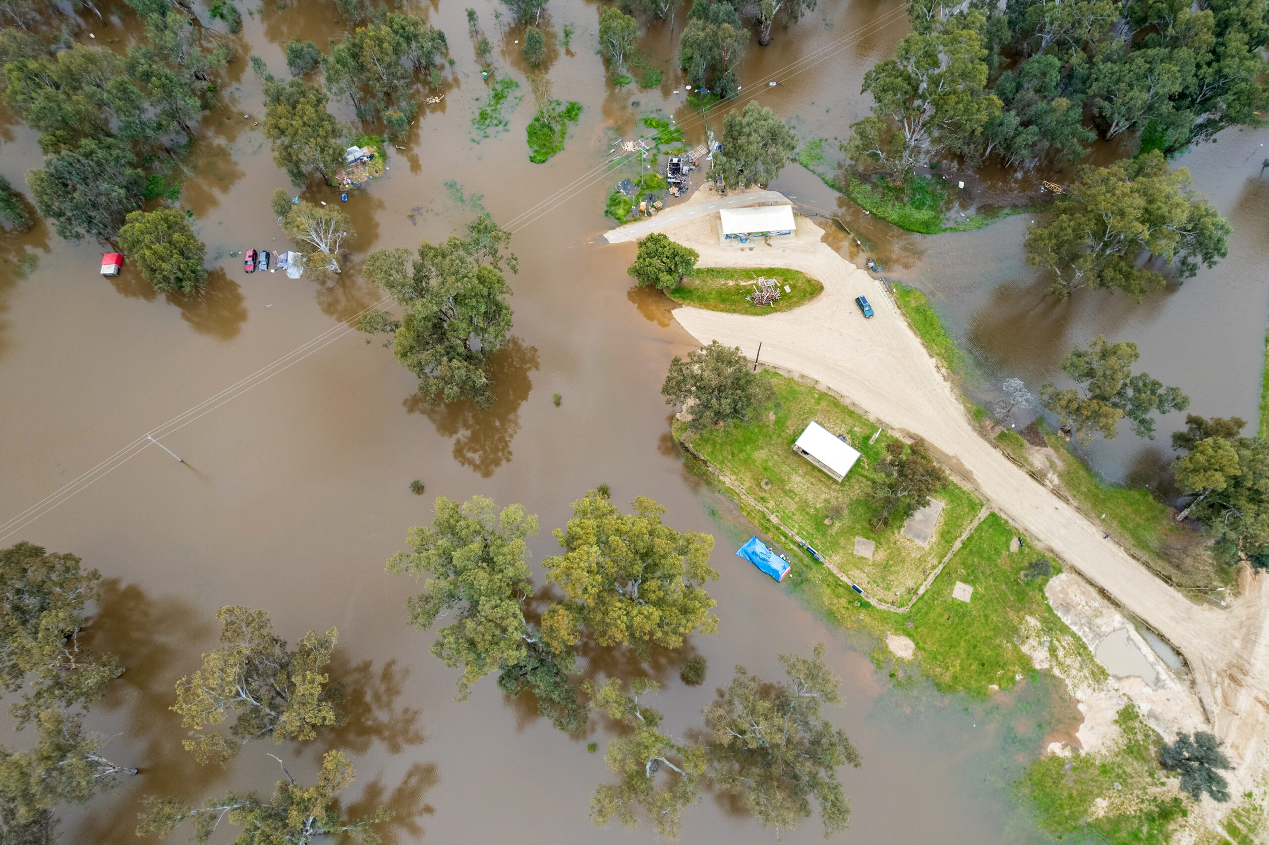
In neighbouring Victoria state, residents of Echuca remain sheltered behind a dirt levee erected last week as the Murray, Australia’s longest river, broached a near 30-year high.
The federal government on Monday said it would set aside A$577 million ($370 million) to speed up the processing of relief payments, a day ahead of publishing the national budget.
Australia flood crisis enters third week as heavy rains lash east
Explainer: Australia floods: why the country is battling weather again
By Sam McKeith in Sydney; editing by William Mallard
15 October 2022
(Reuters) – Floods caused by torrential rain are hitting large swathes of southeast Australia, inundating hundreds of homes and forcing authorities to urge thousands of people to evacuate.
Areas of three southeastern states – Victoria, New South Wales and the island state of Tasmania – are under emergency flood warnings after an intense weather system this week brought more than a month’s worth of rain to the southeast.
The crisis comes after flooding in March and April on the east coast resulted in A$4.8 billion ($3.3 billion) in insured damage, according to the Insurance Council of Australia.
Where is the flooding?
Victoria has been the state hardest hit by the current floods, with several rivers in the state at major flood levels.
The Goulburn River at Seymour, about 100 km (60 miles) north of Melbourne, peaked this week above the May 1974 record 7.64 metres (25 ft), while conditions are expected to worsen in the regional city of Shepparton, where major flooding is forecast overnight Saturday.
In the west of Melbourne, a flood clean-up was underway after the Maribyrnong River burst its banks on Friday, bringing flooding to suburbs near the central business district.
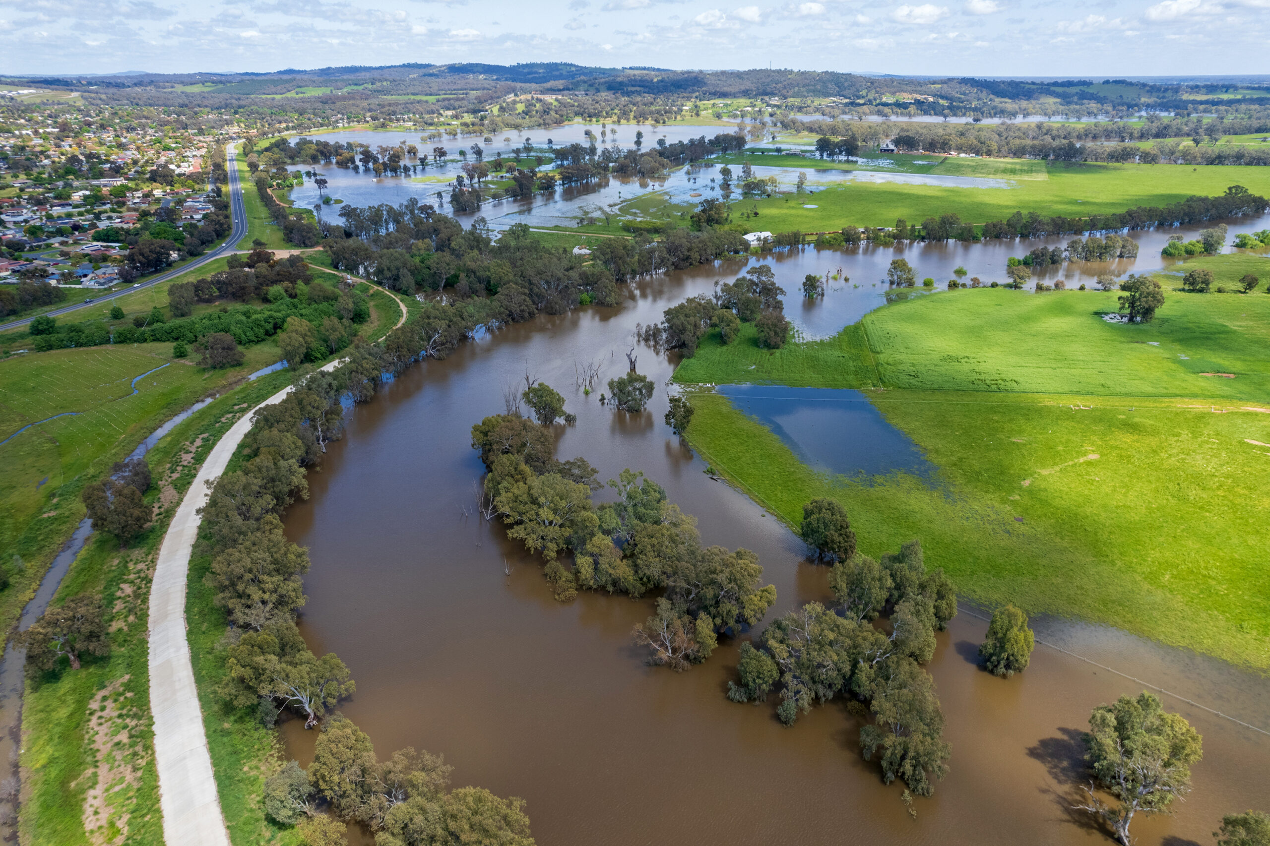
Across the state border, more than 60 warnings are in place in New South Wales, including for the towns of Forbes and Wagga Wagga. Earlier in October Australia’s biggest city, Sydney, marked its wettest year since records began in 1858.
In Tasmania, flooding has affected northern regions, especially rural areas near Launceston, the state’s second-most populous city. Authorities have warned that floodwaters are likely to continue to rise on Saturday in flood-hit areas of the state.
Why so much rain?
Australia is exposed, for a third straight year, to the La Niña weather phenomenon in the Pacific Ocean, which typically brings above-average rainfall to the country’s east.
Another contributor is the Indian Ocean Dipole – a climate phenomenon that affects rainfall patterns near the Indian Ocean, including Australia. It turned negative in May, increasing the chances of above-average rainfall for most of Australia in the September-November spring.
“The oceans north of Australia are warmer and that causes more moisture flowing from the Indian ocean to eastern parts of Australia,” said Agus Santoso, senior researcher at the University of New South Wales Climate Research Centre.
Compounding the situation were storm cells that brought recent heavy rains to the nation’s east, he said. “You have basically bad weather, storm and rain systems.”
Will it keep raining?
For the coming months, Santoso predicted conditions would ease as the effect of La Niña and Indian Ocean Dipole dissipate, especially over summer.
Even so, the country’s weather forecaster expects that with another La Niña underway, eastern Australia should experience above-average rainfall in spring and early summer.
The Bureau of Meteorology has warned of more widespread flooding for eastern and northern Australia during the nation’s severe weather season, which runs from October to April.
With rivers high and dams full across much of eastern Australia, any rainfall now has the potential to cause widespread flooding, the forecaster said this month.
Explainer: Australia floods: why the country is battling weather again


