Western Alaska confronts damage after historic storm – “Boats are going to be scattered all over the tundra”
By Taylor Telford
18 September 2022
(The Washington Post) – Floodwaters began receding in Alaska on Sunday, revealing the damage after the remnants of a typhoon lashed the state with its fiercest storm in years.
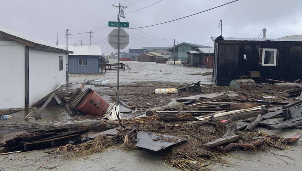
The full extent of the storm’s impact may not be clear for days, but residents across the state’s low-lying western coast are still grappling with water damage, power outages and other hazards. The impacted areas span well over 1,000 miles of coastline, including “some of the most remote areas of the United States,” according to Jeremy Zidek, public information officer with Alaska’s Division of Homeland Security and Emergency Management.
“It’s a very large area and the damages across that area really vary quite a bit,” Zidek said. “Access to these areas is very difficult.”
The storm is still ongoing in the northwest part of the state, Zidek said. No injuries or fatalities tied to the storm have been reported yet, but Alaska State Troopers are conducting a search for a young boy missing from Hooper Bay, one of the heavier-hit villages.
For years, scientists have expressed concern that climate change has set the stage for greater impacts from large nontropical cyclones in Alaska. Warmer summers and oceans have caused a greater-than-normal seasonal loss of sea ice, which makes the region more vulnerable to ocean inundation.
Gov. Mike Dunleavy (R) declared an emergency Saturday in the face of the “unprecedented” storm. Communities along the low-lying western coast saw severe flooding and violent winds.
Roads — of which there few in the region — have been battered and washed away. The storm surge knocked out lines of communication, prompted evacuations and wrenched homes from their foundations. One unoccupied house drifted until it got stuck under the Snake River Bridge.
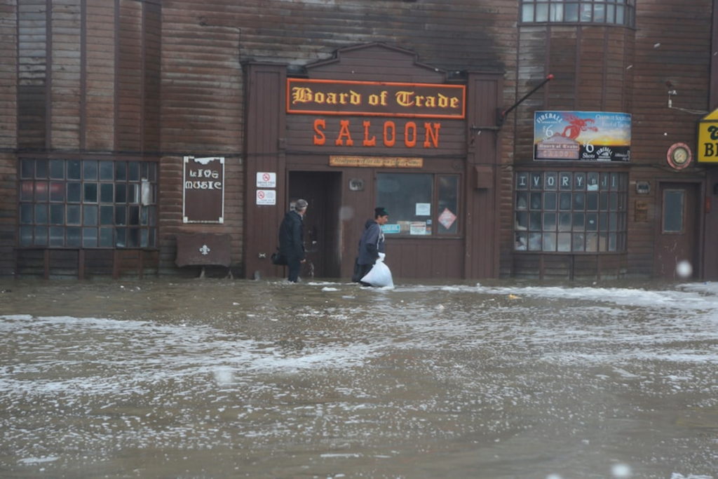
The tide gauge in Nome, which is known for being the endpoint of the famed Iditarod Trail Sled Dog Race, showed water levels more than nine feet above normal levels early Saturday, exceeding the peak seen during ferocious storms in 2011 and 2004, according to the National Weather Service. A fire broke out Saturday at the Bering Sea Bar and Grill in Nome amid the heavy winds.
An offshore ocean buoy reported waves at or above 35 feet for 12 hours, peaking at more than 50 feet, while winds gusted over 70 mph for 11 hours.
Dozens of small, primarily Indigenous communities dotting the coast face unique challenges as they try to recover from the damage before winter comes, according to Rick Thoman, a climate specialist at the International Arctic Research Center.
“All of these communities, there’s basically no road connections to any of them,” Thoman said. “It’s a very different setup than anywhere in the Lower 48.”
Runways will have to be safely cleared before communities can receive critical supplies, Thoman said, as most goods are moved by air or by barge in the region. Without power, people with packed freezers risk losing their food for the upcoming season.
“If your power plant goes out, you can’t get power from somewhere else if it isn’t a generator at your house,” Thoman said.
The system punishing Alaska over the weekend was the remnants of Pacific Typhoon Merbok, which merged with a pair of nontropical storms as it veered toward the Bering Strait, the thin strip of water between Russia and Alaska.It’s not new for Alaska to be hit with the fallout from a former typhoon, Thoman said, but this one came fast and furious, taking a shorter path than usual.
“This one was special because of how strong it developed,” Thoman said.
It was also unusually massive, larger than Texas and almost as big as Alaska proper, according to Kaitlyn Lardeo, a meteorologist at the National Weather Service in Fairbanks. Most of the affected areas saw winds between 60 and 80 miles per hour, she said.
“It’s important for people to understand that these things are possible for us,” Lardeo said. “It was devastating for a lot of communities.”
Mark Springer, the mayor of Bethel, said his town, which is about 60 miles inland from the Bering Sea, is far enough away from the worst of the flooding to avoid much of the property damage. But the water is rising “boot high” in some places.
Springer said he heard that villages lost their fish racks and smokehouses as well as the subsistence sheds where people keep their gear and motors. His social media timelines have been full of pictures of floodwaters and evacuations. Many boats floated away and sank, cutting off another vital means of transportation.
“Boats are going to be scattered all over the tundra,” Springer said. “In some cases, they’re going to have to wait until the ground freezes and go over with snow machines and try to drag them.”
Massive storm surge and gigantic waves would cause heavy beach erosion at any time of year, but the fact that the storm struck in September heightened the erosion risk. It also arrived during hunting season, meaning that hundreds of people who might have been hunting in the remote Alaskan wilderness would be without access to updates about the storm and might be stuck off the grid. The Nome-Council Road, used by hunters and Alaskans to travel inland from the Bering Sea coast, has been partially washed away.
Major flooding was also reported in the small coastal communities of Chevak, Kotlik, Newtok, Golovin and Shaktoolik, where multiple evacuations were necessary.
The area is particularly vulnerable to erosion, with some sections of the coastline losing up to 100 feet of land to the sea each year, according to the Fourth National Climate Assessment, a comprehensive climate change report looking at impacts in the United States published in 2018. [more]