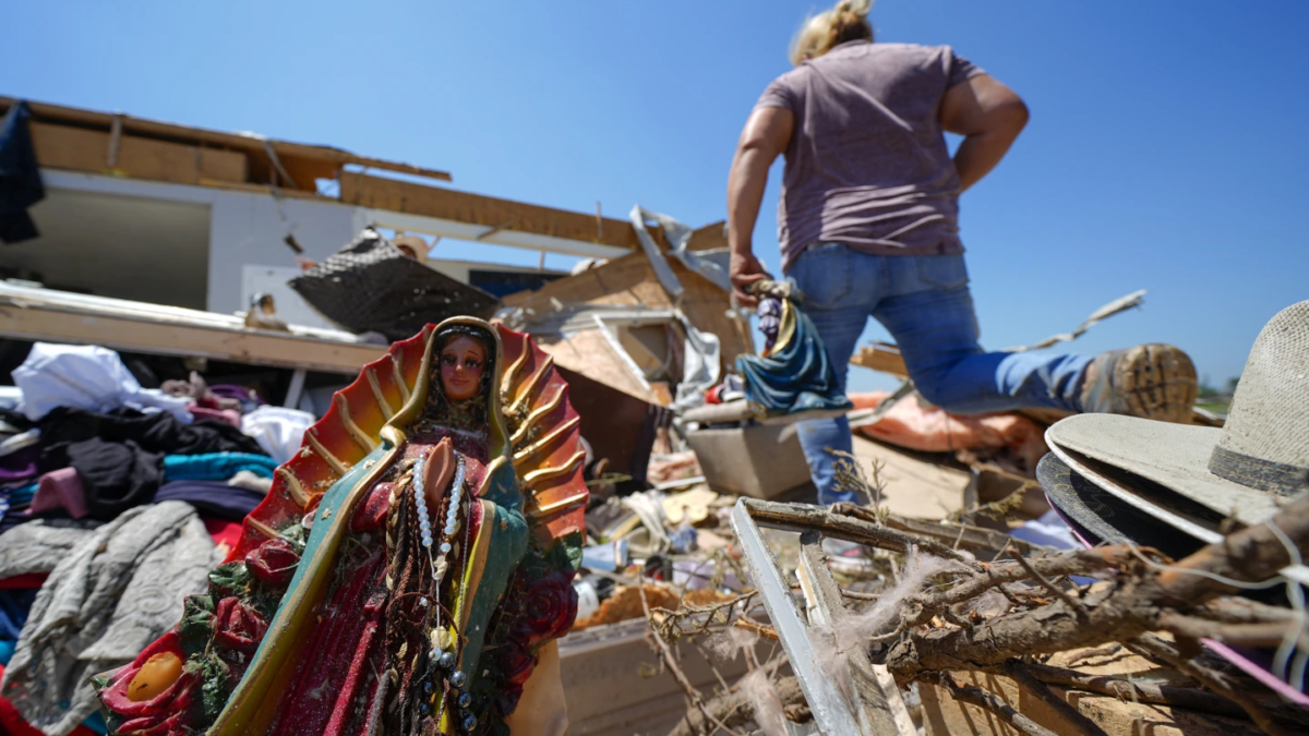
Storm Dennis, 2nd-strongest bomb cyclone on record in North Atlantic, wreaks havoc across UK, parts of France – Record 594 flood warnings and alerts issued in UK
17 February 2020 (AFP) – Britain on Monday began to clear up after Storm Dennis battered the country over the weekend, leading the government’s weather agency to issue a rare “danger to life” warning amid widespread flooding and high winds.
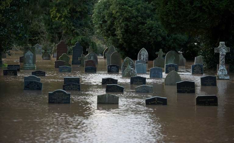
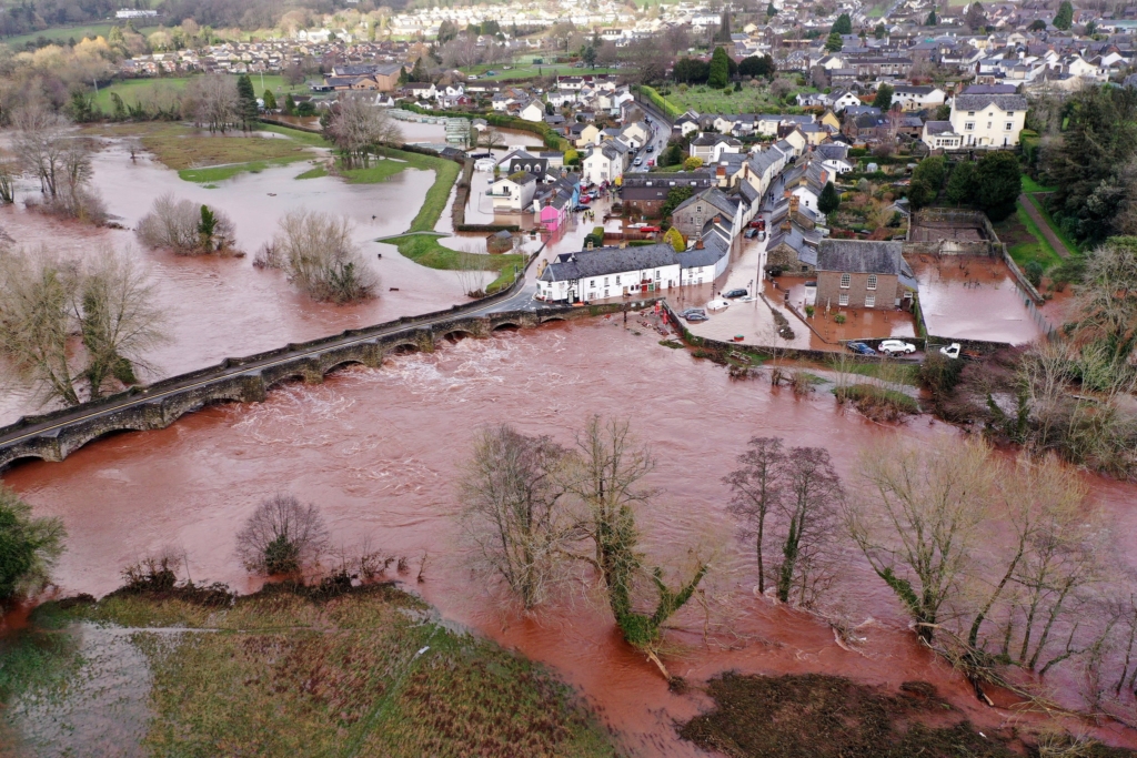
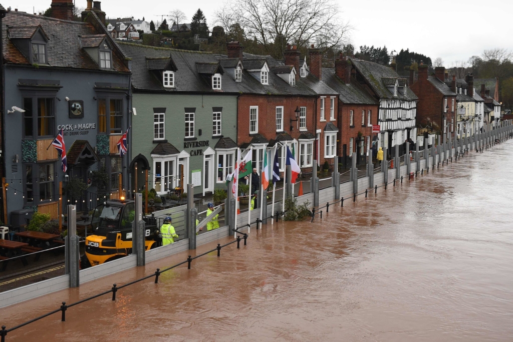
Hundreds of flood warnings remained in place, including five “severe” warnings around the River Teme in Worcestershire in western England, after more than a month’s worth of rain fell in 48 hours in some parts of Britain.
A record 594 warnings and alerts had been put in place on Sunday, extending from Scotland’s River Tweed to Cornwall in southwest England, while major incidents were declared in South Wales and parts of western England due to flooding.
The storm also battered much of France, with some 20,000 people still without electricity on Monday after suffering power cuts in the northwest of the country and rail traffic disrupted.
In south Wales, the government’s weather agency issued a rare red warning, saying there was a risk of “significant impacts from flooding” that included a “danger to life from fast flowing water, extensive flooding to property and road closures”.
Pictures circulated on social media showed the nearby River Taff bursting its banks, while rescue workers rushed to reach people trapped in their homes in Powys. […]
Roads and railways across Britain were badly affected by the downpours and winds, having barely recovered from a similar storm last week. [more]
Storm Dennis wreaks havoc across UK, parts of France
Storm Dennis, 2nd-strongest bomb cyclone on record in North Atlantic, causes severe flooding in U.K.
By Andrew Freedman
16 February 2020
(The Washington Post) – Storm Dennis, the second-strongest nontropical storm on record in the North Atlantic Ocean, caused widespread flooding across parts of the United Kingdom on Sunday, along with winds exceeding hurricane force.
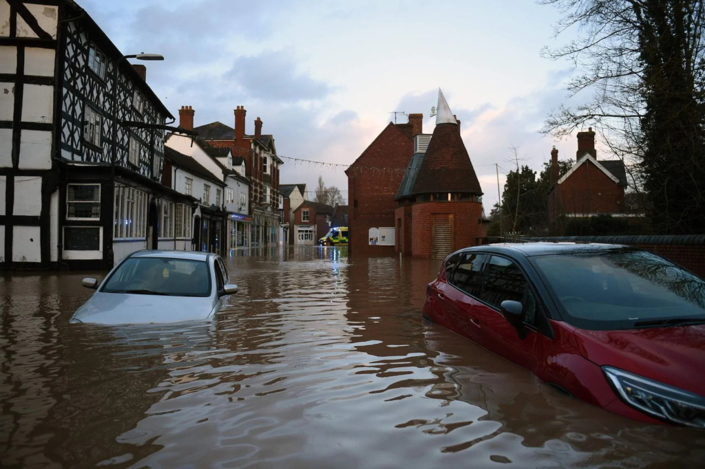
The storm, which is producing waves up to 80 feet tall west of the United Kingdom, dumped more than five inches of rain in South Wales, almost an inch more than the area typically receives for the entire month of February. The resulting flooding has prompted numerous evacuations and even cut off some communities.
The U.K. Met Office, which named the storm, issued its first “red” warning for heavy rainfall since 2015, its highest warning category. The country’s Environment Agency issued a record number of flood warnings, 594, for a single day, according to John Curtin, executive director of flood and coastal risk management at the Environment Agency.
While the rainfall totals were noteworthy, they were not unprecedented. However, coming just one week after another severe bomb cyclone, known in the United Kingdom as Storm Ciara, the ground was already saturated when this one arrived. This caused many rivers, creeks and streams to overflow their banks and even triggered landslides.
[more]
Storm Dennis, 2nd-strongest bomb cyclone on record in North Atlantic, causes severe flooding in U.K.
Twin bomb cyclones to merge into one of strongest-ever storms in North Atlantic, hammering Iceland and threatening Britain as Storm Dennis
By Andrew Freedman
14 February 2020
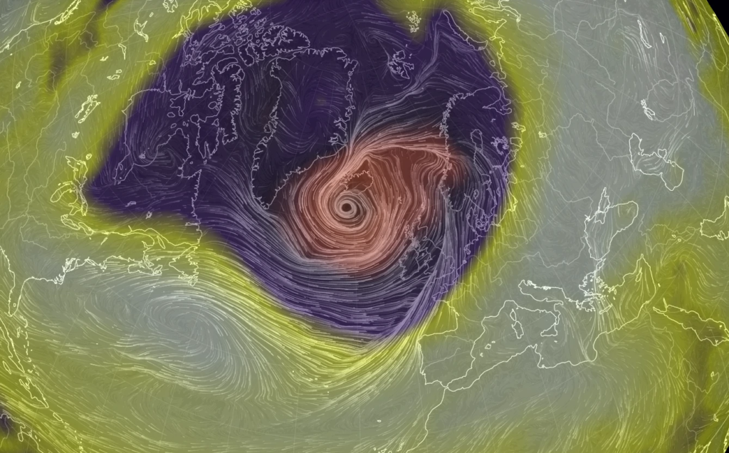
(The Washington Post) – A potentially unprecedented scenario is unfolding in the North Atlantic on Friday, as a bomb cyclone batters Iceland with hurricane-force winds and blizzard conditions, just as another bomb cyclone, known as Storm Dennis, rapidly intensifies behind it. Ultimately, the two storms will enter into a complex dance around each other before combining into one atmospheric behemoth, with a minimum central air pressure that could rank among the top three most intense storms ever observed in the stormy North Atlantic Basin.
Already on Friday morning, the first bomb cyclone, which has a minimum central air pressure of 929 millibars, roughly equivalent to a Category 4 hurricane, is slamming Iceland with blizzard conditions, mixed precipitation and heavy rain. Winds have been clocked at about 70 mph in the capital city of Reykjavik, and 90 mph at the international airport in Keflavik. The forecast called for gusts of higher than 120 mph in a few locations, particularly on the western coast of the island, though conditions were improving early Friday afternoon local time.
The Icelandic Meteorological Office issued rare red warnings for parts of the country into early Friday, with orange warnings continuing into Friday night due to the strong winds and heavy precipitation, and travel was not recommended anywhere.
The National Weather Service’s Ocean Prediction Center reported that a satellite passing over the storm detected a significant wave height of 64 feet west of Ireland. This means individual waves in that area were potentially as high as 128 feet! Significant wave height is defined as the average of the highest one-third of waves in a particular period, and tends to run about half the height of single waves. […]
This storm, and the one to follow it that are combining to form Storm Dennis, will turn the entire North Atlantic into a wave machine, with battering waves reaching Western Europe.
This storm battering Iceland underwent the process of bombogenesis, or rapid intensification, with its air pressure plummeting more than 24 millibars in 24 hours. Over the course of 48 hours, its pressure dropped by 67 millibars as it moved from near Nova Scotia early Thursday morning to near Iceland early Friday morning. […]
The third extraordinarily intense North Atlantic bomb cyclone in 10 days
This is the peak time of year for bomb cyclones in the North Atlantic, given the typical intensity of the jet stream and intense air mass differences that tend to move over moisture-rich waters. What’s been especially noteworthy about the winter’s weather, however, is the frequency and intensity of the storms spawned in the North Atlantic.
Very few of these storms typically see their minimum air pressure drop to 930 millibars or lower; yet assuming Storm Dennis does so, this will have happened three times in the past 10 days. (The low-pressure area that helped propel Storm Ciara into Europe last weekend accomplished this feat as well.) [more]