Intense heat with near-record breaking temperatures will develop across Benelux, W Germany and N France this week, 23-26 July 2019 – Temperatures above 40°C locally possible
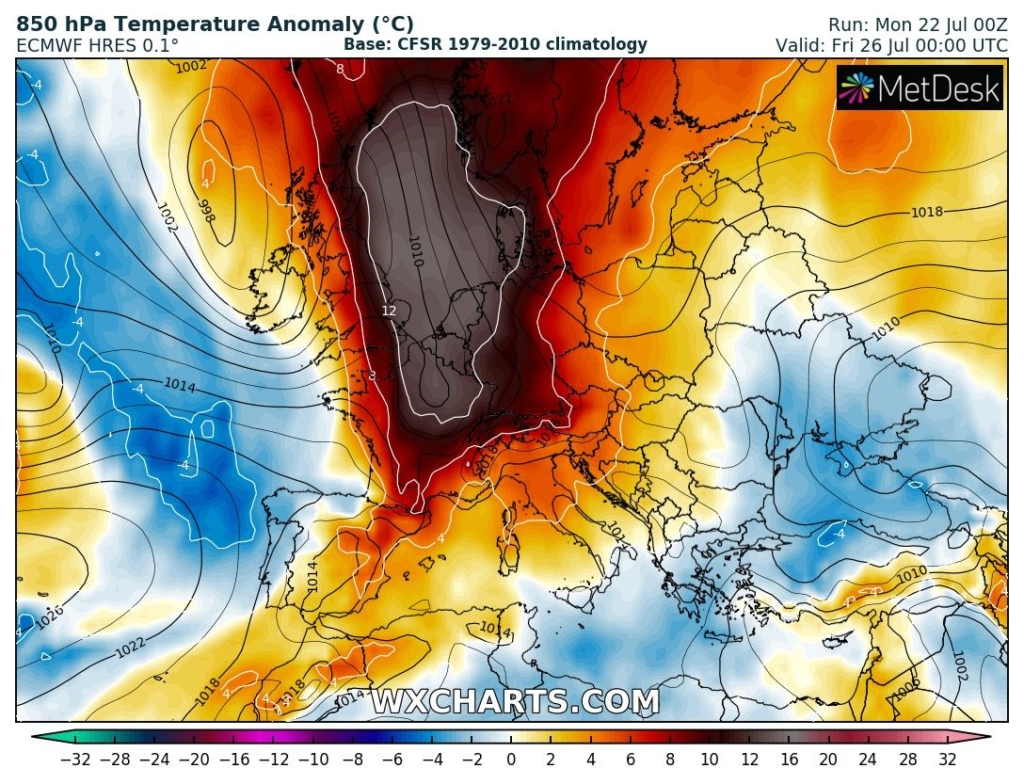
22 July 2019 (SWE) – A development of another potentially record-breaking heat wave is expected this week. Again, similar to the late June intense and record-breaking heat wave for S France, extreme heat will spread across western Europe. We could actually see additional new record-breaking temperature values, precisely across parts of NE France, Benelux and W Germany by Thursday, as models are hinting at peak afternoon temperatures in excess of 40 °C!
The highest temperatures ever recorded (per country) there are:
- +40.3 °C in Kitzingen, Germany on 5 July 2015 and 7 August 2015
- +38.6 °C in Warnsveld, Netherlands on the 3 August 1944
- +38.2 °C in Kleine-Brogel, Belgium on the 21 August 2009
A textbook Spanish plume pattern takes place with a deep trough/low over the N Atlantic and strong Omega blocking ridge pattern over western, central and northern Europe. The heat wave ramps up today as pronounced advection of warm airmass begins over the Iberian peninsula.
Powerful warm advection then continues spreading NNE across France and towards Benelux and UK through the next few days, peaking on Wednesday and Thursday over Benelux and the North Sea. Models are in very good agreement of developing extreme heat with 12-16°C warmer airmass than average in the lowest levels! [more]