Record tides and floods as severe storms lash Ireland, with more on the way – ‘Black Swell’ to hit UK, Ireland, and Portugal
By PATRICK COUNIHAN
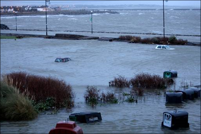
4 January 2014 (IrishCentral) – The latest storms to hit Ireland will cost the economy almost half a billion dollars – with more on the way over the weekend. Record tides and devastating flood and gales lashed the country on Friday with Ireland’s weather forecast service warning of a repeat on Sunday. Experts have branded the freakish winds and rain as the worst series of storms to hit the country in over 15 years. And economists have warned that the price of home insurance will increase after estimating the current damage at over $500 million. Galway and Cork were worst hit with flooding while the River Liffey in Dublin also reached record levels. [more]
Record tides and floods as severe storms lash Ireland with more on the way 
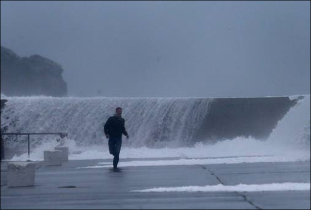
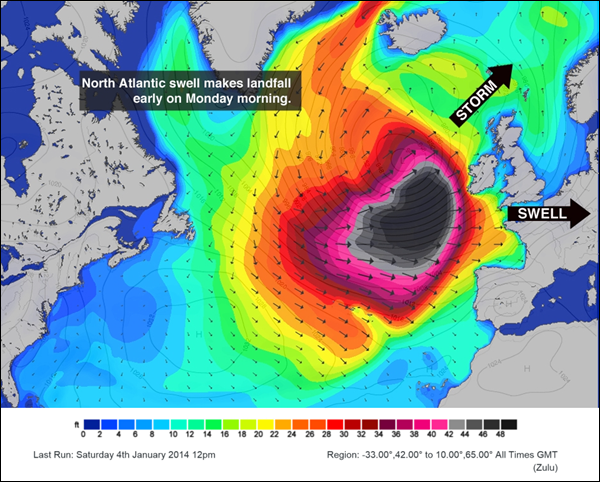
3 January 2014 (Surfer Today) – Europe will be hit by one of largest swells of the decade, as strong winds combined with high tides and large waves are coming in from the Atlantic Ocean. The United Kingdom and the Republic of Ireland are in state of high alert. A severe storm is already hitting the British Islands, with severe flood warnings being issued across the territory. The Royal National Lifeboat Institution (RNLI) says people should protect themselves from the swell and keep a distance from piers and coastal defenses. “They don’t understand how dangerous the sea can be. We would say please, please keep away from this water”, warns Tom Mansell, a RNLI divisional operations manager and flood rescue team leader. Cornwall and Mullaghmore Head will get a truly “Black Swell”, as the fetch travels without losing energy until Tuesday, 7th January, 2014. Waves in the 48-foot plus range are guaranteed. Portugal and the Galician region, in Spain, will also be affected by this extreme wave train, between 5th-7th January. [more]
“Black Swell” prepares to storm UK, Ireland and Portugal 
04 January 2014 (Irish Independent) – Brace yourselves, storm Christine is on her way. As most of the country continues to rebuild the damage from flooding, high tides and hail over the last 48 hours, there’s more to come. ‘Christine’ is set to bring coastal waves of up to 70ft, while Met Eireann have issued a yellow alert for high winds, in particular across Leinster, Connacht, Munster, Donegal, Monaghan and Cavan. TV3 weatherman Deric Hartigan first coined the name of the storm, while the national weather service warns of gale force winds and heavy rain tomorrow morning Winds are expected to be light overnight, but gale-force winds are expected to arrive tomorrow morning along with rainy conditions, which are set to last until Wednesday. High tides, whipped up by strong winds, caused extensive flooding in coastal towns and cities, including Galway and Cork. Several rivers flooded, including the Liffey in Dublin city centre, as water was forced back up river by high seas. Roads were left under water or blocked by debris in many parts of the country, while sea defences were breached along the east and west coasts. And there will be no let-up in the weather into next week. Met Eireann says cold conditions early today will be replaced by strong gusts, rain in the west and south and high tides, which could result in yet more flooding. But temperatures are to plummet tonight – and further flooding next week. “Seas will probably go down a little bit because the winds will be slack but they’ll pick up again Sunday and Monday so there’s still a risk,” said Met Eireann’s Pat Clarke. “There’s an ongoing risk of flooding because the land is saturated and on top of that you have the coastal situation.” Not since 1998 has Ireland experienced such destructive storms, according to Mr Clarke, who recalled record gusts of around 170kph off Donegal when a storm swept across Ireland and the UK causing severe flooding and power outages. [more]
Storm Christine en route to Ireland
