Fires, floods, and heavy snow: An extreme May weather situation in North America
By Dr. Jeff Masters
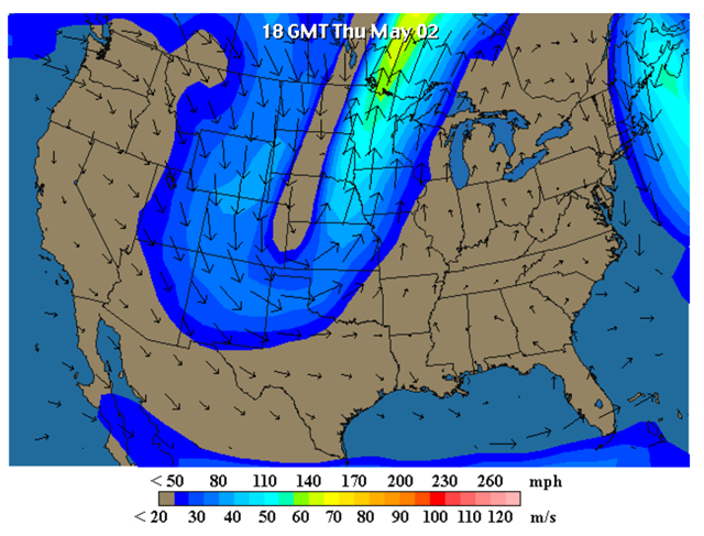
3 May 2013 (wunderground.com) – A highly unusual jet stream pattern is bringing a bizarre combination of heavy May snows, flooding, extreme fire danger, and well below average severe thunderstorm activity to the U.S. A strong “blocking” high pressure system has set up over Greenland, blocking the normal west-to-east progression of weather systems. A truly unusual situation has developed where the blocking high has forced a low pressure system near Greenland to move southwestwards to a point just off the New England coast. The blocking high has also forced an unusually sharp southwards dip in the jet stream over the Central U.S., where all-time May snowfall and cold temperature records are being set. This loop in the jet stream will get cut off from the main flow of the jet over the weekend, forming a “cutoff” low that will drift over the Southeast U.S., bringing cold, flooding rains of 2 – 4″ over a wide swath of the Southeast. But over the Western U.S., an unusually sharp ridge of high pressure has set up, bringing record high temperatures, a strong Santa Ana wind event, and dangerous fire weather. The Santa Ana wind event has entered its second day over Southern California, where a clockwise flow of air has brought offshore winds, record high temperatures in the 90s, powerful winds gusting from 40 – 75 mph, and relative humidities less than 5%. Three destructive fires have erupted since Wednesday. The largest of these fires is called the Springs fire, and has burned 10,000 acres near Camarillo, California, about 50 miles west-northwest of Los Angeles. According to Cal Fire, the blaze was 10% contained at 6:30 am PDT May 3. […]An early start to the California wildfire season
According to the National Interagency Fire Center, as of April 26, the U.S. had the fewest fires and the lowest acreage burned by wildfires in 2013 for any year-to-date period over the past ten years. But in just the past two days, the acreage burned for 2013 has jumped by 20%. Severe drought conditions across much of the Western U.S. are likely to help fuel an early and severe wildfire season during 2013, they said in their latest monthly outlook, issued May 1. Fire season is expected to be in full swing during May–a full month earlier than usual–in Southern California, California’s Sacramento Valley and adjacent lower foothills, and South Central Oregon. In California, “precipitation pretty much shut off at the beginning of the year,” NIFC wildfire analyst Jeremy Sullens said during a conference call with reporters. “Since they’re not expecting a lot more precipitation for the remainder of the summer, conditions are going to worsen as we go into the hotter part of the year.” Significant fire potential will increase to above normal during May in southeastern Arizona, much of western New Mexico, and northern Virginia. Late-season snows across the Rocky Mountains in Wyoming and Colorado have dumped enough moisture to delay wildfire season until its usual June start. However, these storms have largely missed southern Colorado, where the wildfire risks remain elevated.
Water a precious commodity in California in 2013
As of May 2, California’s Sierra Mountain snowpack was just 17% of average for the date, with a water content more typical of what is seen in early July. That’s bad news for a state that relies on a steady stream of meltwater to keep reservoirs filled during the summer. The poor 2012 – 2013 snow season comes on the heels of a poor 2011 – 2012 snow season, as well. But thanks to good water years leading up to 2011 – 2012, two key reservoirs are above 80% capacity: Lake Oroville, the main reservoir for the State Water Project (86%), and Lake Shasta, the main reservoir for farmers in California’s Central Valley (83%.) So, California will likely weather the dry conditions of the summer of 2013–but the snows of the winter of 2013 – 2014 had better be plentiful, or the state could be looking at a serious water shortage in 2014.
Amazing May snowstorm smashes more records
A rare and historic May snowstorm continues to set all-time snow and cold records for the month of May. Winter Storm Achilles brought Arkansas its first May snowfall in recorded history this morning, and four other states have set unofficial new May snowfall records for a 2-day storm: 18″ in Blooming Prairie Minnesota (previous record of 15″); 17″ in Rice Lake, Wisconsin (previous record, 15.4″); 12″ in Chariton, Iowa (previous record: 8″), and 6″ in Warrensburg, MO (previous record: 4.5″.) [more]
Fires, Floods, and Heavy Snow: an Extreme May Weather Situation