Image of the Day: Satellite view of Siberia forest fires, 10 July 2012
Caption by Adam Voiland
12 July 2012
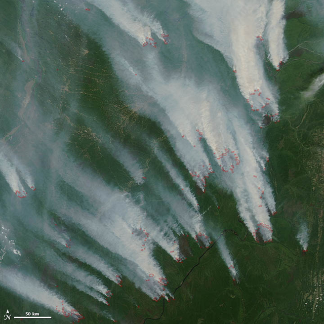
As in the western United States and northern Canada, Russia is ablaze. On 11 July 2012, more than 25,000 hectares (97 square miles) of forests were burning, according to the Russian Federal Forestry Agency. Most of the fires—uncontrolled wildfires in boreal forests—were in central and eastern Siberia. Fires had engulfed 10,500 hectares in Krasnoyarsk, 6,300 hectares in Tomsk, and 2,400 hectares in Yakutia. Yugra, Sakhalin, and Khabarovsk also had large fires burning. The Moderate Resolution Imaging Spectroradiometer (MODIS) on NASA’s Aqua satellite captured this image of fires burning in Yakutia on 10 July 2012. Thick smoke billowed from numerous wildfires near the Aldan River and blew to the north. Red outlines indicate hot spots where MODIS detected unusually warm surface temperatures associated with fires. Smoke from large wildfires in Siberia can be lofted high enough into the atmosphere for winds to push the plumes across the Pacific Ocean to North America. On July 8 and 9, 2012, smoke from Siberia arrived in British Columbia, Canada, and caused ground-level ozone to reach record high levels. […]