Photo gallery: Japan, before and after the tsunami
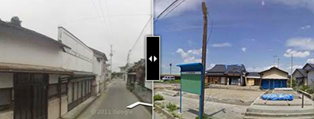
[Desdemona can’t help thinking that the blue tarps in this first image contain radioactive soil.] By Beenish Ahmed
21 December 2011
Years before the monster earthquake shook Japan and unleashed a massive tsunami in March, Google had mapped the roads of northeast Japan with its Street View project, as it had done in many parts of the world. Shortly after the disaster, Google sent video teams back to the worst-hit areas to cover 44,000 square miles’ worth of devastation.
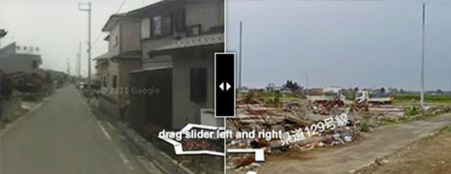
With that material now in hand, Google has just released Memories for the Future, an interactive website that allows users to scroll through Street View images of Japan before and after the disaster. “We wanted to photograph and record traces of the disasters to preserve them for the next generation, so even if the areas are perfectly rebuilt, no one would ever forget what happened there,” said Ken Tokesei, Google’s Project Management Director in the Asia-Pacific region. […]
Darn digital technology… really shows everything.