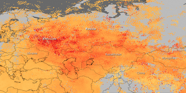
NASA satellites register 368 wildfires in Russia
MOSCOW, August 14 (RIA Novosti) Two NASA satellites registered a total of 368 hotspots from fires across Russia on Saturday, with the central part of the country being the worst affected, a spokeswoman for the ScanEx company said. “Wildfires raging on vast areas and smoke blankets can be clearly seen even on satellite photos of medium definition,” Nadezhda Pupysheva said. Central Russia’s Moscow, Ryazan and Nizhny Novgorod regions are the worst affected, she said. A scorching heat wave has gripped much of European Russia since mid-June, which coupled with the worst drought since the 1970s has made the countryside particularly susceptible to wildfires. Thousands of emergency workers and military personnel have been working round the clock for almost three weeks to fight the fires in 22 regions, which have so far left over 3,500 homeless. The immediate economic cost of the fires has been estimated at $15 billion. About 1,200 people sought medical aid in connection with the wildfires as of Saturday, the health ministry said. “A total of 1,187 people sought medical aid, 1,068 received out-patient treatment, 65 are hospitalized at the moment,” the ministry’s press service said in a statement. The death toll remains unchanged, at 53 people.
NASA satellites register 368 wildfires in Russia

Great images – I have written and called these assholes so many times to ask them to track polluting gases and tree and vegetative decline. They always tell me they can't do it. What a bunch of fucking liars. They can track anything – they just don't want to tell people that the ecosystem is in final retreat.
Jerks.