May 15, 2010
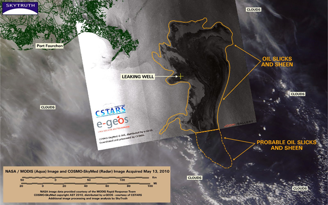
Image of the Day: BP / Gulf Oil Spill — Radar Image, 13 May 2010
NASA/MODIS images have been too cloudy to be much use for May 12 and 13 (see the most recent image we processed, for May 11). But a radar image taken by the Italian COSMO-SkyMed system clearly shows most of the slick in stark detail. The slick covers 4,922 square miles (12,748 km2) on the radar image, and is within about 25 miles of the Delta shoreline. The slick clearly extends south beyond the edge of the radar image; hints of it are visible on the MODIS image through the clouds and haze.
