Oil hits Louisiana shoreline
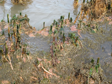
By Brian Merchant, Brooklyn, New York on 05. 9.10 The debate over whether or not oil from the massive slick in the Gulf of Mexico would wash ashore on the mainland is over: It already has, and I’ve got the pictures to prove it. The hundreds-of-miles-wide spill has been well documented, but so far no photos of any oil making landfall have been made public. Here are quite possibly the first. Earlier today, I boarded a chartered boat with Greenpeace, conservation scientist Rick Steiner, and a German television crew. We set off in pursuit of a tip that the currents may push some of the oil ashore in the southernmost parts of Louisiana, at the southernmost point of the Mississippi River. After a two hour boat ride, we saw the the booms deployed around the marshland were indeed already collecting oil. After confirming it was fresh, and noting a BP sanctioned crew on a nearby beach, we headed onshore to investigate. Sure enough, crude oil could be found littering the beach. Though it was a relatively small amount — no blackened shorelines dripping with crude a la the Exxon Valdez spill — it was undeniable proof that the oil was making landfall. We found the oil both seeping into the marshland (which is a vibrant habitat and feeding ground to birds) and caking the sand in a form closer to “tar balls.” …
Breaking: Oil Hits Louisiana Shoreline (Exclusive First Photos)

The content posted above is really appreciable and worth a read. Good job done!