May 12, 2010
Image of the Day: BP Oil Spill Viewed From Orbit, 10 May 2010
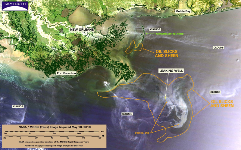
Yesterday’s MODIS/Terra satellite image has some of the usual complications – clouds, haze, and turbidity again may be obscuring portions of the slick. Observable slick and sheen covers 4,683 square miles (12,129 km2). Thicker, fresh-looking oil is apparent in the vicinity of the leaking well, and still appears to be entrained in a counterclockwise gyre (a circular current). …
