May 19, 2010
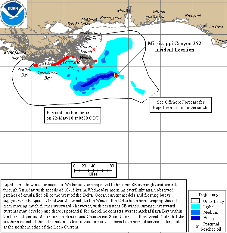
Graph of the Day: Projected Oil Spill Path to 22 May 2010
NOAA extended the boundaries of the closed fishing area in the Gulf into the northern portion of the loop current as a precautionary measure to ensure seafood from the Gulf will remain safe for consumers. The closed area is now slightly less than 19 percent of the Gulf of Mexico federal waters. Dr. Jane Lubchenco, NOAA Administrator, spoke today at a press briefing on the subject of the Loop current. Dr. Lubchenco’s remarks are summarized below: …

