Photo gallery: Arizona wildfires, 2011
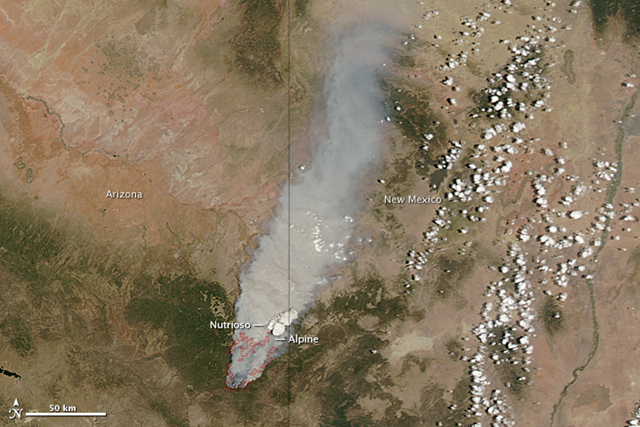
Caption by Holli Riebeek Burning in the mountains of eastern Arizona near the border with New Mexico, the Wallow Fire was well on its way toward becoming one of the largest fires in Arizona history when the Moderate Resolution Imaging Spectroradiometer (MODIS) on NASA’s Aqua satellite took this image on June 4, 2011. Winds and hot, dry conditions helped the fire grow quickly in the week after it ignited on May 29. People caused the fire in the Apache National Forest, though its exact cause is still under investigation, said the Arizona Division of Emergency Management. Red outlines the fire in this image. Winds were blowing the fire northeast toward the communities of Alpine and Nutrioso, both of which were evacuated. The dense plume of smoke pouring north from the massive fire affected air quality as far north as Wyoming and as far east as Georgia. The towering clouds that rise above the smoke between Alpine and Nutrioso resemble classic fire clouds—pyrocumulus or pyrocumulonimbus clouds. Such clouds form when intense heat from the fire pushes air high into the atmosphere. Fire clouds sometimes generate intense thunderstorms that can either dampen the flames with drenching rains, or propel the fire with strong winds. The Arizona Division of Emergency Management reported storm and wind activity in the area covered by the clouds, though the two are not necessarily related. Throughout the fire area, winds and hot, dry weather conditions allowed the blaze to grow quickly on June 5. By early on June 6, the fire had burned 192,746 acres, making it the third largest fire in Arizona’s history behind the Rodeo-Chediski Fire and the Cave Creek Complex Fire. Incidentally, the state’s fifth largest fire, the Horseshoe 2 Fire is currently burning south of the Wallow Fire.
NASA image courtesy Jeff Schmaltz, MODIS Rapid Response Team at NASA GSFC. Caption by Holli Riebeek. 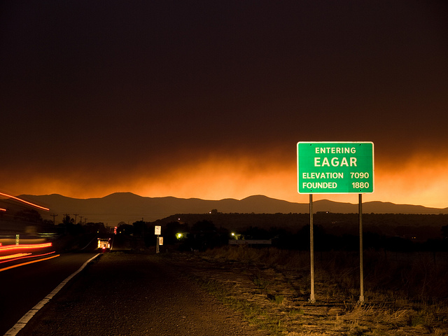
Eager, AZ just after evacuations. Wallow Fire, Arizona, 2011. Photo taken by Kari Greer for NIFC. US Forest Service
Smoke from Wallow Fire more like a volcanic eruption 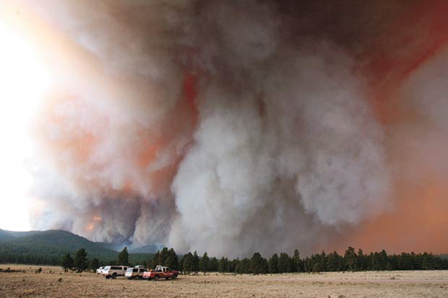
Fire crew trucks along Forest Route 24 are dwarfed by large plumes of smoke from the Wallow Fire burning in the Bear Wallow Wilderness southwest of Alpine Wednesday June 1. The 40,000 acre Wallow fire is burning 12 miles southwest of Alpine. There is no containment of the fire, which ignited Sunday, May 29, 2011. AP Photo / Arizona Daily Star, Greg Bryan
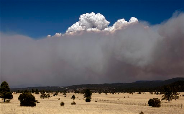
A smoke plume over the east side of the Wallow Fire climbs high into the sky Monday afternoon, June 6, 2011, as strong winds fanned the Wallow Fire in Eager, Ariz. AP Photo / The Arizona Republic, Pat Shannahan
Arizona Fire Image Gallery 2011 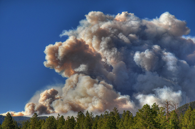
Smoke plume from the Schultz fire, June 20, 2010 in East Flagstaff, AZ, U.S. The Schultz fire started on Father’s Day 2010. It was the second major wildfire to break out in as many days in this mountain town. In its first 24-hours, the Schultz fire consumed more than 5,000 acres and forced the evacuation of 750 homes north of Flagstaff. The smoke plume rose thousands of feet into the sky and loomed over Flagstaff much of the day. Bill Ferris
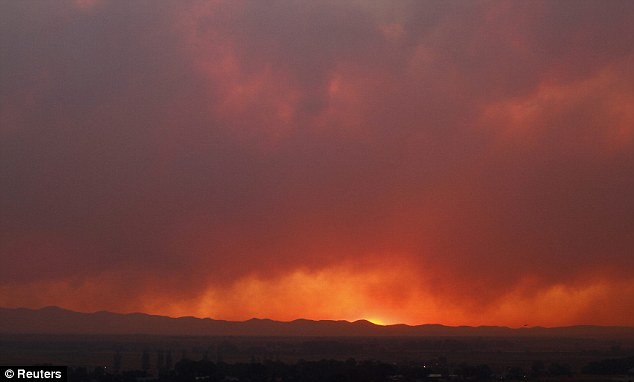
Dramatic sunset: Smoke from the Wallow Fire billows over the White Mountains as the sun goes down, 12th June 2011. Reuters

Freelance photographer Thomas Gaulke, of Germany, photographs smoke from the Wallow Fire near Springerville, Ariz., Friday, June 10, 2011. The major wildfire in Arizona’s eastern mountains burned out of control early Friday after charring more than 603 square miles of timber, destroying dozens of structures and keeping thousands of evacuees away from their homes. Jae C. Hong / AP Photo

A forest burns during a backburn operation to fight the Wallow Fire in Nutrioso, Ariz., Friday, June 10, 2011. A massive wildfire in eastern Arizona that has claimed more than 30 homes and forced nearly than 10,000 people to evacuate is likely to spread into New Mexico soon, threatening more towns and possibly endangering two major power lines that bring electricity from Arizona to West Texas. Marcio Jose Sanchez / AP Photo
Miles of smoke billow skyward from the Wallow Fire near Greer, Ariz., 7 June 2011. Officials say the blaze has already burned 486 square miles and winds have been driving the flames 5 to 8 miles a day since the fire began. Ross D. Franklin / AP
Major wildfire spreads across eastern Arizona 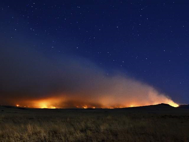
The Wallow Fire lights the night skies near Springerville, 9 June 2011. Eric English / ABC15

Darkness and ash set in under the Wallow Fire blanket of smoke, 9 June 2011. Eric English / ABC15
Blog: How the Wallow Fire is even tougher than it looks 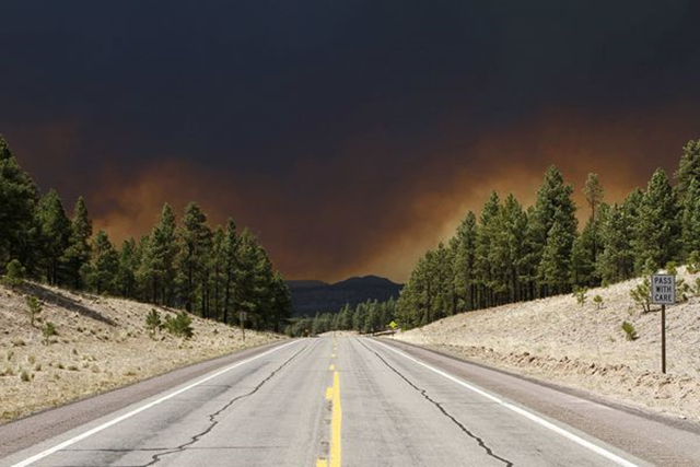
A wildfire blackens the sky above U.S. Route 180 in Luna, New Mexico, on 6 June 2011. Joshua Lott / Reuters
Arizona Wildfire Pictures: Blaze Advancing on Towns 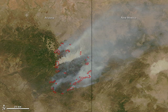
By the end of the day on June 9, 2011, Arizona’s massive Wallow Fire had reached 386,690 acres (609 square miles or 157,701 hectares) and had burned 29 and threatened 5,242 homes. Most of the homes destroyed were in Greer. Approximately 3,012 people are working to contain the fire, which is now just five percent contained. Calmer winds on June 10 should help firefighters make more progress on containing the fire, said InciWeb. The Moderate Resolution Imaging Spectroradiometer (MODIS) on the Terra satellite acquired this image of the Wallow Fire on June 9 at 10:55 a.m. local time. Active fire areas are outlined in red. Smoke rises from the most intensely burning areas, but overall, the fire is producing less smoke than in previous days. NASA image courtesy Jeff Schmaltz, MODIS Rapid Response Team at NASA GSFC. Caption by Holli Riebeek.