Graph of the Day: Australia Hottest- and Coldest-Day-of-the-Month Records, 1910-2011
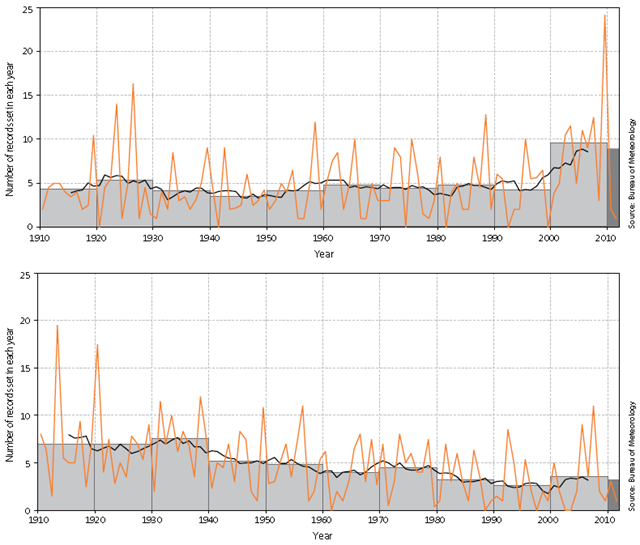
Number of hottest (above) and coldest (below) day-of-the-month (highest maximum) records at 43 Australian climate reference stations with daily data from 1910; for each year (orange line) and each decade (grey boxes), and the 11-year average (black line). The average for the most recent 10-year period (2002-2011) is shown in darker grey. Australian annual-average overnight minimum temperatures have warmed more rapidly than daytime maximum temperatures. Minimum temperatures have warmed by more than 1.1 °C since 1910 – with more than 0.8 °C of that warming occurring since 1960. The number of climate reference stations recording warm (top ten per cent) night-time temperatures and the frequency with which this occurs have increased since the mid 1970s. The rate of very hot (greater than 40 °C) daytime temperatures has been increasing since the 1990s. The frequency of extreme (record) hot days has been more than double the frequency of extreme cold days during the past ten years.