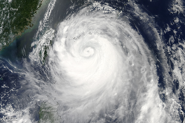
Image of the Day: Satellite view of Typhoon Soulik approaching Taiwan
By Holli Riebeek
13 July 2013 (NASA) – The Moderate Resolution Imaging Spectroradiometer (MODIS) on NASA’s Aqua satellite acquired this image of Typhoon Soulik on July 12, 2013. The storm is moving west across the Pacific Ocean on course to strike Taiwan and China in the next couple of days. At the time the image was taken, the storm had winds of 170 kilometers per hour (90 knots or 100 miles per hour), down from its maximum strength of 230 km/hr (125 knots or 140 miles per hour) on July 10. Though Typhoon Soulik weakened significantly as it moved westward toward Taiwan, it could still cause floods, landslides, and wind damage. Taiwan’s Central Weather Bureau warned residents to brace for extremely heavy rain. Taipei is directly in the storm’s forecasted path, and will likely be impacted on Saturday, July 13. The storm is forecast to move over eastern China on Sunday and Monday. [more]
