Australia floods of 2010 and 2011 caused global sea level to drop – ‘Only in Australia could the atmosphere carry such heavy tropical rains to such a large area, only to have those rains fail to make their way to the ocean’
By Tim Radford for Climate News Network
23 August 2013 (The Guardian) – Rain – in effect, evaporated ocean – fell in such colossal quantities during the Australian floods in 2010 and 2011 that the world’s sea levels actually dropped by as much as 7mm. Rainwater normally runs swiftly off continental mountain ranges, pours down rivers, collects in aquifers and lakes and then winds across floodplains into the sea. But Australia, as any Australian will proudly claim, is different. Rain that falls in the outback of the largest island – also the smallest continent – tends to dribble away into inland waterways and seemingly get lost, without ever making it to the coast, or to collect in shallow inland seas and stay there till it evaporates. “It is a beautiful illustration of how complicated our climate system is”, says John Fasullo, of the US National Centre for Atmospheric Research. “The smallest continent in the world can affect sea level worldwide. Its influence is so strong that it can temporarily overcome the background trend of rising sea levels that we see with climate change.” Fasullo and colleagues outline the drama of the vanishing sea levels in Geophysical Research Letters. Although there are daily, seasonal and annual variations, sea levels worldwide have been creeping up by 3mm a year on average, as a consequence of ocean warming and glacial melting. But in 2010, sea levels mysteriously began to drop by 7mm, and stayed lower than expected for 18 months. This really was unexpected: global average temperatures had not dropped, greenhouse emissions had continued to increase, glaciers had continued to melt.
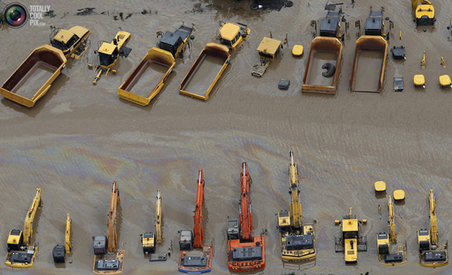
No simple business. But surface waters in the eastern Pacific were affected by a cyclic cooling phenomenon called La Niña: this coincided with two other climatic phenomena known to the weathermen as the Southern Annular Mode and the Indian Ocean Dipole. The resulting cocktail of atmospheric energy combined to gather awesome quantities of water in the atmosphere and then dump it over Australia: in all, 300mm above the normal rate. This water notoriously hit Queensland first in December 2010 and three quarters of the Australian state was declared a disaster zone. But then the water got caught up in what the authors called “Australia’s expansive arheic and endorheic basins”. This is another way of saying the water stayed on land, trapped in salt lakes, to evaporate slowly. Meanwhile, with all that water soaked up in the arid landscape, the sea levels actually began to fall, unexpectedly, and to stay low before once more resuming their ominous and potentially destructive rise. Australia is now hit by drought, and ocean levels now seem to be rising even faster, at 10mm a year. The scientists pieced together the chain of events by studying data from satellites called GRACE, that measure changes in the Earth’s gravity, floating monitors called Argo that measure ocean temperature and salinity, and satellite altimeters that constantly measure changes in sea level. Such research is a reminder once again that climate research is a complicated business, and that Australia, once again, is a most unusual place. “No other continent has this combination of atmospheric set-up and topography”, says Fasullo. “Only in Australia could the atmosphere carry such heavy tropical rains to such a large area, only to have those rains fail to make their way to the ocean.” [more]
Australian floods of 2010 and 2011 caused global sea level to drop
